3 entries match your criteria.
Related Historical Markers
Gardner Junction: Santa Fe, Oregon, and California Trails
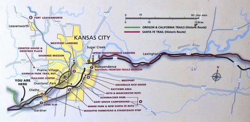
Marker detail: Historical site map
SHOWN IN SOURCE-SPECIFIED ORDER
| | Heavy freight wagons lumbering to and from New Mexico, and emigrant families and gold seekers heading west to Oregon and California all shared this route from Independence and Kansas City. The trails split here at Gardner Junction.
Preserving . . . — — Map (db m131353) HM |
| | From the late 1820s to the 1870s, an estimated 300,000 fur traders, missionaries, settlers, and gold seekers followed these trails. In the 1840s and 1850s, emigrants from the eastern and central United States walked 2,000 miles from the Missouri . . . — — Map (db m131376) HM |
| | Spanning 900 miles of the Great Plains between the United States (Missouri) and Mexico (Santa Fe), this great trail of commerce between two countries was also a route for the frontier military and emigration to the West. For 60 years, the trail was . . . — — Map (db m131377) HM |
Apr. 24, 2024