4 entries match your criteria.
Related Historical Markers
The Erie Canal in Canastota, New York
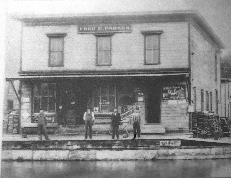
Marker detail: Fred C. Parker's Provision Store
SHOWN IN SOURCE-SPECIFIED ORDER
| | Towns sprouted along the length of the Erie Canal. Canal Street was Canastota's business district. Travelers stopped here for food and supplies or a bed for the night at a hotel or boarding house. Local farmers, merchants, and manufacturers shipped . . . — — Map (db m139500) HM |
| | Canal and street traffic came into conflict where Peterboro Street crossed the Erie Canal in Canastota's busy commercial district. Engineers fixed the problem with a hydraulic lift bridge. Raised, it let boats through and still carried foot traffic. . . . — — Map (db m139501) HM |
| | Its immediate success on opening from Albany to Buffalo in 1825 soon led to calls to enlarge the canal. From 1836 to 1862 the canal was deepened from 4 feet to 7 feet, with bigger locks and aqueducts, and canal boats grew threefold in capacity from . . . — — Map (db m139502) HM |
| | Industrial Growth (marker front panel)
The Erie Canal encouraged settlers to establish farms and helped small upstate towns become economically viable. Plants and mills built near the canal to process farm produce diversified to meet . . . — — Map (db m139499) HM |
Apr. 18, 2024