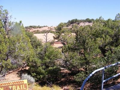
Follow the easy one-mile (1.6 km) round-trip trail to a point overlooking Betatakin Ruin—multi-level cliff-village home to a community of 13th-century Anasazi farmers.
On the way there and back, you’ll be walking through pygmy . . . — — Map (db m71519) HM
The Navajo Indians resourcefully met the demands of desert dwelling when they came up with this comfortable and sturdy forked-stick hogan — so called because its chief structural support is made up of three poles with their forked ends . . . — — Map (db m144378) HM
This miniature forked-stick hogan without a smoke hole is actually a highly effective bath — an ancient solution to the problem of keeping clean in a land where water is scarce.
Here’s how it works: Stones are heated in a fire, then . . . — — Map (db m71517) HM
It is not known if the prehistoric Indians of the canyons used this plant, but both Navajos and Hopis make medicine from it, to cure stomach-ache. The Navajos use it to cure colds and headache. — — Map (db m144404) HM
This trail leads through vegetation typical of the plateaus of northern Arizona. Although the trees are small, they make up a true forest – the pinyon pine-juniper forest. The stunted trees and plants here may seem an unlikely source of food, . . . — — Map (db m144397) HM
The fruit of the pricklypear cactus is widely eaten by Southwestern Indians. It is picked with a forked stick or wooden tongs, and the spines are broken or burned off. It may be eaten fresh or dried. — — Map (db m144403) HM
The nut of this little tree, eaten raw or roasted, is a favorite wild food of the Southwestern Indians. Prehistoric Indians used the pitch to fasten stone arrowheads and knives to wooden shafts and handles, and to repair broken pots. Navajos made . . . — — Map (db m144399) HM
Hopis made arrows from the wood of this plant and shredded the soft bark to make a padding for babies' cradleboards. Like many of these plants, it provided medicine, and was used as an emetic and as a wash for wounds. — — Map (db m144393) HM
As with the narrowleaf yucca, all parts of this plant provided something for the Indians. They ate the fruit, and shredded and twisted the leaves into cord and rope. Soap comes from the crushed roots and is used as a shampoo in Navajo and Hopi . . . — — Map (db m144395) HM
This plant, when made into a brew, was a multipurpose medicine, prescribed for stomach trouble, kidney afflictions, venereal disease, and coughs. — — Map (db m144407) HM
This tree had many uses. Many of the roof beams in Betatakin are juniper. Fires were started with juniper fire-drills, the shredded bark was used for tinder, and the wood was used for fuel. The shredded bark also served as diaper pads, was braided . . . — — Map (db m144396) HM
This Is The Place The Ancestral Puebloans often chose south-facing alcoves like this one for their cliff villages; here are all the basic necessities of life. Benefits of winter sun and summer shade, shelter from the elements, and springwater . . . — — Map (db m144400) HM
By 1286, Betatakin village had grown to fill even the most precarious shelves and niches in the alcove, and housed 100 to 125 people clustered into 20 to 25 households. Looking down at this sheltered site today you can still see most remnants of the . . . — — Map (db m144401) HM
Who Was Here? Descendants of the Hopi people who built this place call it Talastima, a Hopi word for "Place of the Blue Corn Tassels." They call their ancient relatives “Hisatsinom.” Zuni, also pueblo builders, know . . . — — Map (db m144402) HM