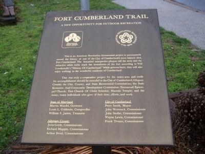
This is an American Revolution bicentennial project to permanently record the history of one of the City of Cumberland's most historic sites, Fort Cumberland. The beautiful interpretive plaques tell the story and the attractive white rocks mark the . . . — — Map (db m17714) HM
Many changes have been made to the landscape on which Fort Cumberland stood. The street behind you was cut from the hillside and the earth removed used by the canal company. the bluff to your left in front of the church once extended on a nearly . . . — — Map (db m18757) HM
Will's Creek Settlement, later known as Cumberland, served as a major gateway for trade, military campaigns against the French, and settlement beyond the mountains in our growing nation. "The New Storehouses" of the Ohio Company were across the . . . — — Map (db m17783) HM
Horatio Sharpe Lived: 1718-1790. Here as Governor of Maryland and the commander of the fort. Fort Frederick was built by his direction. Governor: 1753-1769. Sharpsburg, Md., was named in his honor. Daniel Boone Lived: 1734-1820. Here as a . . . — — Map (db m17681) HM
"A volley fired by a young Virginian in the backwoods of America set the world on fire"
Fort Cumberland was built as a direct result of hostilities between the French and British over control of the Ohio Valley. The British king granted land . . . — — Map (db m17683) HM
Our founding father spent much time in this vicinity when a young man as surveyor, ambassador, aide-de-camp to General Braddock, and commander of Virginia military forces. This cabin served as his headquarters during part of this time.
Young . . . — — Map (db m167057) HM
The land west of the Allegheny Mountains was exclusively the Indians until the mid 1700's. The local Indians were part of the Shawanese tribe and a sub-division of the Algonquin Nation-one of the most warlike. With the coming of the white man, . . . — — Map (db m167128) HM
Most of the early frontier forts were of the palisado type. Before you is a small sample of this type construction. A palisade is a fence of pales or stakes set firmly in the ground, as for enclosure or defense. The word usage in the 1700's was . . . — — Map (db m17782) HM
You stand upon historic ground within the north wall of Fort Cumberland. Your location (X) is shown on the diagram. Lines of barracks (I), parallel with the street, were to your front and in the rear along the line of white rocks in the street. The . . . — — Map (db m167129) HM
The fort proper was the bastioned work at the west end of the fort. It was to your left (primarily on the site of the Church of Christ Scientist). Besides the four bastions (b) and the joining walls, there were four buildings for provisions (6), two . . . — — Map (db m167356) HM
The National Pike was also called the National Road (used national funds) or the Cumberland Road (began in Cumberland). Behind you and to the right along the base of the hill, were the storehouses of The Ohio Company. The earliest trails were made . . . — — Map (db m167058) HM
Trenches and Tunnels It was common for forts of this period to have rifle pits or trenches outside the walls as a line of first defense. Fort Cumberland was likely no exception. However, the excavations most people refer to apparently had other . . . — — Map (db m17684) HM
Fort Cumberland was garrisoned from 1754 to 1765. During this period, there was bickering between Maryland and Virginia as to how the fort should be maintained and whose control it was under.
In early 1756, Colonel Washington favored a small . . . — — Map (db m17708) HM