Scottsville in Albemarle County, Virginia — The American South (Mid-Atlantic)
Scottsville
When War Came
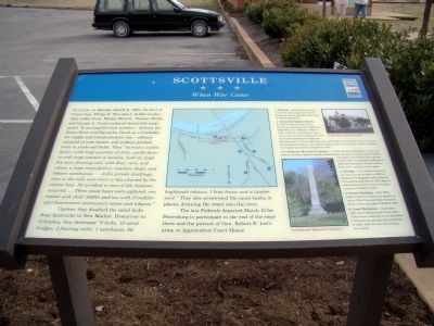
Upriver, they disabled the canal locks from Scottsville to New Market. Downriver to Columbia, they destroyed “8 locks, 13 canal bridges, 4 flouring mills, 1 warehouse, 60 hogsheads tobacco, 1 boat house and a lumber yard.” They also penetrated the canal banks in places, draining the water into the river. The last Federals departed March 10 for Petersburg to participate in the end of the siege there and the pursuit of Gen. Robert E. Lee’s army to Appomattox Court House.
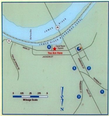
(Legend to Map)
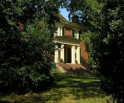
1. Cliffside — Built by John Lewis II about 1785 and enlarged in 1810, this house was used by Sheridan and Custer as their headquarters.
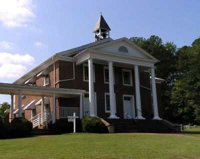
2. Scottsville Baptist Church — Located on Harrison Street, the church was impressed by Confederate authorities as a hospital in 1862. A hotel, a factory, a small frame house, and a newly erected building were also converted to hospital use under the collective name of The Confederate General Hospital at Scottsville. Due to the inadequate physical facilities, the isolated location, and unsatisfactory medical conditions, the hospital was closed in September 1863.
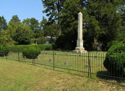
3. Confederate Memorial Cemetery — In 1914, the United Daughters of the Confederacy erected a granite obelisk and headstones marked C.V. honoring the soldiers who died in the Confederate hospitals in Scottsville. A monument dedicated in 2002 lists the names of these soldiers, their units, and their home states.
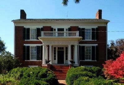
4. Old Hall — This Federal-style brick two-story house was built in 1830 by Benjamin H. Magruder and purchased by Joseph Russell Beal in 1850. Merritt commandeered the house as his headquarters on March 9, 1865.
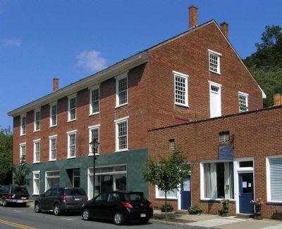
5. Factory Building — This 1850s tobacco factory continued to operate as late as 1880. It was partially burned by Union cavalry the night of March 6, 1865.
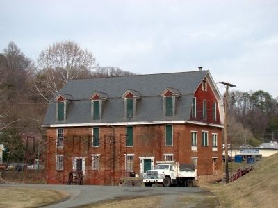
6. Canal Warehouse — Built about 1830, this building stood on the bank of the former James River and Kanawha Canal and was partially burned March 6, 1865. After the war, the building was rebuilt.
Erected by Civil War Trails.
Topics and series. This historical marker is listed in this topic list: War, US Civil. In addition, it is included in the United Daughters of the Confederacy, and the Virginia Civil War Trails series lists. A significant historical date for this entry is March 6, 2007.
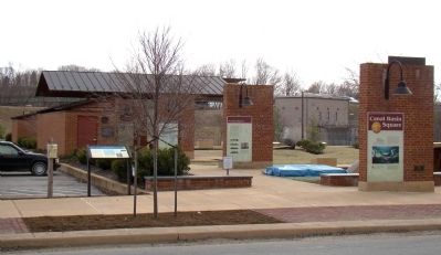
Location. 37° 47.917′ N, 78° 29.6′ W. Marker is in Scottsville, Virginia, in Albemarle County. Marker is on East Main Street (Virginia Route 6) just east of Valley Street (Virginia Route 20), on the right when traveling east. Marker is at the entrance to Canal Basin Square. Touch for map. Marker is in this post office area: Scottsville VA 24590, United States of America. Touch for directions.
Other nearby markers. At least 8 other markers are within 4 miles of this marker, measured as the crow flies. Barclay House and Scottsville Museum (within shouting distance of this marker); Historic Scottsville (about 400 feet away, measured in a direct line); Hurricane Camille (about 600 feet away); Scottsville Confederate Cemetery (approx. 0.3 miles away); Hatton Ferry (approx. 0.8 miles away); a different marker also named Hatton Ferry (approx. 2.9 miles away); a different marker also named Hatton Ferry (approx. 3 miles away); Wilson Cary Nicholas (approx. 3.7 miles away). Touch for a list and map of all markers in Scottsville.
More about this marker. In addition to the map at the center of the marker, there is a period photograph of Scottsville Baptist Church in the upper right and a photo of the Memorial at the Confederate Memorial Cemetery below.
Also see . . .
1. Scottsville in the Civil War. “Sheridan’s men were down to their last ‘coffee and sugar’ rations, and their horses suffered from fatigue and hoof rot. They relied on the Scottsville countryside for ‘subsistence and forage’ and ransacked and looted homes, barns, and any potential hiding place for food, horses, and valuables. Cliffside’s carriage house and barn were torched, although the jewelry, which Mrs. John O. Lewis buried earlier near their chicken house, went undiscovered. Yankees stuffed hams in their knapsacks and strapped dead chickens to their saddles. At age 5, Fannie Patteson stood at a second
floor window and watched her backyard fill with strange men, who upset their beehives and crammed honey into their mouths. As the Yankees snatched up every horse they spotted, twelve year-old Luther Pitts hid two local horses in the basement of the Barclay House on Main Street. Miletus Harris and his son, Charles, beat back the flames on their Main Street store as the nearby Columbian Hotel went up in smoke.” (Submitted on April 11, 2009.)
2. Confederate General Hospital and Moore's Hill Cemetery. (Submitted on September 14, 2009, by PaulwC3 of Northern, Virginia.)
3. Cliffside. (Submitted on September 14, 2009, by PaulwC3 of Northern, Virginia.)
Credits. This page was last revised on February 2, 2023. It was originally submitted on April 11, 2009, by J. J. Prats of Powell, Ohio. This page has been viewed 2,260 times since then and 42 times this year. Photos: 1, 2, 3. submitted on April 11, 2009, by J. J. Prats of Powell, Ohio. 4, 5, 6. submitted on September 19, 2009, by PaulwC3 of Northern, Virginia. 7. submitted on October 16, 2011, by PaulwC3 of Northern, Virginia. 8. submitted on September 19, 2009, by PaulwC3 of Northern, Virginia. 9. submitted on April 11, 2009, by J. J. Prats of Powell, Ohio. 10. submitted on September 19, 2009, by PaulwC3 of Northern, Virginia. • Craig Swain was the editor who published this page.
