4 entries match your criteria.
Related Historical Markers
To better understand the relationship, study each marker shown.
By Paul Crumlish, April 2, 2010
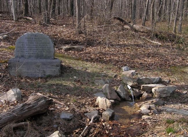
Wide view of the Pilger Ruh Marker
SHOWN IN SOURCE-SPECIFIED ORDER
| |
1742
Pilger Ruh (Pilgram's Rest)
Named by Count
Nicholas Ludwig von Zinzendorf
who with Conrad Weiser and
Moravian Missionaries rested here
besides this spring (Ludwig's Brunne)
on their way to visit Shawnee Indians
in Wyoming . . . — — Map (db m158052) HM |
| | Fort Henry, built 1756 to guard Lebanon Valley from Delaware and Shawnee raids, stood 3/4 mile northwest of here on the Tulpehocken Path. The trail came over the mt. near where present road cutting is seen. Round Head overlooks it from east. — — Map (db m29542) HM |
| | The Indian Ambassadors Road turned east near here over the hills to the Tulpehocken Valley. Used by Iroquois chiefs from Onondaga, now Syracuse, carrying peace wampum from the "Fire that Never Dies" to Philadelphia. Often traveled by Shickellamy. — — Map (db m14405) HM |
| | In 1701, here, John Scull operated a trading post. He was the first known Englishman to visit the Indian village of "Shamokin" and was here as late as 1729. On October 17, 1750 Thomas and Richard Penn executed a deed for this land, including in . . . — — Map (db m14403) HM |
Apr. 19, 2024