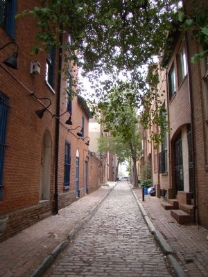
Society Hill in Philadelphia in Philadelphia County, Pennsylvania — The American Northeast (Mid-Atlantic)
Queen Village / The New Market and Head House
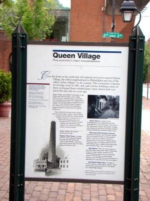
QUEEN VILLAGE. Philadelphia’s first neighborhood. Cross the street to the south side of Lombard and you’ve entered Queen Village, the oldest neighborhood in Philadelphia and one of the oldest “urban villages” in the country. This community is known for its large stock of 18th- and l9th-century buildings, many of them unchanged from colonial times. Some streets look very much like they did 200 years ago.
Queen Village was settled by Swedes in the 1600s and named Wicaco, the Lenape tribe’s word for “peaceful place.” Its name has changed twice since then. William Penn named it Southwark after a neighborhood in London. It was renamed Queen Village in the 1970s to honor the role of Sweden’s Queen Christina in promoting the original settlement.
Early residents included ship builders, rope and sail makers, sailors, dock workers, carpenters and craftsmen. Today Queen Village is home to a vibrant mix of people of all backgrounds and economic levels. Its thriving businesses and residential areas make it an exciting community in which to live and work.
Queen Village has several landmarks of note:
Sparks’ Shot Tower. Located at Front and Carpenter Streets, this was the first shot tower in the United States. Lead shot was made here for the U.S. Army during the War of 1812.
South Street. A place where Philadelphians have shopped and been entertained for over 200 years. The nation’s first permanent theater, Southwark Theater, was located at South and Leithgow Streets. George Washington attended plays there.
Gloria Dei (Old Swedes’) Church. Located at Swanson and Christian Streets, this is the oldest church in Pennsylvania. Built in 1700 as a Lutheran church by descendants of the early Swedish settlers, it became part of the Episcopal Church in 1845. Betsy Ross, credited with sewing the first American flag, was married here.
2nd Street. This is the home base of the Mummers, those New Year’s celebrants known for their colorful costumes and marching string bands. At the southwest corner of 2nd Street and Washington Avenue, you’ll find the Mummers Museum, a repository of costumes and Mummer history.
4th Street Fabric Row. Thought to be the country’s oldest fabric district, these retail stores continue south on 4th Street from Bainbridge Street.
Queen Village extends south from Lombard Street to Washington Avenue, and from the Delaware River west to 6th Street.
(Sidebar) Over the years, Queen Village has been home to many famous people. Here are a few names you may recognize.
• Surveyors of the “Mason-Dixon” line, Charles Mason and Jeremiah Dixon
• Movie actor & comedian, Larry Fine (a.k.a. ‘Larry’ of the Three Stooges)
• The artist. Man Ray (born Emmanuel Rudnitzky)
• Rock ’n Roll singer & musician, Chubby Checker (born Ernest Evans)
• Basketball player, Maurice “Mo” Cheeks of the Philadelphia 76ers
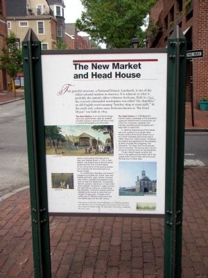
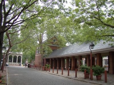
THE NEW MARKET AND HEAD HOUSE. This graceful structure, a National Historic Landmark, is one of the oldest colonial markets in America. It is adjacent to what is probably the nation’s oldest volunteer firehouse. Built in 1745, the covered colonnaded marketplace was called “the shambles,” an old English word meaning “butcher shop or meat stalls.” At the north end, a three-story firehouse known as “the Head House” was built in 1805.
The New Market. In an era before refrigeration and supermarkets, open air markets provided vendors a place to sell fresh foods. In colonial Philadelphia, the first public market was located at the east end of High (now Market) Street. In 1745, a “New Market” was started here at Second Street (stretching from Pine to South Street) for the convenience of the growing population in Society Hill and Southwark (now Queen Village).
On market days (Tuesdays and Fridays) shoppers purchased fish, turtles, fresh vegetables and fruits, eggs, turkeys, chickens, veal, mutton, sausage and prepared foods, such
as meat and apple pies. Occasionally raccoon, possum, bear-bacon or bear’s feet were available. The farmers’ wagons arrived the night before, pulling up to stalls along the shambles. Customers walked inside the covered center arcade to make their purchases. On dark days, oil lamps at the ceiling were lit. Vendors continued to sell their goods here into the 20th century.
The Head House. In 1736 Benjamin Franklin began a campaign of fire prevention, urging the establishment of community volunteer fire companies equipped with manually operated pumping engines and large bells to signal fires.
In 1805 the Head House at Pine Street was built, pairing it to an earlier Head House located at the South Street end of the market shambles (demolished about 1860). These two “head houses” contained fire engines and apparatus for the members of three volunteer fire companies: The Fellowship, The Hope and The Southwark Hose Companies. The second floor interiors served as meeting rooms for the firefighters.
Private citizens raised funds for the clock in the gables and the alarm bell in the cupola which rang for fires and announced the opening of market days.
This property, owned by the City of Philadelphia, was saved from demolition and repaired in 1962-63, but was again in need of preservation thirty years later A grassroots citizens’ group,
The Head House Conservancy, accomplished this in the 1990s.
Topics and series. This historical marker is listed in these topic lists: Colonial Era • Industry & Commerce • Notable Places • Settlements & Settlers. In addition, it is included in the National Historic Landmarks series list. A significant historical year for this entry is 1812.
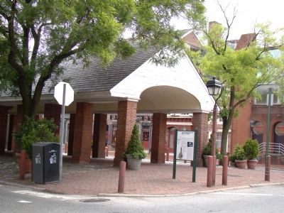
Location. 39° 56.535′ N, 75° 8.729′ W. Marker is in Philadelphia, Pennsylvania, in Philadelphia County. It is in Society Hill. Marker is at the intersection of Lombard Street and 2nd Street on Lombard Street. Marker is at the south end of the New Market. Touch for map. Marker is in this post office area: Philadelphia PA 19106, United States of America. Touch for directions.
Other nearby markers. At least 8 other markers are within walking distance of this marker. Society Hill / The New Market and Head House (about 300 feet away, measured in a direct line); Capt. Charles Massey House (about 500 feet away); Robert Smith (about 600 feet away); Thaddeus Kosciuszko (about 700 feet away); a different marker also named Thaddeus Kosciuszko (about 700 feet away); Stephen Decatur (about 700 feet away); Morris Rosenbaum (about 700 feet away); Mason-Dixon Survey (about 700 feet away). Touch for a list and map of all markers in Philadelphia.
More about this marker. The Queen Village face of the marker has two illustrations. On the left bottom is an
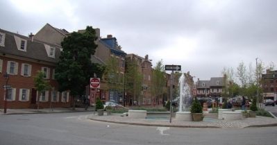
Photographed By J. J. Prats, May 14, 2010
5. Second Street Between Lombard and South Streets
Lombard Street is in the foreground. The New Market and this marker is behind the photographer. The original New Market continued across Lombard Street to South Street, where the earlier South Street Head House (demolished about 1860) was located.
The New Market and Head House face of the marker has three images. The largest (center-left) is a color illustration of the market shown from Lonbard Street captioned “New Market, W. Birch & Son, 1799.”. Below it on the left is a smaller illustration of the inside of the arcade with the same caption. On the bottom right is a color photograph captioned “Head House in the late 1950s.” The logotype of the Head House Conservancy is on the marker’s lower right.
Related marker. Click here for another marker that is related to this marker. It is the Society Hill marker at the north end of the New Market.
Also see . . . Queen Village, A Brief History. by Steve Sitarski. “The local river front was lined with an impressive grove of large beech, elm and buttonwood trees. Nearby meadows were populated with elk, deer and beaver, providing pelts for the fur trade. The area now known as Queen Village was originally owned by the Swedish family of Sven, whose log house stood on a knoll overlooking the river at what is now the NW corner of Beck & Swanson Streets. The one and a half story wooden structure had a large garden with various fruit trees. An inlet of water from the Delaware River allowed small boats to dock in front. The British
Army used the wood from the house as fuel during theRevolutionary War. ” (Submitted on May 30, 2010.)
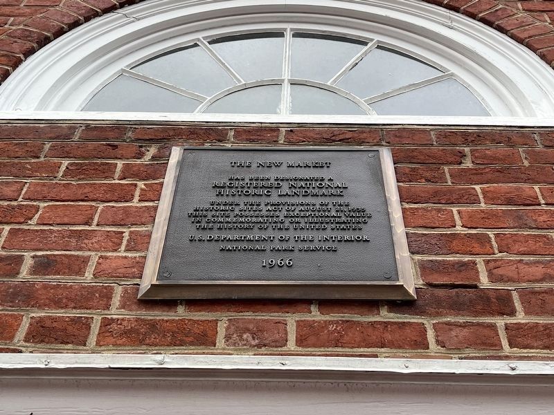
Photographed By Devry Becker Jones (CC0), January 13, 2023
7. National Historic Landmark Plaque for the New Market
Credits. This page was last revised on February 2, 2023. It was originally submitted on May 30, 2010, by J. J. Prats of Powell, Ohio. This page has been viewed 1,381 times since then and 52 times this year. Photos: 1, 2, 3, 4, 5, 6. submitted on May 30, 2010, by J. J. Prats of Powell, Ohio. 7. submitted on January 16, 2023, by Devry Becker Jones of Washington, District of Columbia.
