7 entries match your criteria.
Related Historical Markers
To better understand the relationship, study each marker in the order shown.
By Craig Swain, August 26, 2007
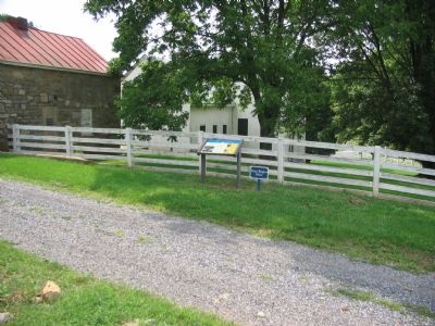
Walking Tour Stop One for Rose Hill
SHOWN IN SOURCE-SPECIFIED ORDER
| | At the beginning of the Civil War, the third generation of the Scots-Irish Glass family lived at Rose Hill. The household consisted of Thomas Glass (age 67), and his wife Margaret (age 51), his son William (age 25) and fifteen slaves, most of them . . . — — Map (db m185092) HM |
| | On March 23, 1862, the opening conflict of the famous Valley Campaign began on the adjoining Glass and Pritchard farms. You are visiting the Glass Farm called Rose Hill. The neighboring Pritchard Farm is 1½ miles to the southeast (right) of where . . . — — Map (db m154721) HM |
| | The Shenandoah Valley's strategic location and rich farmland caused it to be the scene of two major Civil War campaigns that comprised hundreds of battles and skirmishes. Many Valley farms, like Rose Hill, became battlefields or campgrounds . . . — — Map (db m3498) HM |
| | Northern Colonel Nathan Kimball saw the position of his troops on nearby Pritchard's Hill (1.5 miles left and in front of you) becoming indefensible. Southern artillery recently placed on the higher elevation of Sandy Ridge (just in front of you) . . . — — Map (db m3501) HM |
| | Southern General Thomas Jackson was already going by the nickname "Stonewall" when he directed his troops to this location to support the Southern artillery on Sandy Ridge. Ironically, his troops' retreat from this stone wall led to Jackson's only . . . — — Map (db m185120) HM |
| | Northern commander Colonel Nathan Kimball 1.5 miles away (over the hill on your right) on Prichard's Hill faced the threat of defeat. He decided to seize the initiative and order a second assault against the Southern artillery atop Sandy Ridge. At . . . — — Map (db m3504) HM |
| | As Southern units retreated and resistance fell apart, Northern victory was assured. Jackson found himself surrounded by a disorderly retreat of his soldiers. In the growing dark, a few fresh Southern units made gallant attempts to cover the . . . — — Map (db m3507) HM |
Apr. 23, 2024