Trail of Tears
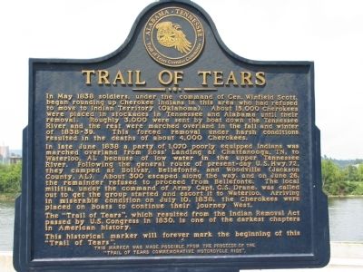
In late June 1838 a party of 1,070 poorly equipped Indians was marched overland from Ross' Landing at Chattanooga, TN, to Waterloo, AL because of low water in the upper Tennessee River. Following the general route of present-day U.S. Hwy. 72, they camped at Bolivar, Bellefonte, and Woodville (Jackson County, AL). About 300 escaped along the way, and on June 26, the remainder refused to proceed from Bellefonte. The local militia, under the command of Army Capt. G.S. Drane, was called out to get the group started and escort it to Waterloo. Arriving in miserable condition on July 10, 1838, the Cherokees were placed on boats to continue their journey West.
The "Trail of Tears", which resulted from the Indian Removal Act passed by U.S. Congress in 1830, is one of the darkest chapters in American history.
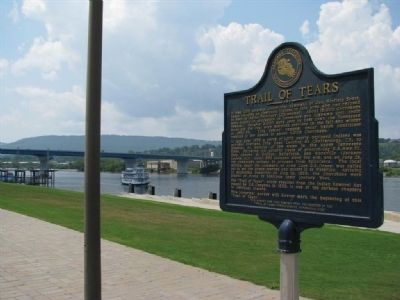
This historical marker will forever mark the beginning
of this "Trail of Tears".Erected by Alabama - Tennessee Trail of Tears Corridor Committee.
Topics and series. This historical marker is listed in this topic list: Native Americans. In addition, it is included in the Trail of Tears series list. A significant historical month for this entry is May 1838.
Location. 35° 3.393′ N, 85° 18.6′ W. Marker is in Chattanooga, Tennessee, in Hamilton County. It is in Riverfront. Marker is on Riverfront Parkway, on the left when traveling east. Touch for map. Marker is in this post office area: Chattanooga TN 37402, United States of America. Touch for directions.
Other nearby markers. At least 8 other markers are within walking distance of this marker. Stickball / Seven Sisters (a few steps from this marker); Ross's Landing (within shouting distance of this marker); Chattanooga's First Citizens (about 400 feet away, measured in a direct line); 1790 John Ross 1866 (about 400 feet away); a different marker also named Ross's Landing (about 500 feet away); "Cherokee" (about 600 feet away); Ross's Landing: River Crossing and Port (about 600 feet away); Headquarters Row (about 700 feet away). Touch for a list and map of all markers in Chattanooga.
Also see . . . Trail of Tears. (Submitted on October 17, 2010, by Tom Gillard of Tullahoma, Tennessee.)
Credits. This page was last revised on February 7, 2023. It was originally submitted on October 17, 2010, by Tom Gillard of Tullahoma, Tennessee. This page has been viewed 1,983 times since then and 195 times this year. Last updated on March 18, 2015, by J. Makali Bruton of Accra, Ghana. Photos: 1, 2. submitted on October 17, 2010, by Tom Gillard of Tullahoma, Tennessee. 3. submitted on June 10, 2015, by Dale K. Benington of Toledo, Ohio. 4. submitted on October 17, 2010, by Tom Gillard of Tullahoma, Tennessee. • Bill Pfingsten was the editor who published this page.


