Pearisburg in Giles County, Virginia — The American South (Mid-Atlantic)
Pearisburg
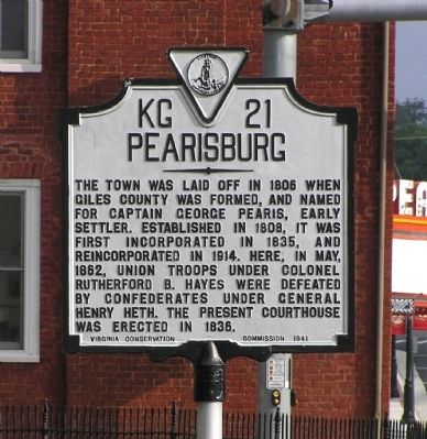
The town was laid off in 1806 when Giles County was formed, and named for Captain George Pearis, early settler. Established in 1808, it was first incorporated in 1835, and reincorporated in 1914. Here, in May 1862, Union troops under Colonel Rutherford B. Hayes were defeated by Confederates under General Henry Heth. The present courthouse was erected in 1836.
Erected 1941 by Virginia Conservation Commission. (Marker Number KG-21.)
Topics and series. This historical marker is listed in these topic lists: Settlements & Settlers • War, US Civil. In addition, it is included in the Virginia Department of Historic Resources (DHR) series list. A significant historical month for this entry is May 1862.
Location. 37° 19.605′ N, 80° 44.111′ W. Marker is in Pearisburg, Virginia, in Giles County. Marker is at the intersection of North Main Street (Business U.S. 460) and Wenonah Avenue (Business U.S. 460), on the right when traveling north on North Main Street. Touch for map. Marker is at or near this postal address: 501 Wenonah Avenue, Pearisburg VA 24134, United States of America. Touch for directions.
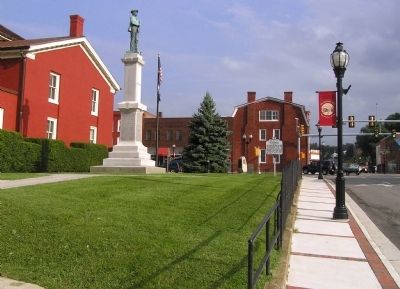
Other nearby markers. At least 8 other markers are within 6 miles of this marker, measured as the crow flies. Giles County Confederate Monument (a few steps from this marker); Giles County War Memorial (a few steps from this marker); McClaugherty Mill Stone (within shouting distance of this marker); Revolutionary War Soldiers of Giles County (within shouting distance of this marker); First Court of Giles County (approx. 1.3 miles away); Snidow's Ferry (approx. 3.3 miles away); Narrows (approx. 4.2 miles away); Snidow Pioneers (approx. 5.3 miles away). Touch for a list and map of all markers in Pearisburg.
Also see . . .
1. History of Pearisburg. Town website entry (Submitted on August 24, 2010, by PaulwC3 of Northern, Virginia.)
2. Giles County History. County website entry (Submitted on February 27, 2022, by Larry Gertner of New York, New York.)
Credits. This page was last revised on February 27, 2022. It was originally submitted on August 24, 2010, by PaulwC3 of Northern, Virginia. This page has been viewed 1,210 times since then and 32 times this year. Photos: 1, 2, 3. submitted on August 24, 2010, by PaulwC3 of Northern, Virginia.
Editor’s want-list for this marker. Photos of current courthouse (ca. 1836) • Can you help?


