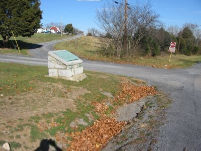
On Old Valley Pike (U.S. 11), on the right when traveling south.
September 22, 1864 General Philip Sheridan with 30,000 Federals defeated General Jubal Early with 11,000 Confederates. Driven in route from Winchester September 19, by Sheridan's overpowering numbers, Early formed his line of battle across the . . . — — Map (db m4139) HM
On Old Valley Pike (U.S. 11), on the right when traveling south.
After his defeat on 19 Sept. 1864 at the Third Battle of Winchester by Maj. Gen. Philip H. Sheridan, Lt. Gen. Jubal A. Early led his 9,500-man army here to Fisher's Hill, a favorite Confederate stronghold. Sheridan pursued, and on 22 Sept. attacked . . . — — Map (db m50313) HM
On Battlefield Road (County Route 601) at Tripplet Road (County Route 821), on the right when traveling west on Battlefield Road.
Soon after the end of the Civil War, veterans on both sides began holding reunions to walk the familiar battlegrounds and renew friendships with former comrades. Here at Fisher's Hill, veterans of the battle fought on September 22, 1864, started . . . — — Map (db m4146) HM
Near Battlefield Road (Virginia Route 601) 0.3 miles Tumbling Run Lane, on the right when traveling east.
This is Fisher's Hill, the Shenandoah Valley's "Gibraltar"—a commanding height that offered Confederate forces a superb defensive position.
Confederate Gen. Jubal A. Early's beaten and bloodied army filed into position here on September 20, . . . — — Map (db m4169) HM
Near Battlefield Road (County Route 601), on the right when traveling east.
You are standing behind the extreme left flank of Confederate Gen. Jubal A. Early's thinly stretched infantry line. At 4 p.m. on September 22, 1864, the soldiers here found themselves wrapped in a deadly pocket of Federal fire. Union Gen. Philip . . . — — Map (db m4170) HM
On Old Valley Pike (U.S. 11) at Battlefield Road (County Route 601), on the right when traveling south on Old Valley Pike.
1864 Valley Campaign Here on Tumbling Run are the remains of the "Old Pike" stone bridge. The Valley Turnpike Company was chartered in 1838 as a joint-stock corporation. The turnpike followed the route of the Great Wagon Road from Philadelphia . . . — — Map (db m4171) HM
On Old Valley Pike (U.S. 11) at Millner Road (County Route 644), on the right when traveling north on Old Valley Pike.
Here Early's Adjutant-General, A.S. Pendleton, while attempting to check Sheridan's advance, was mortally wounded, September 22, 1864. — — Map (db m4143) HM