6 entries match your criteria.
Related Historical Markers
This is a list of markers regarding Wisconsin Dutch settlers, including another marker regarding the Phoenix.
By Keith L, June 19, 2010
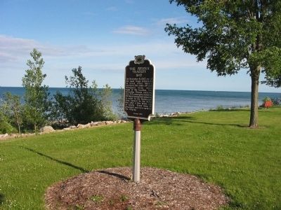
The Phoenix Tragedy Marker
SHOWN IN SOURCE-SPECIFIED ORDER
| | On November 21, 1847, one of the most tragic shipwrecks in Great Lakes' history occurred five miles off Lake Michigan's shore within sight of this location. The steamship Phoenix carrying over 225 passengers, including 175 Dutch . . . — — Map (db m32231) HM |
| | On November 21, 1847 the propeller steamer Phoenix burned, with the loss of 190 to 250 lives, seven miles north of the Sheboygan Harbor. At the time of her loss the Phoenix carried close to 300 passengers and crewmen. Most of the . . . — — Map (db m41888) HM |
| | The Dutch settlement of Oostburg, founded in the 1840s and named for a town in the Netherlands, was once located two miles to the southeast. In 1873, to attract the railroad to this location, local businessman Peter Daane constructed and donated a . . . — — Map (db m41734) HM |
| | The names of many places and families in this vicinity reflect the origin of its early settlers. Most of the settlers of Cedar Grove and Oostburg were from the province of Zeeland, although some have lived for a time in New York before catching the . . . — — Map (db m41735) HM |
| | In 1847 Reverend Pieter Zonne led a group of Netherlanders, originally from the Gelderland Province, to this area where a few other Dutch immigrant families had recently settled. Enticed by Zonne's energetic advertisements that "there is plenty of . . . — — Map (db m41737) HM |
| | Green Bay Road was the main route of settlement and communication in 19th century eastern Wisconsin. The road followed an ancient Indian trail network and was surveyed for use as a military road between Fort Dearborn (Chicago) and Fort Howard (Green . . . — — Map (db m66625) HM |
Apr. 18, 2024