Gillisonville in Jasper County, South Carolina — The American South (South Atlantic)
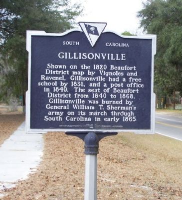
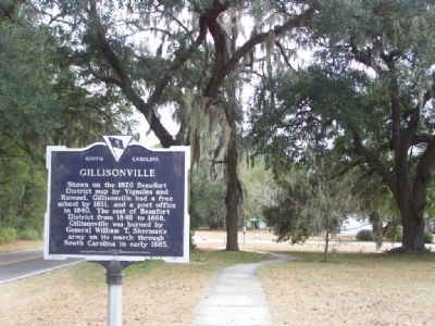
Gillisonville
Erected 1984 by Citizens of Gillisonville and Jasper County Bicentennial Committee. (Marker Number 27-6.)
Topics. This historical marker is listed in these topic lists: Military • Notable Events • Settlements & Settlers • War, US Civil. A significant historical year for this entry is 1820.
Location. 32° 36.552′ N, 80° 59.988′ W. Marker is in Gillisonville, South Carolina, in Jasper County. Marker is on Grays Highway (U.S. 278) 0.1 miles north of South Carolina Highway 462, on the left when traveling north. Touch for map. Marker is in this post office area: Ridgeland SC 29936, United States of America. Touch for directions.
Other nearby markers. At least 8 other markers are within 8 miles of this marker, measured as the crow flies. Gillisonville Baptist Church (about 700 feet away, measured in a direct line); Coosawhatchie (approx. 4.3 miles away); Battle of Coosawhatchie (approx. 4˝ miles away); Grays Consolidated High School (approx. 4.7 miles away); Battle at the Tulifinny Crossroads (approx. 5.4 miles away); Oak Grove Baptist Church (approx. 6 miles away); Pine Level Baptist Church (approx. 6.6 miles away); General Robert E. Lee (approx. 7.3 miles away).
Additional commentary.
1. Gillisonville
Named for Derry Gillison, Coosawhatchie shoe manufacturer of the early 1800s.
— Submitted January 11, 2008, by Mike Stroud of Bluffton, South Carolina.
2. Gillisonville: Holding onto its History
In 1865, as a means to an end of the Civil War, Gen. William T. Sherman marched 60,000 Union troops from Beaufort to Columbia, leveling dozens of towns like Gillisonville along the way. Today, like many sleepy Southern towns, there isn't much in Gillisonville -- a small community just north of Ridgeland in Jasper County -- except a dwindling forest of pine trees, a Baptist church and a community full of old memories about what once was and what will never be again.
"All that comes through here now are log trucks," said the Rev. M. Joseph Hethcoat, a new pastor at the Gillisonville Baptist Church. "But this place has so much history."
In the 1830s, many rice planting families around Coosawhatchie built summer homes between Coosawhatchie and Beaver Dam Creek, according to "The History of Beaufort County South Carolina, Volume 1, 1514-1861." The Gillison family was one of these wealthy families.
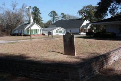
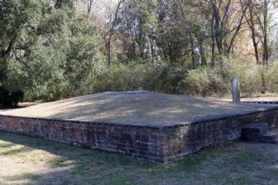
Today, across the street from Coosawhatchie Baptist Church on Morgandollar Road sits the church cemetery and the grave of Derry Gillison, the man for whom Gillisonville is named. Gillison was a Coosawhatchie shoemaker and the head of a successful rice-planting family.
In 1836, the Beaufort District Courthouse was moved from Coosawhatchie to Gillisonville because lawyers where not happy with the "unhealthy" conditions at the Coosawhatchie Courthouse, near marshland insects and fever, according to the book. A courthouse square was developed in the center of Gillisonville. To cater to visiting lawyers and courthouse traffic, in the 1850s, Dedrich Peterman, a German immigrant, built a large brick hotel and tavern on the east side of the square. In 1865, the inn, the courthouse and almost every building except Gillisonville Baptist Church were burned down by Sherman's troops.
From an article by Sandra Walsh published in the Beaufort Gazette on June 5, 2005
Source: http://africanamericangenealogy.blogspot.com/2005/06/gillisonville-holding-onto-its-history.html
— Submitted January 11, 2008, by Kevin W. of Stafford, Virginia.
3. Gillisonville
I've heard that Gillisonville would have been the next large city of South Carolina if Sherman had not came through a burnt the whole town. Please let us know if you have historical information about Gillisonville's pre-Civil War growth potential. Note To Editor only visible by Contributor and editor
— Submitted April 14, 2009, by James Hinely of Gillisonville, SC, Jasper.
Photographed By Mike Stroud, 2009
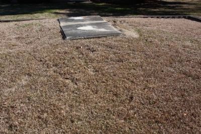
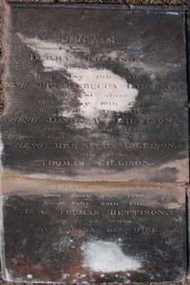
7. Gillison Gravesite
This mound lies the remains
of Derry Gillison
Born June 10th 1713
Died May 11th 1816
Also Mrs, Rebecca Gillison
Wife of above
Born Jany 10th 1751
Died Feby 5th 1819
Also David W. Gillison
Born April 1st 1783
Died May 1st 1815
Also Mrs Jane Gillison
Wife of
Thomas Gillison
Born May 6th 1777
Died May 15th 1814
Also Charles Gillison
Born Jany 28th 1788
Died Feby 29th 1816
Also Thomas Bettison
aged 53 years
and Anna his wfe
aged 19 years.
Credits. This page was last revised on November 16, 2020. It was originally submitted on January 11, 2008, by Mike Stroud of Bluffton, South Carolina. This page has been viewed 4,724 times since then and 167 times this year. Photos: 1, 2. submitted on January 11, 2008, by Mike Stroud of Bluffton, South Carolina. 3, 4, 5, 6, 7. submitted on January 31, 2009, by Mike Stroud of Bluffton, South Carolina. • Kevin W. was the editor who published this page.
