Cape Charles in Northampton County, Virginia — The American South (Mid-Atlantic)
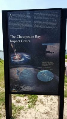
The Chesapeake Bay Impact Crater
The meteor blasted into the shallow sea that covered the state's eastern half, and exploded with more force than the combined nuclear arsenal of today's world powers. Rock flew skyward, bedrock fractured seven miles deep and enormous tsunamis raced westward to the top of the Blue Ridge Mountains.
Melted rock splashed upward in the center, hardening into a central peak nearly a mile tall, which is directly under Cape Charles. Over the centuries sentiment and debris have filled in the crater and what is now called the Chesapeake Bay lays over much of it today.
Although the carter is not visible today, small earthquakes occasionally rock its fault lines, and two low ridges appear to the mimic its contours far underground. One of these can be seen near the town of Painter, northeast of Cape Charles. The other is just east of Gloucester Courthouse on the western side of the Bay.
The meteor's impact flung a huge column of water into the air. When the water collapsed back into the hole, tsunamis (giant waves) between 1,000 and 4,000 feet high scoured the land.
Erected by Chesapeake Bay Gateways Network.
Topics. This historical marker is listed in this topic list: Natural Features.
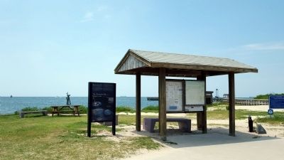
Location. 37° 16.014′ N, 76° 1.396′ W. Marker is in Cape Charles, Virginia, in Northampton County. Marker is at the intersection of Mason Avenue and Bay Avenue, on the left when traveling west on Mason Avenue. Touch for map. Marker is in this post office area: Cape Charles VA 23310, United States of America. Touch for directions.
Other nearby markers. At least 8 other markers are within walking distance of this marker. Rails Overlooking the Chesapeake Bay (a few steps from this marker); A Changing Way of Life... (within shouting distance of this marker); Cape Charles Ice & Lumber Co. (approx. 0.2 miles away); Cape Charles to Little Creek (approx. 0.2 miles away); Veterans War Memorial (approx. 0.2 miles away); The Eastern Shore Railroad (approx. 0.3 miles away); Cape Charles Colored School (approx. 0.8 miles away); Cape Charles (approx. 0.8 miles away). Touch for a list and map of all markers in Cape Charles.
Related marker. Click here for another marker that is related to this marker.
Credits. This page was last revised on June 16, 2016. It was originally submitted on July 19, 2015, by Bernard Fisher of Richmond, Virginia. This page has been viewed 832 times since then and 44 times this year. Photos: 1, 2. submitted on July 19, 2015, by Bernard Fisher of Richmond, Virginia.

