Marker Logo HMdb.org THE HISTORICAL
MARKER DATABASE
“Bite-Size Bits of Local, National, and Global History”


8 entries match your criteria.  


Related Historical Markers

Other markers regarding the Green Bay Road
 
Ancient Paths Marker image, Touch for more information
By Paul F, July 8, 2010
Ancient Paths Marker
SHOWN IN SOURCE-SPECIFIED ORDER
1 Wisconsin, Ozaukee County, Cedarburg — Ancient Paths
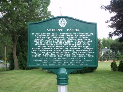
In our ancient past, Wisconsin was crossed by a system of trails first forged by deer and elk as they migrated in search of good weather, food and salt. Native Americans used the Paths as they hunted, traded, and made war in troubled times. Some . . . Map (db m66620) HM
2 Wisconsin, Milwaukee County, Milwaukee, Lincoln Park — Green Bay RoadPioneer Road Chicago to Green Bay
Established by the Federal Government 1832Map (db m66621) HM
3 Wisconsin, Racine County, Racine — Green Bay Road
Green Bay Road —— Pioneer Road —— Chicago to Green Bay —— Established by the Federal Government 1832Map (db m66622) HM
4 Wisconsin, Kenosha County, Kenosha — Green Bay Road
Pioneer Road Chicago to Green Bay Established by the Federal Government 1832Map (db m66623) HM
5 Wisconsin, Kenosha County, Pleasant Prairie — 378 — Green Bay Ethnic Trail
Green Bay Road was the main route of settlement and communication in 19th century eastern Wisconsin. The road followed an ancient Indian trail network and was surveyed for use as a military road between Fort Dearborn (Chicago) and Fort Howard (Green . . . Map (db m66625) HM
6 Wisconsin, Brown County, Green Bay — 540 — Historic Green Bay Road
In 1829, citizens of the Green Bay area petitioned Congress to build a road to Chicago. Following an ancient Indian trail, the military road to connect Fort Howard at Green Bay with Fort Dearborn at Chicago was surveyed by the U.S. War Department . . . Map (db m68166) HM
7 Illinois, Lake County, Lake Bluff — The Dwyer Settlement in Lake County, Illinois
In 1837 William Dwyer, his wife Mary, and her brother, Dr. Richard Murphy, established a claim to the property on this site and created what was known as the Dwyer Settlement. The Dwyer homestead included a tavern and one of the three stage stops . . . Map (db m66619) HM
8 Illinois, Cook County, Winnetka — The Green Bay Trail
One branch of the Green Bay Trail traversed this region. Originally an Indian trail, after 1816 the route connected Fort Dearborn at Chicago with Fort Howard at Green Bay. Couriers faced hunger, cold and Indians to carry dispatches on a round trip . . . Map (db m66618) HM
Paid Advertisement
 
 
CeraNet Cloud Computing sponsors the Historical Marker Database.
This website earns income from purchases you make after using our links to Amazon.com. We appreciate your support.
Paid Advertisement
Apr. 23, 2024