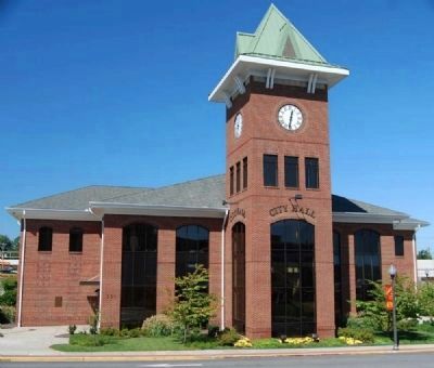
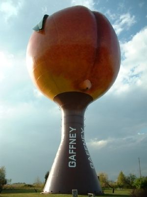
Gaffney in Cherokee County, South Carolina — The American South (South Atlantic)
Gaffney
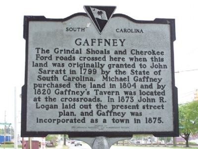
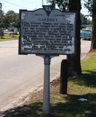
The Grindal Shoals and Cherokee Ford roads crossed here when this land was orininally granted to John Sarratt in 1799 by the State of South Carolina. Michael Gaffney purchased the land in 1804 and by 1820 Gaffney's Tavern was located at the crossroads. In 1873 John R. Logan laid out the present street plan, and Gaffney was incorporated as a town in 1875.
Erected 1977 by Cherokee Historical and Preservation Society. (Marker Number 11-2.)
Topics. This historical marker is listed in these topic lists: Colonial Era • Notable Places • Settlements & Settlers. A significant historical year for this entry is 1799.
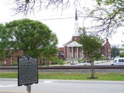
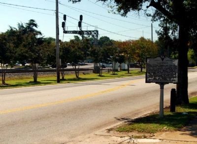
Location. 35° 4.412′ N, 81° 39.026′ W. Marker is in Gaffney, South Carolina, in Cherokee County. Marker is on North Granard Street (U.S. 29) near West Floyd Baker Boulevard (State Highway 11), on the right when traveling west. Touch for map. Marker is at or near this postal address: 115 North Granard Street, Gaffney SC 29340, United States of America. Touch for directions.
Other nearby markers. At least 10 other markers are within walking distance of this marker. A different marker also named Gaffney (about 300 feet away, measured in a direct line); Cherokee County Confederate Monument (about 500 feet away); Michael Gaffney (about 500 feet away); Col. James Williams (about 500 feet away); Cherokee County Veterans Monument (about 500 feet away); Carnegie Library (about 600 feet away); Cherokee County WW I Rememberence (about 600 feet away); Gaffney Cornerstone (about 600 feet away); Michael Gaffney Home (about 600 feet away); 09.11.2001 (about 600 feet away). Touch for a list and map of all markers in Gaffney.
Also see . . . Wikipedia entry for Gaffney, S.C. Gaffney is a city located in the Upstate of South Carolina. (Submitted on April 20, 2008, by Mike Stroud of Bluffton, South Carolina.)
Additional commentary.
1. Gaffney
Gaffney, seat of Cherokee County, is a textile manufacturing town and marketing center for farmers. On "Sales Monday" the town resembles an Eastern bazaar; people gather from the surrounding countryside to trade eggs, butter, and livestock for brogans, coffee, and snuff. Held the first Monday in each month, the occasion was known for years as "swap day," "trade day," or "bone yard day." Like poor Jack in the old fairy story, some farmers bring a cow to the market and go home with things less useful than a handful of beans.
Previously called Gaffney's Old Field, the town was named for an Irishman, Michael Gaffney, who settled here in 1804. Hardly had the first little frame shacks been grouped together around the crossroads, than promoters took over Limestone Springs, which they ballyhooed as the South's Saratoga. It was the heyday of mineral therapeutic treatment and plantation owners in the Low Country, plagued every summer by malaria, which they called "country fever" and believed was caused by "miasmas," flocked here to drink the water. A $75,000 hotel was built in 1835, and the town assumed the characteristics of a gay resort. Wealthy patients paid through the nose for the sumptuousness to which they were accustomed at home; the corks of champagne bottles popped at night and race tracks were crowded in the afternoon. the town also became noted for its tilting tournaments, cockfights, and gander pullings, the last a cruel sport in which a plucked and greased gander was suspended mid-air and exposed to competing horsemen who tried to snatch off its head while riding past at a hard gallop. (Source: South Carolina: A Guide to the Palmetto State by the Federal Writers' Project (1949) pg 349.)
— Submitted October 23, 2009, by Brian Scott of Anderson, South Carolina.
Credits. This page was last revised on June 16, 2016. It was originally submitted on April 20, 2008, by Mike Stroud of Bluffton, South Carolina. This page has been viewed 1,931 times since then and 61 times this year. Photos: 1. submitted on April 20, 2008, by Mike Stroud of Bluffton, South Carolina. 2. submitted on October 23, 2009, by Brian Scott of Anderson, South Carolina. 3. submitted on April 20, 2008, by Mike Stroud of Bluffton, South Carolina. 4, 5. submitted on October 23, 2009, by Brian Scott of Anderson, South Carolina. 6. submitted on April 20, 2008, by Mike Stroud of Bluffton, South Carolina. • Craig Swain was the editor who published this page.
