Near Brownfield in Terry County, Texas — The American South (West South Central)
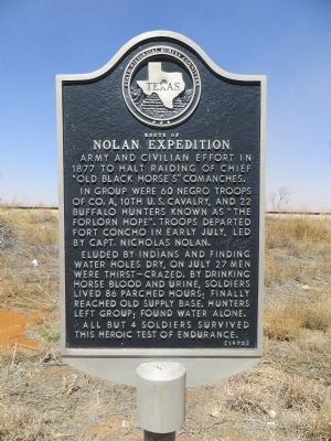
Route of Nolan Expedition
In group were 60 Negro troops of Co. A, 10th U.S. Cavalry, and 22 buffalo hunters known as “The Forlorn Hope”. Troops departed Fort Concho in early July, led by Capt. Nicholas Nolan.
Eluded by Indians and finding water holes dry, on July 27 men were thirst-crazed. By drinking horse blood and urine, soldiers lived 86 parched hours; finally reached old supply base. Hunters left group; found water alone.
All but 4 soldiers survived this heroic test of endurance.
Erected 1972 by State Historical Survey Committee. (Marker Number 4370.)
Topics. This historical marker is listed in these topic lists: African Americans • Notable Events • Wars, US Indian. A significant historical year for this entry is 1877.
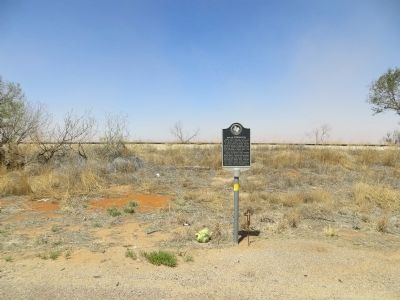
Location. 33° 17.77′ N, 102° 13.556′ W. Marker is near Brownfield, Texas, in Terry County. Marker is at the intersection of Lubbock Road (U.S. 62/82) and Farm to Market Road 260, on the right when traveling south on Lubbock Road. Touch for map. Marker is in this post office area: Brownfield TX 79316, United States of America. Touch for directions.
Other nearby markers. At least 8 other markers are within 8 miles of this marker, measured as the crow flies. Brooks Blacksmith Shop (approx. 3 miles away); Meadow Depot (approx. 3.1 miles away); An Early Native American Resident (approx. 3.1 miles away); Meadow United Methodist Church (approx. 3.2 miles away); Meadow Cemetery (approx. 4 miles away); The Oak Grove (approx. 7˝ miles away); Site of Joe T. and Laura Hamilton Home (approx. 7˝ miles away); A Learning Journey (approx. 7˝ miles away). Touch for a list and map of all markers in Brownfield.
Also see . . . Buffalo Soldier Tragedy of 1877. Wikipedia (Submitted on May 14, 2014, by Richard E. Miller of Oxon Hill, Maryland.)
Additional keywords. "The Staked Plains Horror"
Credits. This page was last revised on June 16, 2016. It was originally submitted on May 7, 2014, by Bill Kirchner of Tucson, Arizona. This page has been viewed 1,161 times since then and 90 times this year. Last updated on May 14, 2014, by Richard E. Miller of Oxon Hill, Maryland. Photos: 1, 2. submitted on May 7, 2014, by Bill Kirchner of Tucson, Arizona. • Bernard Fisher was the editor who published this page.

