Coopers Rock State Forest in Monongalia County, West Virginia — The American South (Appalachia)
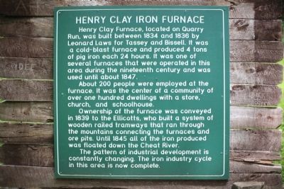
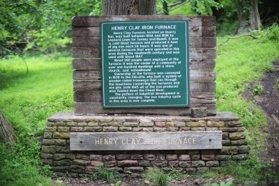
Henry Clay Iron Furnace
About 200 people were employed at the furnace. It was the center of a community of over one hundred dwellings with a store, church, and schoolhouse.
Ownership of the furnace was conveyed in 1839 to the Ellicotts, who built a system of wooden railed tramways that ran through the mountains connecting the furnaces and ore pits. Until 1845 all of the iron produced was floated down the Cheat River.
The pattern of industrial development is constantly changing. The iron industry cycle in this area is now complete.
Topics and series. This historical marker is listed in this topic list: Industry & Commerce. In addition, it is included in the Appalachian Iron Furnaces series list. A significant historical year for this entry is 1834.
Location. 39° 38.939′ N, 79° 49.073′ W. Marker is in Coopers Rock State Forest, West Virginia, in Monongalia County. Marker is on County Line Drive (Local Route 73/12) south of Exit 15 (Interstate 68). Touch for map. Marker is at or near this postal address: 61 County Line Drive, Bruceton Mills WV 26525, United States of America. Touch for directions.
Other nearby markers. At least 8 other markers are within 3 miles of this marker, measured as the crow flies. Fueling a Community: The Henry Clay Iron Furnace (within shouting distance of this marker); Henry Clay Furnace (approx. 0.4 miles away); The CCC: Creating a Lasting Monument to Conservation (approx. 0.8 miles away); Salt Sand (approx. 0.9 miles away); Memorial Fountain (approx. 2.4 miles away); Ice’s Ferry (approx. 2.6 miles away); Site of the Birthplace of David Adam Ice (approx. 2.6 miles away); Clean Water Comes To Morgantown (approx. 2.8 miles away). Touch for a list and map of all markers in Coopers Rock State Forest.
More about this marker. This marker is at the end of a one mile downhill hiking trail, the Clay Furnace Trail, blazed red and described as moderate in difficulty. It is fairly level with some steep sections. It begins at the furnace parking area in Coopers Rock State Park where the Henry Clay Furnace state marker is located. There is no fee to enter the park. Park closes at dusk.
Regarding Henry Clay Iron Furnace. The wagons on the wooden tramways were hauled by oxen. Pig iron and finished goods were transported to Jackson’s Iron Works near Ice’s Ferry on the Cheat River where a sawmill made barrels and flat boats that floated the goods to market on the Monongahela and some as far as the Ohio and Mississippi. The boats were sold for lumber at the destination and the crew walked back to Ice’s Ferry.
After 1849 the industry declined rapidly. The last iron was made at Ice’s Ferry in 1868. —Source: A very thorough and readable pamphlet by Ben White and Kenneth Carvell available at no charge at the Coopers Rock State Park concession building.
Related marker. Click here for another marker that is related to this marker.
Also see . . .
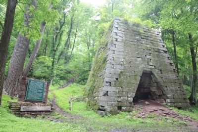
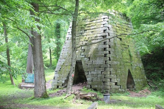
1. Wikipedia Entry. “Henry Clay Furnace is a historic iron furnace located in Cooper's Rock State Forest near Cheat Neck, Monongalia County, West Virginia. It was built between 1834 and 1836, and is a 30 foot square, 30 feet high stone structure in the shape of a truncated pyramid. The furnace may have continued to operate until 1868 when all the Cheat River iron works ceased production. It is among the ten or more abandoned iron furnaces still existing in northern West Virginia. It was listed on the National Register of Historic Places in 1970” (Submitted on June 17, 2014.)
2. The Antebellum Iron Industry In Western Virginia: the Cheat Basin ironworks. “As the 1800s progressed, three major thoroughfares were built. First, the National Road was built from Cumberland, MD through southern Pennsylvania and on to Wheeling and the Ohio River. This route is present-day US 40 and I-70. Senator Henry Clay of Kentucky and US Treasury Secretary Albert Gallatin greatly influenced this route. Had they not interceded for their friends in Wheeling and Uniontown (PA), the National Road would likely have followed the Cheat River watergrade and then crossed a ridge to Fishing Creek and New Martinsville.
“Next came the Northwestern Turnpike. Originally planned to follow nearby Decker’s Creek into Morgantown, political pressures forced a realignment to Clarksburg, some forty miles to the south. And finally, the Baltimore & Ohio RR was forced to follow a southerly route to Clarksburg because politicians and merchants along the National Road in Pennsylvania fought competition from the railroad.
“Though the Cheat Mountain ironworks comprised a healthy industrial district, politicians of all stripes saw to it that no road would benefit the area’s mills.” (Submitted on June 17, 2014.)
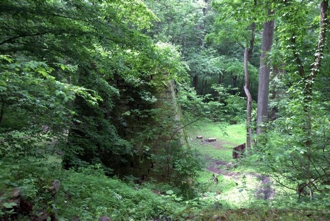
Photographed By J. J. Prats, June 17, 2014
5. First View of the Furnace from the Trail
The trail continues to the left, curving around to the front of the furnace as it finishes its drop to the valley floor. You can scramble down this shortcut if you would like. It was from this elevated path that a wooden bridge to the top of the structure was used to introduce the iron ore, lime, and charcoal into the furnace.
Credits. This page was last revised on June 16, 2016. It was originally submitted on June 17, 2014, by J. J. Prats of Powell, Ohio. This page has been viewed 1,060 times since then and 70 times this year. Photos: 1, 2, 3, 4, 5. submitted on June 17, 2014, by J. J. Prats of Powell, Ohio.
