Near Terrebonne in Jefferson County, Oregon — The American West (Northwest)
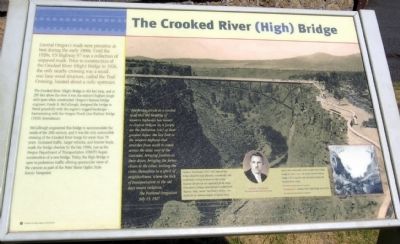
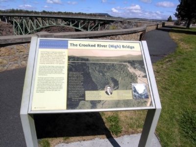
The Crooked River (High) Bridge
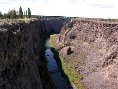
The Crooked River (High) Bridge is 464 feet long, and at 295 feet above the river it was the nation's highest single arch span when constructed. Oregon's famous bridge engineer, Conde B. McCullough, designed the bridge to blend gracefully with the region's rugged landscape -- harmonizing with the Oregon Trunk Line Railway Bridge (1910) downstream.
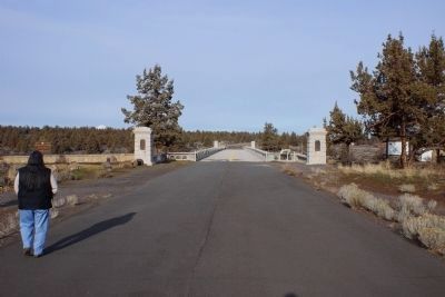
McCullough engineered this bridge to accommodate the needs of the 20th century, and it was the only automobile crossing of the Crooked River Gorge for more than 70 years. Increased traffic, larger vehicles, and heavier loads, made the bridge obsolete by the late 1990s, just as the Oregon Department of Transportation (ODOT) began construction of a new bridge. Today, the High Bridge is open to pedestrian traffic offering spectacular views of the canyon as part of the Peter Skene Ogden State Scenic Viewpoint.
(Background Photo Caption)
"The bridge stands as a symbol of all that the building of modern highways has meant to central Oregon. In it people see the fruitation (sic) of their greatest hopes, the last link in the modern highway that stretches from north to south across the state east of the Cascades, bringing tourists to their doors, bringing the farms closer to the cities, uniting the cities themselves in a spirit of neighborliness, where the lack of transportation in the old days meant isolation."
The Portland Oregonian
July 15, 1927
(Inset)
Conde B. McCullough (1887-1946) believed that bridges should be built efficiently, economically, and aesthetically. During his tenure as State Bridge Engineer, McCullough was responsible for the design of hundreds of bridges characterized by architectural elegance. Today, several McCullough bridges are eligible for the National Register of Historic Places.
Prior to the construction of the Crooked River (High) Bridge in 1926 (right), the Oregon Trunk Railway Bridge (1911) was the only structure crossing the Crooked River Gorge.
Topics. This historical marker is listed in this topic list: Bridges & Viaducts. A significant historical date for this entry is July 15, 1927.
Location. 44° 23.509′ N, 121° 11.64′ W. Marker is near Terrebonne, Oregon, in Jefferson County. Marker can be reached from U.S. 97, 0.4 miles south of SW Culver Highway, on the left when traveling north. Marker is located along the view
trail of the Peter Ogden Skene State Scenic Viewpoint. Touch for map. Marker is in this post office area: Terrebonne OR 97760, United States of America. Touch for directions.
Other nearby markers. At least 7 other markers are within 14 miles of this marker, measured as the crow flies. Oregon Scenic Highways (within shouting distance of this marker); Peter Skene Ogden Park (within shouting distance of this marker); A Bridge for the New Millenium (within shouting distance of this marker); Colonel Rex T. Barber Memorial (about 300 feet away, measured in a direct line); The Oregon Trunk Railroad Bridge (about 400 feet away); Peter Skene Ogden (about 500 feet away); Metolius Depot (approx. 13˝ miles away).
More about this marker. The photograph in the marker background is of the Crooked River High Bridge circa 1926.
Also see . . . Peter Skene Ogden State Scenic Viewpoint - Wikipedia entry. (Submitted on August 19, 2013, by Duane Hall of Abilene, Texas.)
Photographed By Chris English, January 20, 2015
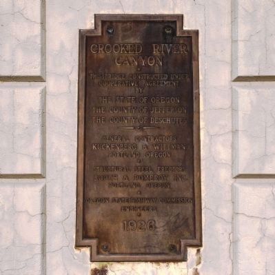
5. Crooked River Bridge Marker
Crooked River Canyon. This bridge constructed under cooperative agreement by the State of Oregon, the County of Jefferson, the County of Deschutes. General contractors Kuckenberg & Wittman, Portland Oregon. Structural steel erectors Booth & Pomeroy Inc. Portland, Oregon. Oregon State Highway Commission Engineers 1926
Credits. This page was last revised on January 28, 2018. It was originally submitted on August 19, 2013, by Duane Hall of Abilene, Texas. This page has been viewed 1,133 times since then and 56 times this year. Photos: 1, 2, 3, 4. submitted on August 19, 2013, by Duane Hall of Abilene, Texas. 5, 6. submitted on January 26, 2015, by Chris English of Phoenix, Arizona.
Editor’s want-list for this marker. Other markers and interpretive signs at the Peter Skene Ogden State Scenic Viewpoint. • Can you help?
