2 entries match your criteria.
Related Historical Markers
By David Seibert, February 2, 2008
Point Peter Marker
SHOWN IN SOURCE-SPECIFIED ORDER
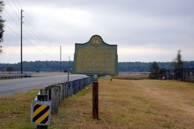
| 1 ► Georgia, Camden County, St. Marys — 020-8 — Point Peter — |
| East of here, at the junction of Peter Creek and the St. Marys river, the British built Fort Tonyn in 1776; controlling the southern part of the colony of Georgia for two years. In 1778, American Revolutionary forces, both land and water, forced . . . — — Map (db m81753) HM | |||
| 2 ► Georgia, Camden County, Kingsland — 020-5 — Post Road — |
| This road, formerly an Indian trail which paralleled the coast, was used by the Spanish and the British. In 1778 it was traveled by the Revolutionary soldiers who marched against Fort Tonyn at Point Peter. Albert Gallatin while U.S. Secretary . . . — — Map (db m81752) HM | |||