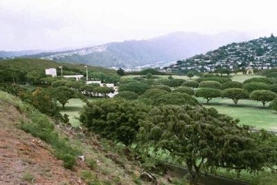
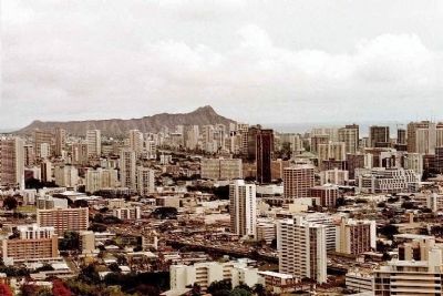
Nuuanu - Punchbowl in Honolulu in Honolulu County, Hawaii — Hawaiian Island Archipelago (Pacific Ocean)
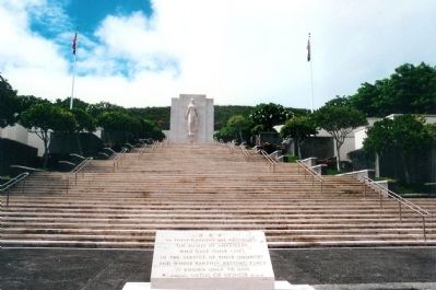
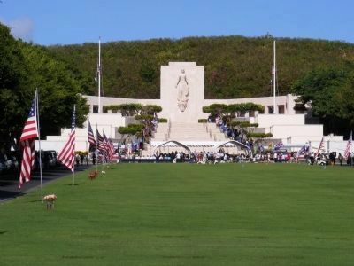
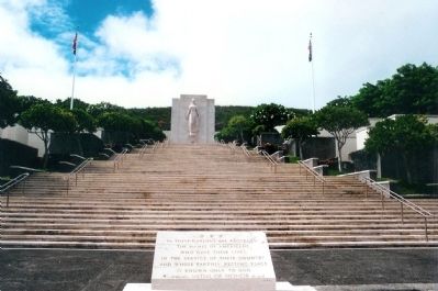
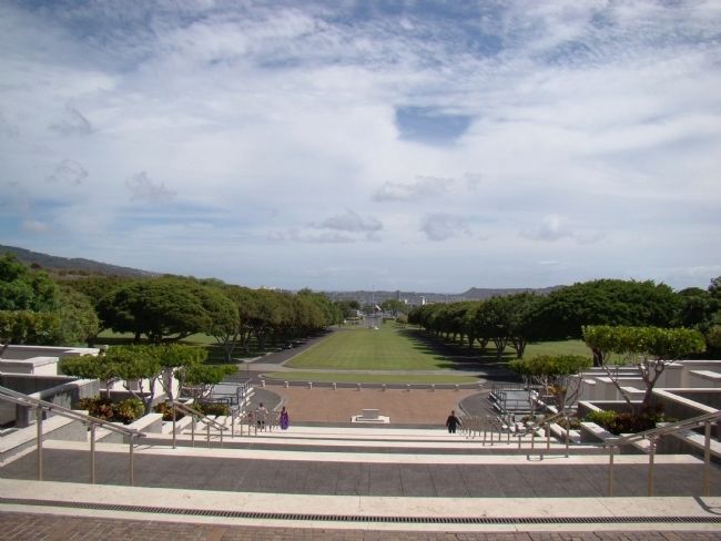
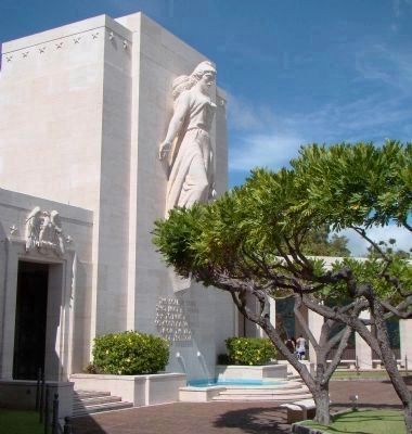
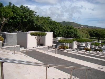
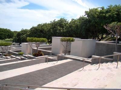
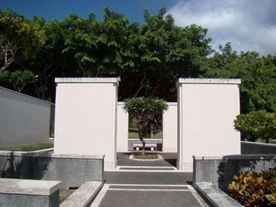
The Honolulu Memorial at the National Memorial Cemetery of the Pacific
Inscription.
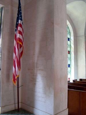
the names of Americans
who gave their lives
in the Service of their Country
and whose earthly resting place
is known only to God
*Indicates Medal Of Honor Award
Erected 1949.
Topics and series. This memorial is listed in these topic lists: Cemeteries & Burial Sites • War, World II. In addition, it is included in the Lost at Sea, and the National Cemeteries series lists.
Location. 21° 18.81′ N, 157° 50.839′ W. Marker is in Honolulu, Hawaii, in Honolulu County. It is in Nuuanu - Punchbowl. Memorial can be reached from Puowaina Drive. Located in the Punchbowl National Memorial Cemetery, above the city of Honolulu. From Ala Moana Boulevard, take Ward Avenue to a right on Prospect Street, and follow the signs to the Punchbowl. Touch for map. Marker is at or near this postal address: 2177 Puowaina Drive, Honolulu HI 96813, United States of America. Touch for directions.
Other nearby markers. At least 8 other markers are within walking distance of this marker. Father Damien (approx. ¾ mile away); Iolani Palace (approx. 0.9 miles away); First Hawaiian Printing (approx. 0.9 miles away); Kawaiaha'o Landmark (approx. 0.9 miles away); Reverend James Kekela (approx. 0.9 miles away); a different marker also named Kawaiaha‘o Landmark (approx. 0.9 miles away); Hiram Bingham (approx. 0.9 miles away); King William Charles Lunalilo (approx. 0.9 miles away). Touch for a list and map of all markers in Honolulu.
Regarding The Honolulu Memorial at the National Memorial Cemetery of the Pacific. The first interment was made Jan. 4, 1949, followed by an official dedication on September 2, 1949. Among the first to be buried here were 776 casualties from the December 7, 1941 attack on Pearl Harbor, and servicement from locations around the Pacific Theater, including Wake Island and Japanese prisoner-of-war camps.
In 1964, the American Battle Monuments Commission erected the Honolulu Memorial at the National Memorial Cemetery of the Pacific “to honor the sacrifices and achievements of American Armed Forces in the Pacific during World
War II and in the Korean War.” It was officially dedicated on 1 May 1966. The memorial was later expanded in 1980 to include the Vietnam War.
The names of 28,788 military personnel who are missing in action or were lost or buried at sea in the Pacific during these conflicts are inscribed on marble slabs in ten “Courts of the Missing” which flank the Memorial’s grand stone staircase.
The Punchbowl's Hawaiian name is "Puowaina," translated as the "Hill of Sacrifice."
Also see . . . Wikipedia entry for the National Memorial Cemetery of the Pacific. (Submitted on January 4, 2008, by Mike Stroud of Bluffton, South Carolina.)
Additional commentary.
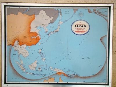
1. Operations in the Pacific, 1942–1945
This is the text on the map shown in Photo 7.
1. Exploiting their successful attack upon Pearl Harbor on 7 December 1941, the Japanese struck at American, British, Chinese and Dutch territories. The United States, forced initially upon the defensive, nevertheless determined to hold open the line of communications to Australia, to aid in its defense, and to regain her status in the Philippines. In May and
Photographed By Michael Stroud, September 27, 2000
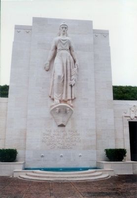
3. Lady Columbia ... For all the Mothers
At the top of the staircase stands a statue of Lady Columbia, holding a laurel branch. She is reported to represent all grieving mothers. The inscription below the statue, taken from Abraham Lincoln's letter to Mrs. Bixby, reads:
“The Solemn Pride that must be yours to have laid so costly a sacrifice upon the altar of freedom.”
2. To halt the Japanese advance in The Solomons, U. S. Forces took the offensive, landing on Guadalcanal on 7 August 1942. The succession of hard-fought naval battles and grim struggles on land and in the air which followed marked the turning point of the Pacific War. In southeastern New Guinea, U. S. and Australian forces repulsed the Japanese and started on the long road back to the Philippines. Supplies flown from India over the Himalayas aided the Chinese effort against the invaders.
3. Submarines persistently attacked Japanese ships carrying oil, rubber and other materials essential to the enemy’s industry. Relentless assault against his combat and merchant ships, from the sea and from the air, continued with ever-increasing attrition throughout the war.
4. To penetrate the enemy’s defenses and gain bases from which aircraft could strike at the Japanese home islands, the United States in 1943 committed its forces in a succession of triphibious assaults along two main axes of advance. One thrust continued the attacks northwestward simultaneously through The Solomons and along the coast of New Guinea; the other crossed the vast reaches of the central Pacific via the Gilbert and Marshall Islands, then The Marianas (bringing on the Battle of the Philippine Sea) and The Palaus. Far to the north other American forces expelled the enemy from the Aleutians. In Burma Allied forces fought to reopen the overland supply route to China and stimulate her efforts to eject the Japanese.
5. After the capture of The Marianas, bombers from these islands joined the assault on Japan, already started from airfields in China, which developed into continual and violent bombardment aimed at the destruction of the enemy’s military and industrial systems.
6. The landing at Leyte in October 1944 led to the decisive naval victories at Leyte Gulf. Landings on Luzon, Iwo Jima and Okinawa followed in rapid succession carrying American forces to the enemy’s threshold. Fast carrier task forces coming from the central Pacific joined in the bombardment of Japan while warships shelled her coastal stations. Following the devastation from the air of Hiroshima and Nagasaki, the Japanese government sued for peace; the surrender terms were signed in Tokyo Bay on 2 September 1945.
— Submitted December 31, 2008.
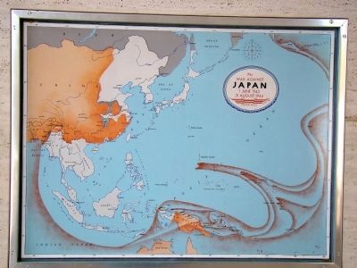
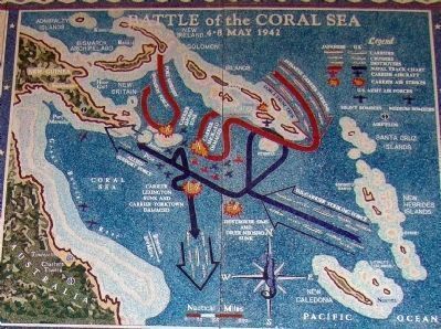
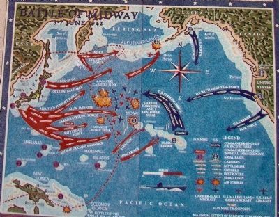
2. Battle of the Coral Sea, 4–8 May 1942; Battle of Midway, 3–7 June 1942
This is the text to the left of the maps shown in Photos 11 and 12.
By mid-April 1942 the Japanese had established bases in the New Guinea-Solomon Islands area, thus menacing Australia itself. On 3 May they occupied Tulagi, in The Solomons. Aircraft from the U. S. Carrier Yorktown attacked Tulagi the next day sinking an enemy destroyer, several mine-sweepers, smaller craft and seaplanes. The Yorktown task force then turned south to rendezvous with U.S.S. Lexington. On 5 May the Allied task force moved northwest to intercept the Japanese Port Moresby invasion group which was covered by a powerful aircraft carrier striking force.
On 7 May, Lexington and Yorktown aircraft sank the enemy carrier Shojo; the Japanese then withdrew their amphibious invasion force. That same morning Japanese carrier aircraft sank destroyer Sims and damaged oiler Neosho so badly that she had to be scuttled. The climatic carrier battle occurred on 8 May. American carrier aircraft, having located two large
Japanese carriers, Shokaku and Suikaku, protected by four heavy cruisers, severely damaged the Shokaku. The enemy in turn damaged Yorktown and Lexington. The latter being abandoned and sunk.
The Battle of the Coral Sea, the first naval battle in which all losses were inflicted by carrier-based aircraft, was a strategic victory of the first magnitude for the U. S. Navy. When the Port Moresby invasion was thwarted the Japanese push southwards was halted for the first time. Occurring immediately after the surrender of Corregidor, the morale value of the victory was immeasurable. Furthermore, damage to Shokaku and large loss of aircraft by Zuikaku prevented these powerful Japanese carriers from participating in the crucial Battle of Midway.
When their advance toward Australia was checked at the Battle of the Coral Sea, the Japanese shifted the direction of their main offensive. Enemy occupation forces, supported by the Japanese combined fleet, moved against Midway Island, and Kiska and Attu in the western Aleutians. On 4 June aircraft from four Japanese fleet carriers attacked Midway. In its defense U. S. Marine Corps antiaircraft batteries, and land-based
Photographed By J. J. Prats, October 23, 2008
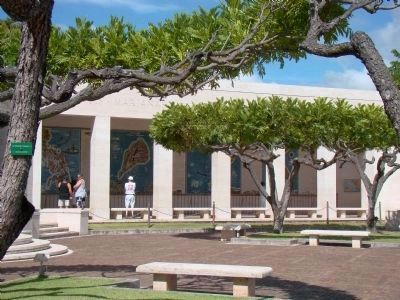
7. Loggia to the Right of Lady Columbia
The murals shown on the following photographs are shown in the order they are found from left to right, interrupted by the chapel behind Lady Liberty. Three smaller maps showing the sphere of influence of the enemy are found next to and across from the first and last murals at the extreme end of the loggias.
Far to the north, Japanese airplanes from two other carriers bombed Dutch Harbor on 3 and 4 June, meeting resistance from U. S. Navy and Army air forces aircraft. Under cover of this diversion the Japanese, without opposition, occupied the islands of Attu and Kiska on 7 June.
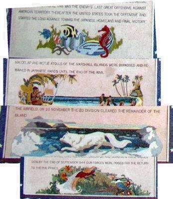
The Japanese loss of four large aircraft carriers and their complement of 250 aircraft with many first-line pilots reversed the strategic situation in the Pacific, this was the enemy’s last great offensive against American territory. Thereafter the United States took the offensive and started the long advance towards the Japanese homeland and final victory.
— Submitted 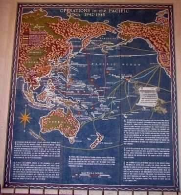 January 1, 2009.

Photographed By J. J. Prats, October 23, 2008
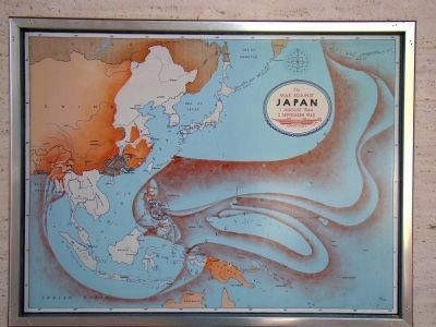
8. Operations in the Pacific, 1942–1945
The text in the white scroll on the right quotes General Douglas MacArthur (1880-1964) and reads, “the problem basically is theological and involves a spiritual recrudescence and improvement of human character.” Click on the image for a clear, full-size version.
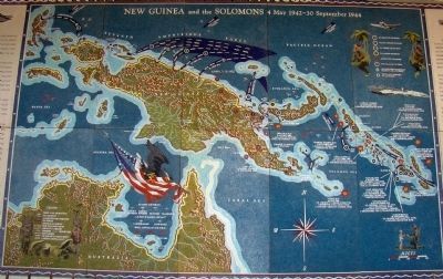
3. New Guinea and The Solomons, 4 May 1942 – 30 September 1944
This is the text to the left of the map shown in Photo 13.
Reacting to their defeats at the Battles of the Coral Sea and Midway in May and June 1942 which restored the balance of sea power in the Pacific Ocean, the Japanese aimed at New Guinea and the Solomons as their new objectives. On July 21 they seized Buna and Gona in eastern New Guinea, then crossed the Owen Stanley Range to within 30 miles of Port Moresby. The Japanese also started to build an airfield in Guadalcanal.
To block the advance in The Solomons which threatened our vital supply line to Australia, U. S. forces took the offensive, landing on Guadalcanal and Tulagi on 7 August 1942. The enemy response was prompt and vigorous. The series of hard-fought naval battles and grim struggles on land and in the air which followed marked the ebbing of the Japanese onslaught. Although their tenacious opposition forced us to reinforce our land, sea and air forces heavily. Six long months passed before American troops overran the last Japanese positions on Guadalcanal.
Simultaneously, in New Guinea,
the Australians drove the enemy back to his Buna-Gona beachhead and defeated another Japanese force at Milne Bay. Australian and American troops then expelled the Japanese force at Milne Bay. Australian and American troops then expelled the Japanese from their beachhead, aided by the Allied air forces which both transported troops and supplies and also constantly bombarded the enemy.
During the last week of January 1943, air-transported Australian troops repulsed a thrust at Wau. In March, in the Battle of the Bismark Sea, U. S. and Australian aircraft executed an annihilating attack on a Japanese convoy attempting to reinforce their New Guinea garrisons. In June, the Allies launched heavy air assaults against the strongholds of Rabaul and Kavieng; after occupying Woodlark and Kiriwina Islands they opened simultaneous amphibious offensives in The Solomons and New Guinea. Seizing Rendova, U. S. forces assaulted New Georgia and, after a severe struggle, captured the enemy airfield at Munda, then moved on Vella Lavella. In New Guinea Australian and U. S. forces captured Salamaua, Lae and Finschhafen. Preceded by diversionary attacks on Choiseul and the Treasury Islands, American forces next landed on Bougainville; landings on New Britain and at Saidor, New Guinea, followed. The encirclement of Rabaul was completed when our troops seized the Admiralties in February and occupied Emirau in March 1944. Meanwhile a major counteroffensive against our Bougainville beachhead was repulsed.
In order to speed the westward advance in New Guinea it was now decided to bypass the strong Japanese base at Wewak by leapfrogging some 350 miles to Hollandia, with a secondary landing at Aitape to the east; here a severe struggle ensued. Then, while Australian troops continued the advance on land, U. S. Army troops, in close teamwork with U. S. naval and air forces, seized Wakde, Biak, Noemfoor, Sansapor and Morotai in rapid succession. By the end of September 1944 our forces were poised for the return to the Philippines.
— Submitted January 1, 2009.
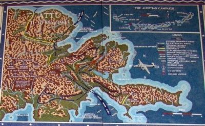
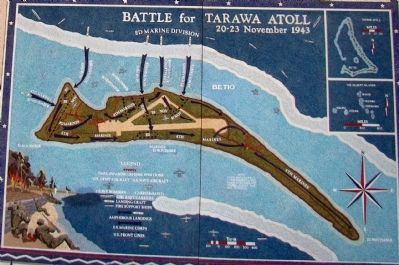
4. Attu, 11–30 May 1943; Battle for Tarawa Atoll, 20–23 November 1943
This is the text to the left of the maps shown in Photos 14 and 15.
During the Battle of Midway in June 1942 Japanese aircraft attacked Dutch Harbor; the enemy then occupied Attu and Kiska to block a possible American
advance. In August American forces started westward along the Aleutian chain, constructing airfields and naval bases. Despite persistently hazardous weather U. S. naval forces, the Eleventh Air Force, and Canadian aircraft attacked the enemy at every opportunity. Japanese efforts to send reinforcements were halted at the naval Battle of the Komandorski Islands, west of Attu on 26 March 1943.
By-passing Kiska, the U. S. Navy North Pacific Force sailed for Attu. A mountainous island 40 miles long by 15 miles wide. On 11 May the reinforced 7th Infantry Division landed north and south of the Japanese, who held only the east end of the island. The troops made good progress ashore in spite of fog, treacherous tundra, and precipitous snow-covered mountains, until they encountered stiff resistance on both fronts. Although supported by naval gunfire, and by Army and Navy aircraft whenever the weather permitted, the advance was costly and difficult.
Finally on 16 May the northern force broke through he skillful, determined defense. Thereupon our infantry captured Prendergast and Gilbert ridges, then seized positions on Fishhook Ridge. On the night of 28–29 May the enemy pushed a suicidal counterattack 3½ miles
through a gap in the lines until halted by U. S. Amry engineers and artillerymen; organized resistance ended on 30 May.
The strategic soundness of by-passing Kiska was then demonstrated when Americans and Canadians landed on that island on 15 August, the Japanese had already departed.
Toward the end of 1943 the United States committed its forces in an advance across the central Pacific to converge with its thrusts through New Guinea and the Solomons, the initial effort was against Makin and Tarawa in the Gilbert Islands. To gain bases for an attack on the Marshalls, fast carrier strikes by the Fifth Fleet and bombing attacks by the Seventh Air Force, which had been started during the summer, were intensified in preparation for the assault. On 20 November, using its fire support, the northern attack force landed the 165th and elements of the 105th Infantry Regiments of the Army’s 27th Division on Makin. Overcoming stubborn defense the troops secured the atoll.
Simultaneously the southern attack force, likewise covered by naval and aerial bombardment, landed five battalions of the 2nd and 8th Regiments of the 2nd Marine Division on Betio, the stronghold of the Tarawa atoll. The chain of pillboxes, gun emplacements and rifle pits had not been destroyed by the bombardment and the defenders took a heavy toll of all who approached the island. By nightfall the small beachheads had been established on the north shore.
Reinforced on 21 November, the Marines fought their way across the island. On the following day the 6th Marines, from their western landing beach, advanced along the south shore to link up with the 2nd, and then in cooperation with the 8th, to extend the front line to the eastern edge of the airfield. On 23 November the 2nd division cleared the remainder of the island.
— Submitted January 4, 2009.
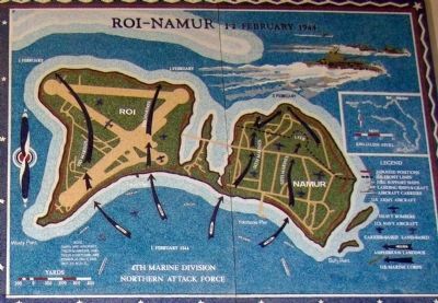
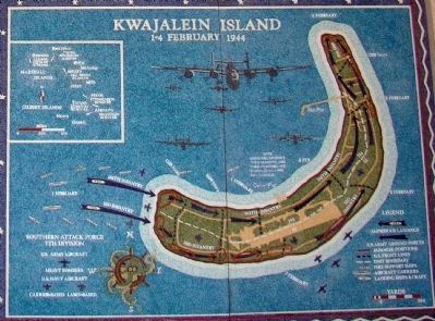
5. Roi–Namur, 1–2 February 1944; Kawajalein Island, 1–4 February 1944
This is the text to the left of the maps shown in Photos 16 and 17.
Even before the amphibious assaults upon the Gilbert Islands were launched, the next step in the central Pacific advance, the air attack upon the Marshall Islands was initiated. As early as November 1943 aircraft of the Seventh Air Force and carrier-based airplanes of the Fifth Fleet started the preliminary bombardment of the Marshalls; in December
and January the attacks were progressively intensified.
On 29 January 1944 fire support units of the fifth fleet joined in the bombardment of Roi and Namur, the twin northernmost islands of Kawajalein Atoll. Then on 31 January the six islets to the south of, and closest to Roi and Namur, were seized by the 25th Marines of the 4th Marine Division, which emplaced artillery to fire in support of the main attack.
On 1 February the 23rd Marines landed on Roi while the 24th Marines landed on Namur. Overcoming the Japanese garrison the 23rd Marines pushed forward and captured Roi before nightfall. The 24th Marines encountered much stronger resistance on Namur and their advance was stopped after they had established abeachhead 500 yards deep. On 2 February they resumed the attack with renewed aggressiveness and early in the afternoon Namur was declared secure.
To the south, Army and Naval aircraft cooperated in the preliminary bombardment of Kwajalein, the largest islands in the atoll, as they had against Roi and Namur in the North. Here, too, the ships of the Fifth Fleet took the island under heavy fire commencing on 30 January 1944. The next day the 17th Infantry of the 7th Division seized four islets to the north of Kwajalein and artillery was emplaced.
On 1 February, covered by Army and naval air support, gunfire of the ships, and by its own artillery, the 7th Division landed its 32nd and 184th infantry regiments on the narrow western end of Kwajalein. The two regiments advanced steadily and by nightfall had established a beachhead almost a mile deep. The attack continued on the two succeeding days against increasing resistance, which was finally beaten down; capture of the island was completed on the afternoon of 4 February. The remaining islets comprising Kwajalein Atoll were taken by 5 February. In the meantime our forces landed on Majuro Atoll in the southeastern part of the group.
In the western Marshalls, between 17 and 22 February the 22nd marines with the 106th infantry of the 27th division took Eniwetok Atoll, bringing our forces closer to the next objective, the Marianas. The Jaluit, Mille, Maloelap and Wotje Atolls of the Marshall Islands were bypassed and remained in Japanese hands until the end of the war.
— Submitted January 4, 2009.
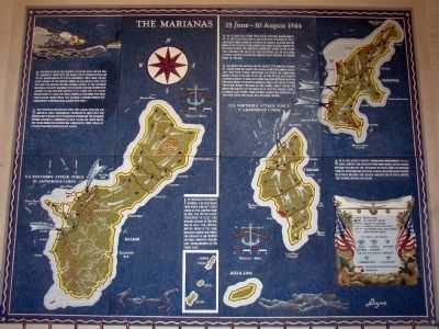
6. The Marianas, 15 June – 10 August 1944
This text is the on the map shown in Photo 18.
1. To penetrate the enemy’s defenses and gain bases from which aircraft could strike at the Japanese home islands, the United States undertook to seize the Mariana Islands in the summer of 1944. For several months prior to the landings, fast carrier task forces and aircraft of the Seventh Air Force conducted preliminary bombardments of the target area.
2. On 15 June 1944, under cover of air and naval bombardment by the Fifth Fleet, the 2nd and 4th Marine Divisions of the V Amphibious Corps landed on Saipan. The Japanese reaction was immediate and vigorous; their carrier task force steamed toward the Marianas to meet the American Amphibious effort. In the action that followed, the Battle of the Philippine Sea on 19–20 June, Japanese carrier aviation was substantially impaired as a major force in the war.
3. Meanwhile the Marines and the Army’s 27th Infantry Division fought their way across the island against determined resistance. They then turned northward and seized the dominating heights of Mr. Tapotchau on 25 and 26 June. One the later night an enemy attempt to break out of his isolated position on Nafutan Point was decisively defeated. American forces continued to press the attack against the mass of the enemy, slowly forcing him northward. Finally, on the night of 6–7 July, the Japanese made a desperate last effort; their furious assault was repulsed and two days later the island was declared secure.
4. On 24 July, after a lengthy preparatory bombardment by U. S. ships, aircraft and artillery firing from Saipan, the 4th Marine division followed by the 2nd marine division landed on northern Tinian. After nine days of severe fighting, with continuous support by seventh air force and carrier aircraft and by naval gunfire, the Marines secured the island.
5. Preceded by one of the heaviest sustained naval and air bombardments conducted in the Pacific, the 3rd Marine Division and the 1st Marine Brigade of the III Amphibious Corps made two separate landings on the western shores of Guam on 21 July. On 24 July the 77th Infantry Division assumed control of the southern beachhead. The next day, while the 3rd Marine Division continued its assault to gain the high ground to its front, the 1st Marine Brigade began to clear the Orote Peninsula. That night the crisis came on both fronts when the Japanese launched spirited but unsuccessful counterattacks against both units.
6. The individual beachheads were then linked together and American lines consolidated, supported by Army, Navy and Marine Corps aircraft. The 77th Infantry Division and the 3rd Marine Division launched a coordinated attack toward the north end of the island where the Japanese had concentrated their forces. By 10 August organized resistance had ceased.
— Submitted January 4, 2009.
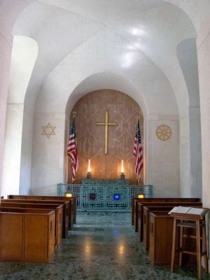
7. Chapel Vestibute Inscriptions
(Photo 20.) To the right of the entrance the following text is inscribed in the marble: “In proud rememberance of the achievement of her sons and in humble tribute to their sacrifices this memorial has been erected by the United States of America. 1941–1945 • 1950–1953 • 1961–1973”
The following is inscribed to the left of the entrance: “The American Battle Monuments Commission. Weihe Frick Kruse, Architects. Theodore A. Vierra, Architect Honolulu Representative. 1962.”
— Submitted January 4, 2009.
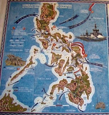
8. Liberation of the Philippines, 20 October 1944 – 15 August 1945
This is the text on the map shown in Photo 21.
From the early days of the long enemy occupation of the Philippines, United States forces persistently fought their way back. Eventually, on 20 October 1944, under cover of naval gunfire and air bombardment of the Seventh Fleet and with long-range support by aircraft of the Third Fleet, the Sixth Army landed on the eastern shores of Leyte.
Thereupon the Japanese decided to risk a major sea battle in a determined effort to destroy the American forces; three fleets moved towards the Philippines. On 23 October American submarines attacked the center force in Palawan Passage. On the following day aircraft from the Third Fleet inflicted heavy losses on the force in the Sibuyan Sea while Japanese aircraft from Luzon destroyed a U. S. carrier.
During the night of 24–25 October the enemy’s southern force steamed into Surigao Strait directly toward the waiting Seventh Fleet and was decisively defeated by torpedo attacks and gunfire. Meanwhile the Third Fleet moved to intercept the northern force and on 25–26 October won a major victory off Cape Engaño.
On the morning of 25 October the
center force pushed through San Bernadino Straight and attacked the escort carriers of the Seventh Fleet off Samar. Although outnumbered and outgunned, the escort carriers and their screen of destroyers forced the enemy to withdraw. Relieving our ground forces from the menace of isolation, the decisive defeat of the Japanese fleet at these Battles for Leyte Gulf also rendered it powerless to prevent future amphibious operations.
Two months of hard fighting freed most of Leyte, although many Japanese escaping to the north and west resisted the pursuing Eighth Army, now in control of the island. In December the Sixth Army seized Mindoro. Meanwhile the Japanese massed a quarter million men to defend Luzon.
On 9 January 1945 the Seventh Fleet landed the Sixth Army at Lingayen Gulf. Supported by the Fifth Air Force and by Marine Corps and naval aircraft, the troops pushed inland. Initially, resistance was encountered along the left flank; on the right American forces advanced down the central plains towards Manila. After fierce fighting, Manilla, Bataan and Corregidor were cleared of the enemy. U. S. troops and Philippine guerrilla forces, continuously supported by aerial bombardment, then forced the enemy deep into the mountains. On 1 July the Eighth Army assumed responsibility for land operations; the Sixth Army regrouped in preparation for an invasion of Japan.
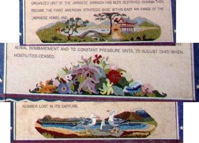
With the cooperation of the Seventh and Thirteenth Air Forces, the Eighth Army and the Seventh Fleet had already embarked on a series of amphibious assaults on Palawan and Zamboanga and overpowered the enemy in the Visayan Sea area. In April it landed units on the southern coast of Mindanao and advanced toward Davao Gulf. Others followed and fought their way northward to meet additional forces which landed in May. By the end of June, American soldiers and Filipino guerrillas had compressed the enemy into isolated mountain areas. There he was subjected to intensive aerial bombardment and to constant pressure until 15 August 1945 when hostilities ceased.
— Submitted January 4, 2009.
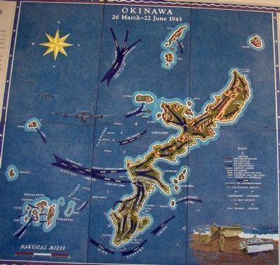
9. Okinawa, 26 March – 22 June 1945
This is the text on the left of the map shown in Photo 23.
Early in 1945 the great concentration of U. S. sea, land and air power in the Pacific enabled our forces to challenge Japan in her own waters. For months aircraft from the Navy’s
fast carriers, and Army Air Force bombers from the southwest Pacific area and the Marianas, had bombed the important bases in the Ryukyus. Others in Japan and Formosa were also attacked prior to the invasion. The amphibious assault was initiated when a division of the Tenth Army landed on Kerama Retto on 26 March. Five days later troops landed on the Keise Islets and emplaced artillery to cover the landing on the main island.
On 1 April, under cover of an intensive naval and air bombardment by the U. S. Fifth Fleet, two divisions of the U. S. Army XXIV Corps and two divisions of the Marine III Amphibious Corps landed on Okinawa itself. The two corps, attacking abreast, pushed rapidly across the island, thus splitting the Japanese forces. The III Amphibious Corps then turned north, while the XXIV Corps turned south to attack Japanese main defensive positions. There followed a desperate three months struggle on land, on sea and in the air.
To insure early warning of the expected air reaction from enemy bases in Japan, China, and Formosa, the Fifth Fleet established a ring of radar picket destroyers and escort vessels around Okinawa. Although sustaining heavy losses, the picket ships and other fire support ships
fought off incessant and desperate attacks by the Japanese land-based kamikaze airplanes. Meanwhile, aircraft from the U. S. fast carriers and Army Air Force bombers and fighters from the Marianas and the southwest Pacific struck heavy blows at enemy airfields. On the night of 6–7 April the enemy surface fleet made its last sortie from its home waters. U. S. carrier aircraft attacked the force sinking a battleship, a cruiser and four destroyers. Commending on 9 April land-based aircraft of the U. S. Marines and the Army Air Forces augmented the carrier-based aircraft, and together with ship antiaircraft fire, ultimately checked the kamikazes. The seizure of Ie Shima after four days of bitter fighting provided the site for an excellent air base which further strengthened our air defense.
The Marine divisions, which had cleared the northern half of the island, joined in the battle to the south. Naval gunfire, massed artillery and mortar file, and continuous strikes by tactical aircraft supported the advance of these and the Army divisions as they pushed southward against fanatical resistance and furious counterattacks. The high ground held by the Japanese in southern Okinawa was ideal for a prolonged defense. The limestone hills, honeycombed with natural caves, afforded every advantage of terrain. Each successive enemy strongpoint was cleared only by persistent and heroic effort. By the middle of June our ground forces had battered their way through the fortified Naha-Shuri line. By 22 June 1945 the last organized unit of the Japanese garrison had been destroyed. Okinawa then became the first American strategic base within easy air range of the Japanese homeland.
— Submitted January 4, 2009.
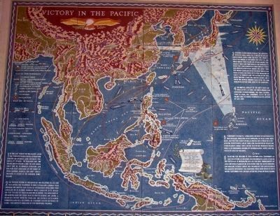
10. Victory in the Pacific
This is the text on the map shown in Photo 26.
1. In the last year of the war against Japan the tempo quickened. Having already penetrated the Japanese basic defensive perimeter by invading the Marianas and the Palaus and by pushing along the New Guinea coast and on to Morotai. Bypassing the enemy by their leapfrog assaults, our joint forces prepared to strike at the Japanese home islands.
2. The decisive victory of the Battle of the Philippine Sea in June 1944 opened the Philippines to direct attack; our landings were advanced two months and scheduled intermediate operations were cancelled. On 20 October
American forces landed on Leyte. Realizing that the loss of these islands would imperil the remainder of his wartime gains the enemy reacted swiftly, risking, and loosing, a major sea contest with Third and Seventh Fleets which eliminated Japan as a sea power. On 9 January 1945 we returned to Luzon—the complete liberation of the Philippines followed.
3. In Burma Allied forces overran the Japanese, while in China, under the stimulus of air- and ground-borne supply from the west, the enemy’s grasp was broken. In November 1944 the U. S. air forces opened their major air attacks against the Japanese homeland from bases in the Marianas, to which they soon redeployed their aircraft which had operated effectively against the enemy from the Chinese mainland. Until the end of hostilities these attacks continued with ever increasing intensity. In February came the capture of Iwo Jima, which provided a base for fighter escorts and a haven for crippled bombers faced with the long over-water return from Japan to the Marianas.
4. For months, aircraft of the Navy’s fast carriers as well as Army air forces bombers had repeatedly attacked Okinawa, the final stepping-stone to Japan; Our triphibious assault on that island early
Photographed By J. J. Prats, October 23, 2008
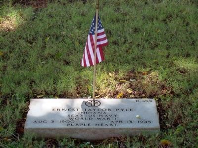
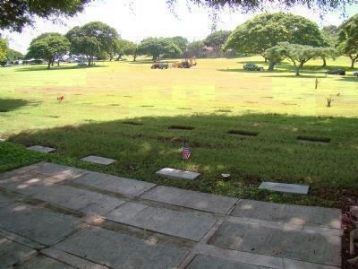
26. Ernie Pyle’s Gravesite
Ernie Pyle is perhaps America’s most famous war correspondent. He died on the island of Ie Shima, just off the coast of Okinawa in the Pacific. He was a native of Dana, Indiana. Search this database for more markers about Ernie Pyle.
5. Throughout the war U. S. submarines contributed materially to our successes. Operating often thousands of miles from their bases, deep within enemy-controlled waters, they struck with devastating effectiveness and, by war’s end, had destroyed nearly one third of Japan’s combat ships and one half of her merchant marine, while also performing missions of reconnaissance, supply, and the rescue of isolated personnel.
6. Plans for the invasion of Japan contemplated a triphibious assault on Kyushu in November 1945 followed by a later attack on the Tokyo Plain. In preparation, our air and naval bombardments of Japan continued unabated. The devastation from the air of Hiroshima and Nagasaki in early August was followed by the capitulation of the Japanese government, the surrender terms being signed in Tokyo Bay on 2 September 1945, 1,365 days after the attack of Pearl Harbor.
— Submitted January 4, 2009.
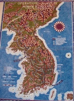
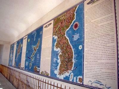
11. Operations Against the North Koreans, 15 June – 13 November 1950
This is the text to the right of the map shown in Photo 29.
On 25 June 1950
Photographed By J. J. Prats, October 23, 2008
27. Victory in the Pacific
The text in the white scroll on the map quotes Admiral Chester W. Nimitz (1885–1966) at the official surrender of Japan in 1945. It reads, “names that are cross-section of Democracy —— They fought together as brothers-in-arms. They died together and now sleep side by side —— To them we have a solemn obligation to ensure that their sacrifice will help to make a better, a safer, world in which to live.”
The Far East air forces promptly nullified air opposition while naval forces neutralized the North Korean navy, met the serious enemy mine threat and established a blockade of the peninsula. Nevertheless, North Korean ground troops, which heavily outnumbered and outgunned the Republic of Korea forces, captured the city of Seoul and advanced rapidly southward.
On 5 July advance elements of the U. S. 24th Infantry division from the Eighth Army in Japan met the enemy near Osal; then began a series of costly delaying actions. The U. S. 25th Infantry and 1st Cavalry Divisions arrived and were promptly committed.
By 5 August the defenders were compressed into a small beachhead around Pusan although the U. S. Fifth Air Force and the far east air forces had greatly assisted in slowing the enemy’s advance by continuously bombing industrial targets and supply lines, and by providing close support. Carrier-based aircraft and naval gunfire were rendering
effective interdiction as well as ground support. Command of the seas made possible a rapid build-up of supplies and reinforcements.
The U. S. 2nd Infantry Division and 1st Marine Brigade landed on August 1 and 2, followed by several units from other nations. On 7 August soldiers and marines launched the first sustained U. N. counterattack in southeast Korea, stopping the enemy drive toward Pusan. Further counterattacks, supported by Air Force, Marine Corps and naval aircraft, aided by naval gunfire, established a firm perimeter.
On 15 September the initiative changed hands; preceded by air and naval bombardment the 1st Marine Division was landed at Inchon in a daring flanking operation. The 7th Infantry Division followed and together they pressed forward towards Seoul. On 16 September the Eighth Army began its offensive to break out of the Pusan perimeter. Opposition was strong and the fighting severe until the enemy line was broken and resistance collapsed. On 26 September elements of the 1st Cavalry Division met troops of the 7th infantry division near Osan; on the same day the liberation of Seoul was announced.
Preceded by aircraft whose attacks hastened the disorganization of the enemy, United Nations
forces crossed the 38th parallel. The boundary of North Korea, whose capital, Pyonyang, they occupied on 21 October. After their defeats the North Koreans showed little aggressiveness as U. N. troops advanced toward the Yalu River.
At this moment large Chinese units attacked United Nations forces. In the western sector the Eighth Army withdrew to a shorter line and prepared for further offensive operations. In the eastern sector, U. N. forces continued forward, reaching a line which extended from the Chosin Reservoir to the Chinese border and Chongjin.
— Submitted January 4, 2009.
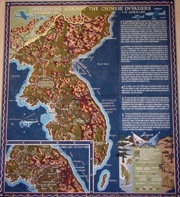
12. Operations Against the Chinese Invaders, 23 November 1950 – 27 July 1953
This is the text on the map shown in Photo 31.
1. On 24 November 1950 the U. S. Eighth Army launched an offensive against the North Koreans but was abruptly thrown back by a massive attack by Chinese Communist forces which had secretly crossed the Yalu River border. The X Corps advance met a similar fate when the Chinese cut off most of the 1st Marine Division and four Army battalions near Hagaru and Koto. Surmounting heavy odds, bitterly cold
weather, and rugged terrain, the Marines and soldiers fought their way to Hungnam where, together with other troops in northeast Korea, they were evacuated by sea and air to South Korea. Land- and carrier-based aircraft and supporting naval groups proved invaluable in the redeployment.
2. Meanwhile the Eight Army withdrew south of Pyonyang, then to a stronger defensive position still further south. On the last day of December 1950 the enemy launched a vigorous attack across the 38th parallel into South Korea, recapturing Seoul on 4 January 1951. Three weeks later the invaders were halted, except for one division which infiltrated almost to Uisong before being driven back. This marked the high tide of the second invasion of Korea.
3. The eighth army then began a series of limited-objective attacks; opposition was particularly intense south of Seoul and in the center of the peninsula. In March U. S. troops crossed the Han River east of Seoul, and, outflanking the city, forced its evacuation. In this attack troops were continuously assisted by air and naval forces which not only provided close support and interdiction, but also performed many missions of air supply and evacuation. Supplied poured into Korea by sea.
4. On 22 April 1951 the enemy again attacked in force but was halted short of Seoul and Hongchon. In mid-May, he struck once more but by the 22nd exhaustion, supply difficulties and casualties forced him to accept failure.
5. On the next day U. N. troops began a steady drive northward. So hard hit was the enemy by early June that 10,000 Chinese surrendered in a week. Armistice representatives met in July but conferences were suspended in Late August, whereupon U. N. forces resumed the offensive and gained commanding ground along the whole front. The negotiations were resumed late in October 1951.
6. Fighting continued but the front lined remained substantially unchanged. The air was intensified during the summer of 1952 as U. N. aircraft struck at supply centers, troop concentrations and industrial targets within North Korea. Ground fighting was particularly heavy in October and again in the Spring of 1953, thus bringing to a successful conclusion the United Nations defense of the Republic of Korea against the communist invaders.
— Submitted January 4, 2009.
Photographed By J. J. Prats, October 23, 2008
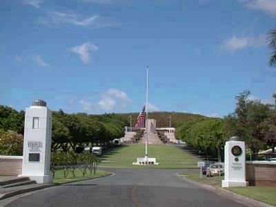
39. Entrance to the National Memorial Cemetery of the Pacific
The plaque on the right pillar is an excerpt from Theodore O'Hara's "The Bivouac Of The Dead." It reads,
The muffled drums sad roll has beat
The soldier's last tattoo;
No more on life's parade shall meet
That brave and fallen few.
On Fame's eternal camping-ground
Their silent tents are spread,
And Glory guards, with solemn round,
The bivouac of the dead.
The muffled drums sad roll has beat
The soldier's last tattoo;
No more on life's parade shall meet
That brave and fallen few.
On Fame's eternal camping-ground
Their silent tents are spread,
And Glory guards, with solemn round,
The bivouac of the dead.
Credits. This page was last revised on February 10, 2023. It was originally submitted on January 4, 2008, by Mike Stroud of Bluffton, South Carolina. This page has been viewed 12,796 times since then and 189 times this year. It was the Marker of the Week May 24, 2009. Photos: 1. submitted on January 4, 2008, by Mike Stroud of Bluffton, South Carolina. 2. submitted on March 8, 2015, by Don Morfe of Baltimore, Maryland. 3, 4. submitted on January 4, 2008, by Mike Stroud of Bluffton, South Carolina. 5. submitted on December 30, 2008, by J. J. Prats of Powell, Ohio. 6, 7, 8, 9, 10, 11. submitted on December 31, 2008, by J. J. Prats of Powell, Ohio. 12, 13, 14. submitted on January 1, 2009, by J. J. Prats of Powell, Ohio. 15, 16, 17, 18, 19, 20, 21, 22, 23, 24. submitted on January 4, 2009, by J. J. Prats of Powell, Ohio. 25, 26. submitted on November 2, 2008, by J. J. Prats of Powell, Ohio. 27, 28, 29, 30, 31, 32, 33, 34, 35. submitted on January 4, 2009, by J. J. Prats of Powell, Ohio. 36, 37, 38, 39. submitted on October 28, 2008, by J. J. Prats of Powell, Ohio. 40, 41. submitted on January 4, 2008, by Mike Stroud of Bluffton, South Carolina. • Kevin W. was the editor who published this page.
