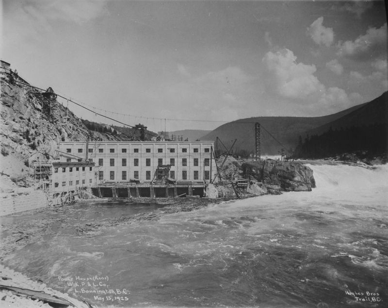
When hydro-electric power was first delivered from No. 1 plant to Rossland's mines in 1898, the 32-mile transmission lines were the longest on the continent. Utilizing the 360-foot drop from Kootenay Lake to the Columbia River, additional . . . — — Map (db m187946) HM
[English] This historic Bridge commemorates an achievement of the Doukhobors of Canada in establishing communal settlements in the Kootenay Boundary region of British Columbia during the early 20th century. Built in 1913 by community labour, . . . — — Map (db m197114) HM
Sawmill pilings and a burner are the only reminders of the former Patrick Lumber Co., established in 1907. By 1911, the Patricks sold the mill to the British Canadian Lumber Corporation. Joseph and sons Frank and Lester risked the proceeds to . . . — — Map (db m187882) HM
It was the dream, in the 1880's of W.A. Baillie-Grohman, British sportsman and financier, to reclaim these fertile flats from the annual river floods. His canal at Canal Flats diverted part of the Kootenay into the Columbia but was abandoned. The . . . — — Map (db m188032) HM
As this community prospered in the 1890s, tent hotels and log stores gave way to ornate edifices, and Nelson changed from a crude mining camp into the "Queen City of the Kootenays." The gully that divided Baker Street in two was bridged in 1890, . . . — — Map (db m187922) HM
The 1902 opening of Nelson's new Dominion of Canada offices for postal, customs and inland revenue at 502 Vernon street was a huge step up from the tent that first housed Nelson's postal service. The building, constructed of Spokane brick and local . . . — — Map (db m197112) HM
The orebody, known to Indians as
a source of lead for musket balls,
was staked in 1882 by Bob Sproule,
later restaked by Tom Hamill. The
resulting lawsuit cost Sproule
the property, and in revenge he
murdered his rival; was convicted
and . . . — — Map (db m187919) HM
In the the early 1860s placer gold drew prospectors from all parts of the West to the Salmo River valley, and the Dewdney Trail from the west coast soon opened the region to increased travel. Development increased dramatically in 1893, when Daniel . . . — — Map (db m187931) HM
Silver was the key that opened the Slocan. Discovery in 1891 of the rich outcrops of the "Slocan Star" and "Payne" touched off the wildest lode excitement in our history. The silver-lead ore was easily and cheaply mined, speeding development, and . . . — — Map (db m187952) HM