Fishing has been the backbone of Yarmouth's culture and economy for over 200 years. In the early days, salted dried cod was shipped by schooners and barques headed to the West Indies in exchange for rum, molasses and sugar. Today Yarmouth's . . . — — Map (db m107349) HM
The Southwestern shore of Nova Scotia, including Yarmouth County, is home to one of Canada's largest fisheries. For over two hundred years, fishing boats have sailed past this point, as well as from other ports in this region, to fish groundfish, . . . — — Map (db m107638) HM
An enduring symbol of Yarmouth's historic and economic ties to the sea, a lighthouse has towered over the rocky headlands of Cape Forchu since 1839, guiding mariners to the safety of Yarmouth Harbour. The current lighthouse was automated in . . . — — Map (db m107293) HM
Cheboque
The name "Cheboque" comes from the Mi'kmaw word for "big marshes", a very accurate name for this area. Beginning at Arcadia, the Cheboque salt marsh sprawls 343 hectares (837 acres) alongside the Cheboque River.
According to a 1607 . . . — — Map (db m107735) HM
The amazing geological formations you see along the Leif Ericson Trail, and at Cape Forchu, are the result of ancient volcanoes that erupted approximately 444-429 million years ago during the Silurian and early Devonian periods in Earth's . . . — — Map (db m107540) HM
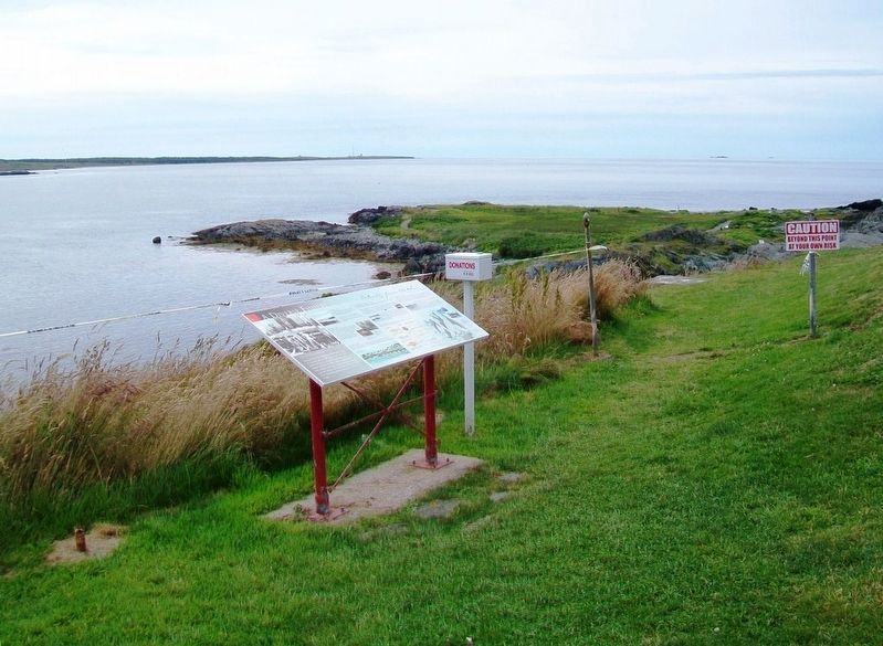
Harbour of Deception
For almost two centuries, Yarmouth's False Harbour has lived up to its name. Located at the end of Cape Forchu, False Harbour's rocky shores have fooled the most experienced and capable of mariners, especially during . . . — — Map (db m107719) HM
The Town of Yarmouth, and its surrounding area, was settled in 1761 by Planters from Massachusetts. These settlers fished along the coast and harvested lumber from the forests to build homes, businesses and sailing vessels. By the . . . — — Map (db m107298) HM
The year 1879 was a disastrous one for Yarmouth County, Nova Scotia, with no fewer than 31 vessels lost along with 106 persons. The ships lost were among the best of the Yarmouth fleet, some carrying valuable cargoes. The loss of life left 26 . . . — — Map (db m107392) HM
Balise canadienne
Lorsque Samuel de Champlain visita la région en 1604, il la nomma Cap-Fourchu. Un an plus tard, Champlain s'installa à Port-Royal ou, La Cadie, un nom dérivé du nom « L'Arcadie » qu'un explorateur italien aviat donné à la . . . — — Map (db m107359) HM
Pieces of the Past
Since 1840, a lighthouse has kept watch over Cape Forchu and the approaches of Yarmouth Harbour.
In 1962, the original lighthouse was replaced with the iconic "apple core" structure that towers over the Cape today.
The . . . — — Map (db m107551) HM
Watching the waves crashing around Cape Forchu provides a small glimpse of the awesome and terrifying power of the sea. It continually shapes the lives of those who live and work by it. A source of beauty, bounty and economic prosperity, the . . . — — Map (db m107284) HM
The Tusket Islands
Located south of Yarmouth, the Tusket Islands extend mainly along the coast, from Pinkney's Point to Wedgeport. The Tusket Island chain was once a great asset to the fishing economy of Nova Scotia's Southwestern . . . — — Map (db m107652) HM
A Yarmouth - Viking Connection?
This scenic trail is named after the famous Norse explorer, and son of Eric the Red, Leif Ericson, who may have visited these shores sometime around 1000 AD.
Many scholars regard Leif Ericson as the first . . . — — Map (db m107487) HM
On Nova Scotia Route 308 at Chemin des Gasson, on the right when traveling south on Provincial Route 308.
Jusaqu'aux années 1950 on pouvait encore voir plus de 1000 barges ou meules de foin entre la Pointe-du-Sault et la Pointe-des-Hubbard, surtout dans la région appelée « Passe de pré ». Des hommes habiles à la faux pouvaient faucher environ . . . — — Map (db m108766) HM
Le Village presents the lifestyle, culture and traditions of the Acadians of Nova Scotia at the turn of the 20th century, approximately 250 years after they first settled in the Pubnico area. This is the longest established Acadian region . . . — — Map (db m108266) HM
Before You Step Back in Time...
Though Le Village historique acadien is a created outdoor museum, it speaks to truths about the overall Acadian experience in Nova Scotia, and to the particular life and times of the Pubnicos in the . . . — — Map (db m108272) HM
On Old Church Road, 0.7 kilometers east of Nova Scotia Route 335, on the left when traveling east.
Les pionniers acadiens
Pubnico est le plus ancien village acadien encore habité par les descendants des familles fondatrices. Vous trouverez, dans l'annuaire téléphonique, près de 400 personnes du nom d'Entremont. Ils sont les descendants . . . — — Map (db m107971) HM
On Dennis Point Road, 1 kilometer south of D'Entremont Road, on the left when traveling south.
Récolter la mer
Vous êtes debout sur l'un des quais de pêche les plus achalandés au Canada.
Autrefois, le hareng était pêché dans des parcs en fascines, ou « nijagans » inventés par les Mi'kmaq. Le poisson entrait dans le parc . . . — — Map (db m108006) HM
On Old Church Road, 0.7 kilometers east of Nova Scotia Route 335, on the left when traveling east.
Foundateur de la
Baronnie de Pobomcoup
(Pubnico) 1653
Founder of the
Barony of Pobomcoup
(Pubnico) 1653
Don du reveil de Pombcoup
Sculpteur - Albert Deveau - Sculptor
Aout - 1998 - August
Remplace - Replaced
Sculpteur - James . . . — — Map (db m107967) HM
There is not now and never has been a single definition of Acadie, or Acadia. It all depends on the time period and one's point of view.
Back in the 1600s and early 1700s, Acadie was a loosely defined region that more or less . . . — — Map (db m108271) HM
Acadians themselves can best answer this question, and our staff looks forward to sharing stories and insights into Acadian history and culture. We are also pleased to share some information on this panel for your reading pleasure.
As Acadie was . . . — — Map (db m108270) HM
On Dennis Point Road, 1 kilometer south of D'Entremont Road, on the left when traveling south.
Following the fish
While Dennis Point's most valuable fishery is lobster, this wharf is also home to Canada's largest ground fishing fleet. This diverse fishery takes our fishermen (and women) to many special fishing areas.
Going the . . . — — Map (db m108001) HM
Near Rocco Point Road, 1.2 kilometers south of the Lighthouse Route (Nova Scotia Route 3).
La chapelle originale fut construite sur le site en 1784. La vue sur la colline est superbe. Vous pouvez facilement imaginer l'arrivée des fidèles à la messe à pied, à cheval, par bateau, ou par attelage de bœufs.
Après son arrivée de France en . . . — — Map (db m108627) HM
Near Rocco Point Road, 1.2 kilometers south of the Lighthouse Route (Nova Scotia Route 3).
Le Site
La Pointe-à-Rocco fut fondée en 1767 par les Acadiens revenus de l'exil. Pierre LeBlanc, Pierre et Louis Muis et Pierre Surette furent les premiers à s'établir dans le village. Ce site était le lieu de la première chapelle. . . . — — Map (db m108641) HM
Near Rocco Point Road, 1.2 kilometers south of the Lighthouse Route (Nova Scotia Route 3).
Avant la construction des églises, les enterrements avaient lieu près de la mer du côté d'Eel Brook. C'est dans cet endroit d'inhumation que seraient enterrés Catherine Bro et Pierre Suret II, le couple fondateur de la région.
Catherine Bro, de . . . — — Map (db m108637) HM
On the Lighthouse Route (Nova Scotia Route 3) at Rocco Point Road, on the left when traveling west on the Lighthouse Route.
Une chapelle fut construite à la Pointe-à-Rocco en 1784. Elle fut utilisée par des Acadiens et des Mi'kmaq de la région jusqu'à ce qu'une église plus grande soit construite sur le site en 1808. À la suite d'un incendie dévastateur en 1900, . . . — — Map (db m108513) HM
On the Lighthouse Route (Nova Scotia Route 3) at Rocco Point Road, on the right when traveling west on the Lighthouse Route.
1914 - 1918
[Died in Service]
Anthony Doucette • Felix Doucette
Simon Doucette
[Honor Roll of Veterans]
1939 - 1945
[Died in Service]
Louis Babin • William Doucet
Walter Deveau
[Honor Roll of Veterans]
Parishioners who . . . — — Map (db m108613) WM
On the Lighthouse Route (Nova Scotia Route 3) at Courthouse Road, on the right when traveling north on the Lighthouse Route.
This well-preserved building, constructed between 1802 and 1805, is the oldest-known combined court house and jail still remaining in Canada. A prominent symbol of law and order, this building type was common to British North American towns in the . . . — — Map (db m108770) HM
On the Lighthouse Route (Nova Scotia Route 3) at Courthouse Road, on the right when traveling north on the Lighthouse Route.
Nova Scotia was the first colony in British North America to receive English law in all its jurisdictional variants, and the first colony to establish the legislative institutions necessary for the enactment of law. It was the first to evolve . . . — — Map (db m108771) HM
On the Lighthouse Route (Nova Scotia Route 3), on the right when traveling north.
The year 1879 was a disastrous one for Yarmouth County, Nova Scotia, with no fewer than 31 vessels lost along with 106 persons. The ships lost were among the best of the Yarmouth fleet, some carrying valuable cargoes. The loss of life left 26 . . . — — Map (db m112154) HM
On Courthouse Road just east of the Lighthouse Route (Nova Scotia Route 3), on the right when traveling east.
Le plus ancient tribunal
Le premier gouvernement local de la région du comté actuel de Yarmouth fut institué en 1789 par l’établissement du Tribunal des Sessions générales de la paix qui servait les districts de Yarmouth et d’Argyle. Il . . . — — Map (db m112162) HM
On the Lighthouse Route (Nova Scotia Route 3) at Courthouse Road, on the right when traveling north on the Lighthouse Route.
Next to the Court House on the east side of the street was the Tusket Cycle Company and just south of that, the Methodist Church built in 1877. On the opposite side of the street, the building in the foreground with the bundle of . . . — — Map (db m108772) HM
On the Lighthouse Route (Nova Scotia Route 3) at Nova Scotia Route 308, on the right when traveling north on the Lighthouse Route.
GIIIR
In proud memory
of those
United Empire Loyalists
the majority
of them of Dutch origin
who
defeated and despoiled
were compelled to find
refuge here following the
American Revolution.
Arriving here, . . . — — Map (db m108760) HM
On the Lighthouse Route (Nova Scotia Route 3) at Nova Scotia Route 308, on the right when traveling north on the Lighthouse Route.
In honour and loving memory
of our heroes
who met death to save life.
Corp. Joseph B. Jeffery
222979, 85th. Canadian Battalion
Died of Wounds, St. Pol. France
Oct. 4th. 1918
Aged 25 years
Pte. Clement Jeffery . . . — — Map (db m108761) WM
On the Lighthouse Route (Nova Scotia Route 335) at Argyle Sound Road/Martell Lane, on the left when traveling south on the Lighthouse Route.
A la mémoire de sieur
Philippe d'Entremont
pionier, colonizateur et
fondateur de Pubnico
arrivé le 29 août 1651
——————
Pro Deo et Patria . . . — — Map (db m108366) HM
On the Lighthouse Route (Nova Scotia Route 335) at Argyle Sound Road/Martell Lane, on the left when traveling south on the Lighthouse Route.
Hommage aux femmes courageuses et fortes
qui ont formé et nourri notre communauté depuis 350 ans
Le 28 septembre 2003
——————
Tribute to the courageous and strong women
who have trained . . . — — Map (db m108393) HM
On the Lighthouse Route (Nova Scotia Route 335) at Argyle Sound Road/Martell Lane, on the left when traveling south on the Lighthouse Route.
A la mémoire de ceux de Pubnico qui
ont donné leur vie dans les deux guerres mondiales
——————
In memory of those of Pubnico who
gave their lives in the two World Wars
1914 — . . . — — Map (db m108394) WM
On Nova Scotia Route 335, 0.5 kilometers south of Old Abbotts Harbour Road, on the right when traveling south.
Cette propriété familiale qui date des années 1800 a une bonne ossature et elle dégage une énergie extraordinaire. Mais pour sentir le pouls du musée, il faut rencontrer les Acadiens et écouter leurs histoires.
Prenons, par exemple, Simon « . . . — — Map (db m108360) HM
On the Lighthouse Route (Nova Scotia Route 335) at Argyle Sound Road/Martell Lane, on the left when traveling south on the Lighthouse Route.
L'eau de la mer, des lacs et des rivières peut être source de bonheur, de plaisir, de richesses, mais l'eau peut être aussi source d'épreuves, de malheur.
Ce monument veut rappeler la mémoire de ceux et celles qui furent engloutis dans . . . — — Map (db m108397) HM
Les plantes dans le jardin sont représentatives
de celles disponibles aux Acadiens en 1653.
———————————
Plants in the garden represent those accessible to the Acadians in . . . — — Map (db m108362) HM
This Ballard [sic - Bollard]
was located on a
wharf in Yarmouth
in the early 1900's.
It's purpose was to
tie ships to the wharf.
It weighs 450 pounds.
Donated by
Mr. Danny MacIsaac — — Map (db m172552) HM
This Bell was donated to Friends of the Yarmouth Light Society by Bay Ferries.
It was located on the wharf in Yarmouth and used to help guide the ferry during times of thick fog or heavy snow. — — Map (db m172551) HM
This replica was created and donated
to the citizens of Yarmouth, Nova Scotia
from
Doug Koohtow, Holland Landing, Ontario
May 28, 2014 — — Map (db m107869) HM
On Main Street (Nova Scotia Route 1) at Herbert Street, on the right when traveling north on Main Street.
Sophia Killam Caie saw a need, and she was determined to meet it. The north end of town - Milton - needed a recreation ground for sports and games.
Mrs. Caie, along with her husband, Robert, owned a portion of land that was ideally suited to . . . — — Map (db m107323) HM
On Water Street, on the right when traveling south.
With its sheltered harbour and abundant habitat for a natural food supply, the Yarmouth area was frequented by the native Mi'kmaq before the arrival of European visitors. The area was visited in 1604 by the French explorer Samuel D. Champlain . . . — — Map (db m106161) HM
Near Main Street (Nova Scotia Route 1) just south of Public Street, on the left when traveling south.
This plaque was erected
to commemorate all Naval, Army,
Air Force and civilian personnel
who served
at the Yarmouth Air Base in the
War of 1939 - 1945
to maintain our democratic freedoms. — — Map (db m107738) HM
On Main Street (Nova Scotia Route 1) at Glebe Street, on the left when traveling north on Main Street.
The Town of Yarmouth
_ Nova Scotia _
On its 75th anniversary
as an incorporated town
erects this memorial as a
grateful tribute to the vision,
devotion and unselfish public
service of its
First Mayor and Council
we of . . . — — Map (db m107878) HM
On Main Street (Nova Scotia Route 1) just south of Public Street, on the right when traveling south.
This park
named in honor of
Charles Sydney Frost, M.C.
Native son who,
through diligence
and ability, became
President of the
Bank of Nova Scotia
June 14, 1956 — — Map (db m107872) HM
On Main Street (Nova Scotia Route 1), on the left when traveling north.
[Excerpt from Town of Yarmouth informational sign]
Get your bearings
Named after Charles Sydney Frost, a Yarmouth resident who became president of the Bank of Nova Scoita, this green space at the heart of the town is the perfect place to . . . — — Map (db m107960) HM
On Water Street, on the right when traveling north.
Executive Director
Yarmouth Waterfront Development Corporation
It is with great pleasure that the Yarmouth Waterfront
Development Corporation dedicates this trail
to the memory of Robert E. Hartlin. The "Hartlin Trail"
extends . . . — — Map (db m107897) HM
On Water Street, 0.1 kilometers south of Richards Lane, on the right when traveling south.
Early transportation in Yarmouth was largely centred on the coast. Gradually, road development linked Yarmouth with the rest of Nova Scotia by land and regular passenger and mail services were established by stage coach. By 1891 railway links . . . — — Map (db m107313) HM
On Water Street at Glebe Street, on the right when traveling north on Water Street.
Dedicated to the memory of all those
residents of Yarmouth County
and crew members of ships owned
in Yarmouth County who have been
lost to the sea
We honour those here named as well
as those not yet known to us
[Remembered Dead . . . — — Map (db m107927) HM
On Water Street at Glebe Street, on the right when traveling north on Water Street.
The year 1879 was a disastrous one for Yarmouth County, Nova Scotia, with no fewer than 31 vessels lost along with 106 persons. The ships lost were among the best of the Yarmouth fleet, some carrying valuable cargoes. The loss of life left 26 . . . — — Map (db m107934) HM
This Anchor was donated to Freinds [sic - Friends] of the Yarmouth Light Society, by Bay Ferries. The fluke was broken off, when it got caught in [the] rocks on bottom, while at anchor just off the lighthouse. This anchor came off the M.V. . . . — — Map (db m172550) HM
On Water Street, 0.1 kilometers south of Richards Lane, on the right when traveling south.
Early manufacturing in Yarmouth grew in support of the shipbuilding industry, the fishery, and the maintenance of vessels engaged in shipping. The flourishing textile industry had its origins in the ability to import inexpensive raw materials, . . . — — Map (db m107320) HM
On Water Street, on the right when traveling south.
Erected in 1911 at a cost of $1,200.00, the original Milton Clock was donated by Mrs. Robert Caie. The mechanical works of the clock were manufactured by J. Smith and Sons, Midland Clock Works, Derby, England. Located in the tower at the . . . — — Map (db m106141) HM
On Water Street, on the right when traveling south.
During its early development Yarmouth was a part of Queens County and reported to the administrative seat in Liverpool. After 1784 Shelburne became the county town for Yarmouth. More local control was achieved with the formation of Yarmouth . . . — — Map (db m106165) HM
On Water Street, on the right when traveling south.
The passage of the National Prohibition Act on January 16, 1920 signalled the prohibition of alcohol for general consumption in the United States and provided an opportunity for enterprising Yarmouth businessmen and seamen. Yarmouth-based . . . — — Map (db m106221) HM
On Water Street, on the right when traveling north.
It is a long way from the farming community of Chegoggin, Yarmouth County, to a small village at the foot of Mount Ararat, but no journey was too far for Sarah Corning if there were children in need of care. Sarah Corning was born on 16 March, . . . — — Map (db m107902) HM
On Water Street, on the right when traveling south.
The first vessel known to have been built in Yarmouth was launched by John Sollows at Fish Point in 1764. Over the years, many ships were built in nearby communities such as Argyle, Tusket, Plymouth, Salmon River, Meteghan, and Belliveau's . . . — — Map (db m106216) HM
On Main Street at Marshall Lane, on the right when traveling south on Main Street.
From its early beginnings on Cape Breton Island the shipbuilding industry grew as settlement did in the late 18th century. During the Golden Age of Sail in the 19th century, thousands of wooden vessels of all sizes were built in bays and harbours . . . — — Map (db m106067) HM
On Water Street at Lovitt Street, on the left when traveling north on Water Street.
The Age of the Passenger Steamer
With the coming of the steam engine, it was only a matter of time before the sleek lines of wooden hulls and trim masts were replaced by riveted steel plates and tall stacks. By the mid-nineteenth . . . — — Map (db m112166) HM
On Water Street, on the right when traveling south.
A cornerstone of Yarmouth's economy from its first settlement, fishing continues to the present day to be an important aspect of life in the community. Yarmouth fishermen have always pursued a diversity of species: lobsters, scallops, cod, . . . — — Map (db m106323) HM
On Water Street just north of Central Street, on the left when traveling north.
The Killam Family Built a Business
By the third quarter of the nineteenth century, many Yarmouth companies and their owners were enjoying substantial profits as a result of their investments in shipping and labours as commission . . . — — Map (db m112200) HM
On Water Street at Lovitt Street, on the left when traveling north on Water Street.
Merchants and Mariners
True to the code of merchant-mariners, Parker-Eakins & Co. saw their mission as an endeavor “to facilitate the production, distribution and exchange of goods and services for mutual profit and . . . — — Map (db m112171) HM
On Main Street (Nova Scotia Route 1) at Frost Park, on the right when traveling north on Main Street.
To the men
of Yarmouth County
who fell
An•Dom•MCMXIV-MCMXIX
[Roll of Honored Dead]
—————————————
To the glory of God
and dedicated to the memory
of . . . — — Map (db m107832) WM
On Main Street (Nova Scotia Route 1) at Herbert Street, on the right when traveling north on Main Street.
Those Amazing Women
The Age of Sail brought a considerable amount of wealth to the port of Yarmouth. There have been many instances in which those who earned these riches undertook projects to benefit the citizens of the area. However, none . . . — — Map (db m107330) HM
On Yarmouth Bar Road (Nova Scotia Route 304), on the left when traveling south.
On this, the site of the
first launching in the county,
1764, this monument is erected
in proud memory of
all the seafaring sons
of Yarmouth County
who, "going down to the sea
in ships," by their outstanding
seamanship and . . . — — Map (db m107252) HM