Clinton in Clinton County, Iowa — The American Midwest (Upper Plains)
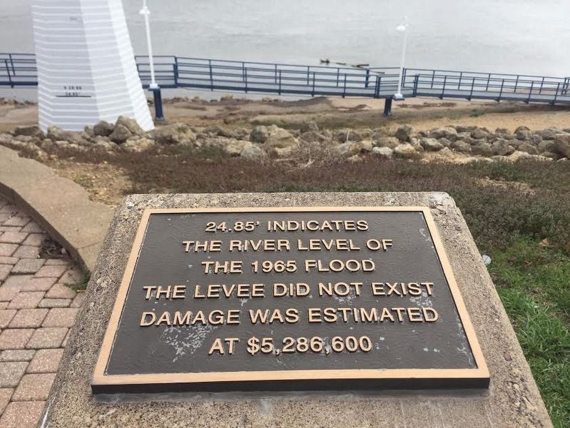
Clinton, Iowa Mississippi River Flood of 1965
Topics. This historical marker is listed in these topic lists: Disasters • Waterways & Vessels. A significant historical date for this entry is April 28, 1965.
Location. 41° 50.765′ N, 90° 11.018′ W. Marker is in Clinton, Iowa, in Clinton County. Marker is on Riverview Drive, on the right when traveling north. Just south of the Showboat Theater. Touch for map. Marker is in this post office area: Clinton IA 52732, United States of America. Touch for directions.
Other nearby markers. At least 8 other markers are within 2 miles of this marker, measured as the crow flies. The Dutch on the River (approx. 1.6 miles away in Illinois); Fulton: A River Town (approx. 1.6 miles away in Illinois); Illinois Lincoln Highway (approx. 1.7 miles away in Illinois); a different marker also named Illinois Lincoln Highway (approx. 1.7 miles away in Illinois); Lincoln Highway (approx. 1.7 miles away in Illinois); The Lincoln Highway – The nation's first coast-to-coast highway! (approx. 1.7 miles away in Illinois); Dement House (approx. 1.7 miles away in Illinois); The Market Place (approx. 1.8 miles away in Illinois).
Regarding Clinton, Iowa Mississippi River Flood of 1965. The Mississippi River in Clinton, Iowa crested at a record 24.85 feet on April 28, 1965, nearly nine feet above flood stage. The Army Corps of Engineers began a seven-year, $28.9 million levee project in August 1974. An 8.1 mile dyke, 4,330 feet of concrete flood wall, six pumping stations, seven closure structures, five major street crossings, 17,320 feet of new sewer, and 23 gatewells were completed and dedicated in June 1981.
Additional keywords. Mississippi River, Clinton IA
Credits. This page was last revised on April 12, 2017. It was originally submitted on April 11, 2017. This page has been viewed 842 times since then and 101 times this year. Photo 1. submitted on April 11, 2017. • Bill Pfingsten was the editor who published this page.
