Ava in Douglas County, Missouri — The American Midwest (Upper Plains)
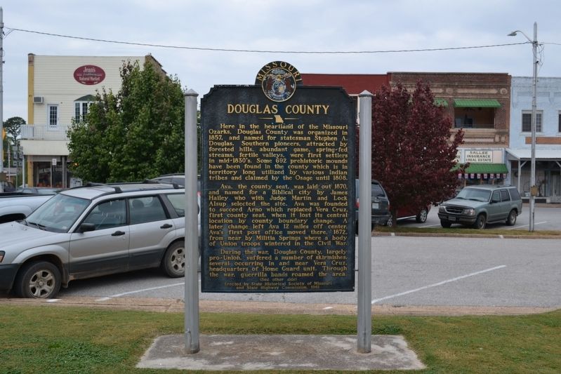
Douglas County
Ava, the county seat, was laid out 1870, and named for a biblical city by James Hailey who with Judge Martin and Lock Alsup selected the site. Ava was founded to succeed Arno which replaced Vera Cruz, first county seat, when it lost its central location by county boundary change. A later change left Ava 12 miles off center. Ava's first post office moved there, 1872 from nearby Militia Springs where a body of Union troops wintered in the Civil War.
During the war, Douglas County, largely pro-Union, suffered a number of skirmishes, several occurring in and near Vera Cruz, headquarters of Home Guard unit. Through the war, guerrilla bands roamed the area.
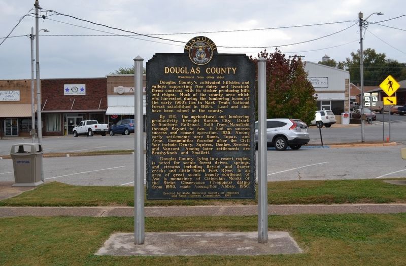
Douglas County's cultivated hillsides and valleys supporting fine dairy and livestock farms contrast with its timber producing hills and ridges. Much of the county area which was harvested during the lumber boom of the early 1900's lies in the Mark Twain National Forest established in 1930's. Lead and zinc have been mined in the county.
By 1910, the agricultural and lumbering productivity brought Kansas City, Ozark, & Southern Railroad. Built from Mansfield through Bryant to Ava. It had an uneven success and ceased operation, 1935. Among early settlements were Rome, Topaz, and Arno. Communities founded after the Civil War include Drury, Squires, Denlow, Sweden, and Van Zant. Among later settlements are Brushyknob and Smallett.
Douglas County, lying in a resort region, is noted for scenic forest drives, springs, and streams including Bryant and Beaver creeks and Little North Fork River. In an area of great scenic beauty southeast of Ava is monastery of Cistercian Monks of the Strict Observance (Trappists) dating from 1950, made assumption Abbey, 1956.
Erected 1961 by State Historical Society of Missouri and State Highway Commission.
Topics and series. This historical marker is listed in these topic lists: Agriculture • Churches & Religion • Settlements & Settlers • War, US Civil. In addition, it is included in the Missouri, The State Historical Society of series list. A significant historical year for this entry is 1857.
Location. 36° 57.105′ N, 92° 39.6′ W. Marker is in Ava, Missouri, in Douglas County. Marker is on Jefferson Street (Business State Highway 5) 0.1 miles south of East Washington Avenue (State Highway 14), on the left when traveling south. Touch for map. Marker is at or near this postal address: 102 Southeast 2nd Avenue, Ava MO 65608, United States of America. Touch for directions.
Other nearby markers. At least 8 other markers are within 15 miles of this marker, measured as the crow flies. Rocky Ridge Farm (approx. 11˝ miles away); Carl "Sub" Mays (approx. 11˝ miles away); Wilder's Pecan Tree (approx. 11˝ miles away); War Memorial (approx. 11˝ miles away); Laura Ingalls Wilder (approx. 11˝ miles away); The Wilder Home / The Little House Books Began Here (approx. 11.7 miles away); Veterans Memorial (approx. 11.9 miles away); Veterans / Pioneers Memorial (approx. 14.8 miles away).
Credits. This page was last revised on January 8, 2022. It was originally submitted on January 13, 2020, by Michael E Sanchez, Jr. of Kansas City, Missouri. This page has been viewed 566 times since then and 112 times this year. Last updated on January 7, 2022, by Carl Gordon Moore Jr. of North East, Maryland. Photos: 1, 2. submitted on January 13, 2020, by Michael E Sanchez, Jr. of Kansas City, Missouri. • Bernard Fisher was the editor who published this page.

