On Sea-to-Sky Highway (Provincial Highway 99) 1.2 kilometers north of Copper Drive, on the left when traveling north.
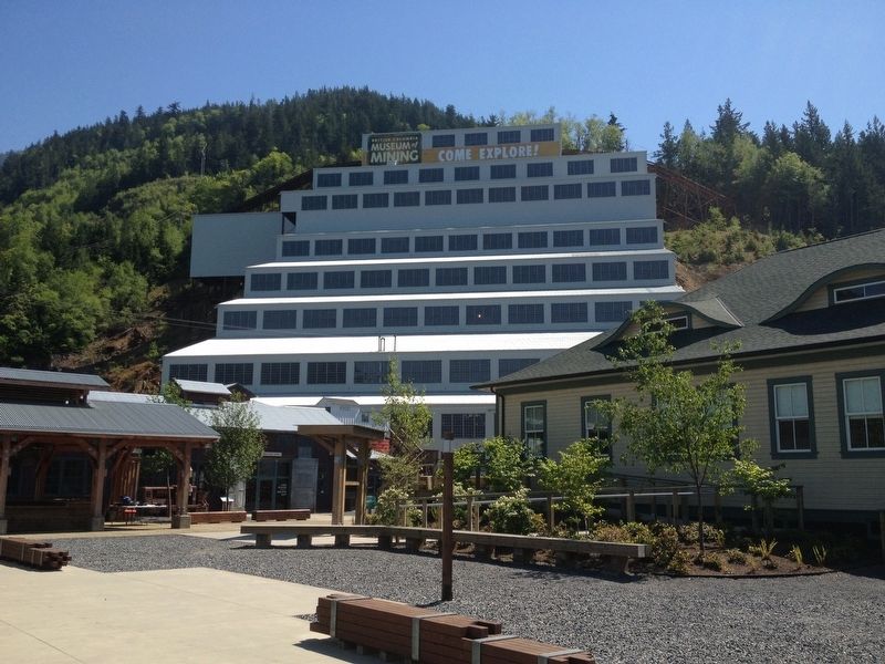
Dr. A.A. Forbes first discovered copper on Britannia Mountain in 1888, leading to the creation of Britannia Mine in 1899. At one time it produced more copper than any mine in the British Commonwealth. Having survived landslide, flood and fire, the . . . — — Map (db m188024) HM
On Lytton-Lillooet Highway (Provincial Highway 12) at Summner Road, on the left when traveling north on Lytton-Lillooet Highway.
In 1942, over 21,000 Japanese Canadians were unjustifiably removed from British Columbia’s coast. Over 300 men, women and children lived in East Lillooet, one of four internment camps in this region. They built 62 wooden shacks, a school and . . . — — Map (db m187890) HM
On Provincial Highway 99 at Davis Road, on the right when traveling south on Provincial Highway 99.
Here was the gateway to gold! Yellow gold lined bars of the Fraser and beyond was the lure of the Cariboo. Like a magnet it drew thousands of miners on the long Harrison trail through the Coast Mountains. From this focal point the first Cariboo . . . — — Map (db m187984) HM
On Old Bridge Road, 0.7 kilometers north of Kaser Lane when traveling east.
Since the construction of the ‘Bridge of the 23 Camels’ in 1981, this old span is known as “The Old Bridge” to people in this community.
The middle of this wooden suspension bridge is supported by steel cables and has “dead men” embedded in the . . . — — Map (db m198545) HM
On Lillooet Pioneer Road, 1.1 kilometers north of Bralorne Road, on the left when traveling north.
The famed Bralorne and Pioneer mines constitute British Columbia's leading gold camp.
In the 1860's prospectors from the Fraser River and Cariboo region found gold in the gravel of Bridge River. Hardrock claims were staked in the 1890's.
More . . . — — Map (db m188025) HM