Elkhart in Morton County, Kansas — The American Midwest (Upper Plains)
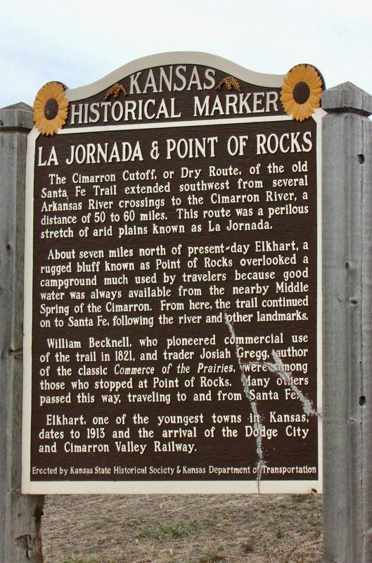
La Jornada & Point of Rocks
About seven miles north of present-day Elkhart, a rugged bluff known as Point of Rocks overlooked a campground much used by travelers because good water was always available from the nearby Middle Spring of the Cimarron. From here, the trail continued on to Santa Fe, following the river and other landmarks.
William Becknell, who pioneered commercial use of the trail in 1821, and trader Josiah Gregg, author of the classic Commerce of the Prairies, were among those who stopped at Point of Rocks. Many others passed this way, traveling to and from Santa Fe.
Elkhart, one of the youngest towns in Kansas dates to 1912 and the arrival of the Dodge City and Cimarron Valley Railway.
Erected by Kansas Historical Society and Kansas Department of Transportation. (Marker Number 84.)
Topics and series. This historical marker is listed in these topic lists: Natural Features • Roads & Vehicles • Settlements & Settlers. In addition, it is included in the Kansas Historical Society series list. A significant historical year for this entry is 1821.
Location. 36° 59.717′ N, 101° 53.864′ W. Marker is in Elkhart, Kansas, in Morton County. Marker is on U.S. 56 west of Trim Avenue, on the right when traveling west. Located at a roadside pulloff. Touch for map. Marker is in this post office area: Elkhart KS 67950, United States of America. Touch for directions.
Regarding La Jornada & Point of Rocks. Santa Fe Trail
Also see . . . Wikipedia article on the Point of Rocks. (Submitted on November 16, 2020, by Mark Hilton of Montgomery, Alabama.)
Credits. This page was last revised on December 5, 2022. It was originally submitted on November 16, 2020, by Mark Hilton of Montgomery, Alabama. This page has been viewed 420 times since then and 74 times this year. Last updated on November 18, 2022, by Jeff Wilson of North Springfield, Virginia. Photo 1. submitted on November 16, 2020, by Mark Hilton of Montgomery, Alabama. • Bill Pfingsten was the editor who published this page.
