Upon sighting American war ships at the mouth of the Thames River on October 1, 1813, the British Army boarded scows and bateaux near this site. One by one, the boats and their cargo were pulled across the river to their next encampment site at . . . — — Map (db m184677) HM
While British Army was encamped at Dolsen's, Procter travelled to Fairfield to investigate the site as a defensive position. At Tecumseh's urging, and learning that the Americans were closing rapidly, Colonel Warburton, Procter's second-in-command, . . . — — Map (db m71360) HM
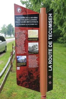
East of the Forks, the Thames River becomes shallower and not navigable for larger ships. With the American forces close behind, the British vessels were threatened with capture. One cargo ship, probably the Miamis, had already been set on fire . . . — — Map (db m71398) HM
There were many casualties at the skirmish at the Forks. Although we do not presently know the identities of the warriors who were killed, we do know that two Kentucky men in Colonel Johnson's Mounted Infantry lost their lives at this site on that . . . — — Map (db m71379) HM
The Chatham Armoury was constructed in 1905 as a result of reform and expansion of the volunteer militia. The first unit to occupy the Armoury was the 24th Kent Regiment that was formed in 1901. It was the centre for local recruitment and training . . . — — Map (db m71382) HM
On this site a blockhouse was constructed in 1794 by order of Lieutenant-Governor John Graves Simcoe. He planned to establish here a small naval arsenal which would form a link in the defences of Upper Canada's western frontier and also draw the . . . — — Map (db m71313) HM
Thomas McCrae was an early settler, innkeeper, and political figure in Raleigh Township along the Thames River. He served as a captain and company commander in the Kent Militia and was present at the capture of Fort Detroit. Family tradition relates . . . — — Map (db m71308) HM
On May 10, 1858, American abolitionist John Brown held the last in a series of clandestine meetings here at First Baptist Church. Brown planned to establish an independent republic within the United States and wage guerrilla war to . . . — — Map (db m71386) HM
In 1847 the Kent District was established and authority was given for the erection of a court house and jail at Chatham. One year later construction began according to plans submitted by the prominent Canadian architect William Thomas. Designed in . . . — — Map (db m198312) HM
Following the defeat of the British at the Battle of the Thames on October 5, 1813, American forces controlled the Thames Valley west of Moraviantown. In early December a detachment of 3 officers and 36 men of the American 26th Regiment established . . . — — Map (db m71292) HM
During the American occupation of the lower Thames, this house was used as a base for U.S. troops. In mid-December 1813, the house was occupied by 39 officers and men of the 26th Regiment led by Lieutenant Larwill.
At the same time, a group of . . . — — Map (db m71310) HM
On October 2, 1813, Tecumseh moved his warriors up-river to the Forks where he had been led to believe that fortifications would be prepared for a full-scale confrontation with harrison's army. When Tecumseh arrived, he was enraged to find no . . . — — Map (db m71335) HM
Robert McAfee, a member of Colonel Johnson's Kentucky Mounted Regiment, described the skirmish in his journal. He wrote:
Oct 4: …a woman … informed us that about six miles above the River forked, that there was a large bridge across the mouth . . . — — Map (db m71378) HM
On this site, Tecumseh, a Shawnee Chief, who was an ally of the British during the War of 1812, fought against American forces on October 4, 1813. Tecumseh was born in 1768 and became an important organizer of native resistance to the spread of . . . — — Map (db m71322) HM
From 1783 until the 1860s, abolitionists in British North America took part in the fight to end slavery both at home and in the United States. Thanks to the determination of colonial officials, anti-slavery organizations, and the thousands of . . . — — Map (db m71391) HM
The Forks of the Thames are formed by the joining of the Thames River and McGregor Creek creating a peninsula that is present day Tecumseh Park in Chatham, Ontario. The strategic importance of the site was recognized by Lieutenant Governor John . . . — — Map (db m71331) HM
The Paw Paw tree (Asimina triloba) is native to the southern, eastern, and mid-western United States and extends to Canada only in the extreme southern part of Ontario. It has the largest edible fruit native to North America. The fruit looks . . . — — Map (db m71405) HM
This house belonged to James Harris and his family, who are believed to be descendants of Weldon Harris, an African American who came to Canada and in 1825 purchased 50 acres on Lot 3, Concession 3 in Camden Township. Weldon Harris made . . . — — Map (db m78404) HM
English
Built in the mid-19th century, this house was the last residence of Josiah Henson and his second wife, Nancy Gambril, who lived in it until Henson’s death in 1883. Henson’s house was substantial in size compared to other . . . — — Map (db m78387) HM
After escaping to Upper Canada from slavery in Kentucky, the Reverend Josiah Henson became a conductor of the Underground Railroad and a force in the abolition movement. The founder of the Black settlement of Dawn, he was also an . . . — — Map (db m78377) HM
This area was once covered in a thick, growth of trees including black walnut, maple, beech, elm and white oak. To make use of these natural resources, Josiah Henson and his sons used donations from benefactors in Boston to build a . . . — — Map (db m78402) HM
Built around 1850, this modest rural church was moved from Mersea Township to this site in the 1960s and is representative of the churches in which Reverend Henson preached while living at Dawn.
Reverend Josiah Henson was most . . . — — Map (db m78388) HM
In the 1830s, the Reverend Josiah Henson and other abolitionists sought ways to provide refugees from slavery with the education and skills they needed to become self-sufficient in Upper Canada. They purchased 200 acres of land here in . . . — — Map (db m78376) HM
In 1846 Daniel van Allen, a Chatham merchant, laid out a town plot on land purchased from Jared Lindsley, the first settler (1825) on the site of Dresden. By 1849 the erection of a steam sawmill, and the operation a grist-mill in the neighbouring . . . — — Map (db m78416) HM
On November 7, 1763 a fleet of small boats carrying nearly 700 officers and men of the 60th and 80th Regiments under Major John Wilkins was forced ashore by a violent storm abut three miles east of this point. The expedition had set out from Niagara . . . — — Map (db m108505) HM
As Lieutenant Colonel James Johnson's horsemen were charging the British front line, his brother, Colonel Richard Johnson led an attack against the First Nations warriors in Backmetack Marsh. The mounted infantry charged the Native left flank led by . . . — — Map (db m233828) HM
In September 1813, during the second year of the War of 1812, the United States won control of Lake Erie, cutting British supply lines with the east and forcing the British to withdraw from the Detroit River region. Then, on October 5, . . . — — Map (db m78367) HM
The Moravians or "Bohemian Brethren" were a protestant sect that originated in the 1400s in Moravia and Bohemia, the present day Czech Republic. They faced persecution in their homeland and in 1722 many moved to Saxony (now part of Germany) where . . . — — Map (db m72448) HM
(Front of monument)
Fairfield on the Thames / Fairfield sur la Thames
Here stood the village of Fairfield, destroyed by invading American forces following the Battle of the Thames. , 5th October, 1813.
Its inhabitants, Delaware . . . — — Map (db m116758) HM
Jacques (James) Baby 1763-1833: A member of the Legislative and Executive Council for Upper Canada, judge for the Western District, and in command of the 1st Kent Militia, Baby was captured by the Americans at the Battle of the Thames.
Billy . . . — — Map (db m71415) HM
Makataimeshekiakiak, Black Hawk, 1767-1838: A Sauk war leader and experienced warrior, Blackhawk was a veteran of the Battles of Fort Meigs and Fort Stephenson. Although he left the war for a period of time, he rejoined the British, and scholars . . . — — Map (db m71418) HM
Shabbona 1775-1859: A Potawatomi chief, grand nephew of Pontiac, and veteran of Tippecanoe, Shabbona was an accomplished warrior and strong supporter of Tecumseh. He persuaded many natives to join the confederacy.
Sou-veh-hoo-wah, Split Log, . . . — — Map (db m71419) HM
John Adair 1757-1840: Pioneer, soldier, and statesman, Adair was a veteran of the American Revolution, was 8th governor of Kentucky, and represented that state in both the U.S. House of Representatives and the Senate. He fought at the Battle of the . . . — — Map (db m72381) HM
James Johnson 1774-1826: The brother of Richard Johnson, James was elected as a Kentucky State senator in 1808. He served as a lieutenant colonel in Johnson's Mounted Infantry and led the charge on the British lines at the Battle of the Thames along . . . — — Map (db m72385) HM
Isaac Shelby 1750-1826: Shelby was the 1st and 5th governor of Kentucky and a veteran of the American Revolution. As governor and at 63years of age, Shelby personally led the Kentucky Militia at the Battle of the Thames.
Tarhe 1742-1816: A . . . — — Map (db m72388) HM
By the early morning of October 5, 1813, the American Army had forded the Thames River and was advancing quickly. The British rearguard was able to destroy Cornwall's mill, west of Sherman's farm (present-day Thamesville, Ontario) but not the mill . . . — — Map (db m71413) HM
Born in a Shawnee village in what is now Ohio, Tecumseh became in the 1770s co-leader with his brother, the Prophet, of a movement to restore and preserve traditional Indian values. He believed a union of all the western tribes to drive back white . . . — — Map (db m71410) HM
Many of the men of the 41st Regiment had been stationed in Canada for 13 years. By October 5, 1813, they had not been paid for 6 to 9 months; they lacked tents and blankets; their uniforms were in rags; they were plagued by a variety of diseases; . . . — — Map (db m72393) HM
Robert McAfee, a soldier in Colonel Johnson's Mounted Regiment, kept a journal of his experiences, and wrote on October 7, 1813:
Spent the day in collecting in plunder ... Colonel Owings Regiment of Regulars came up and took charge of the . . . — — Map (db m72414) HM
At some point during the attack on Backmetack Marsh, Tecumseh was fatally shot. As word spread of their leader's death, one American account tells of the warriors giving, "the loudest yells I ever heard from human beings and that ended the fight." . . . — — Map (db m72405) HM
Some British officers involved reported that, due to the proximity of the enemy and the fact that the troops were exhausted and hungry, they were unable to outpace the American mounted units to Fairfield. Another theory is that Procter sought to . . . — — Map (db m71414) HM