On York Boulevard north of Dundurn Street North, on the right when traveling north.
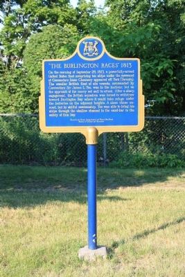
On the morning of September 28, 1813, a powerfully-armed United States fleet comprising ten ships under the command of Commodore Isaac Chauncey appeared off York (Toronto). The smaller British fleet of six vessels, commanded by Commodore Sir James . . . — — Map (db m56759) HM
On York Boulevard just north of Dundurn Street North, on the right when traveling north.
[English Text]:
Here in June, 1813, General John Vincent assembled troops that made the successful night attack on the invaders at Stoney Creek. From this point of vantage, in December, 1813, the force which retook Fort George and . . . — — Map (db m56725) HM
Near York Boulevard just north of Dundurn Street North, on the right when traveling north.
This villa was completed in 1835 for Allan Napier MacNab. Incorporating an existing farmhouse, it was designed by the local architect, Robert Wetherell, as a statement of its owner's place in Hamilton society. The house features an eclectic blend . . . — — Map (db m66126) HM
On York Boulevard just north of Dundurn Street North, on the right when traveling north.
This mansion was built 1832-35 by Allan Napier MacNab (1798-1862) and named after the family ancestral seat in Scotland. Enlisting at fifteen, MacNab distinguished himself by his bravery in the War of 1812. He subsequently entered politics and was . . . — — Map (db m66129) HM
Near York Boulevard north of Dundurn Street North.
These ramparts were
erected by the British troops
during the War of 1812-15.
From this place on the night
of June 5th 1813,
700 men under the command
of Lieut. Colonel Harvey,
marched to Stoney Creek
where they surprised . . . — — Map (db m56756) HM
Near York Boulevard just north of Dundurn Street North, on the right when traveling north.
Politician, businessman, land speculator and soldier, Allan MacNab enjoyed a very public life. He was a successful lawyer and was appointed Upper Canada's first Queen's Counsel. In 1838 he was knighted for his role in suppressing the rebellion in . . . — — Map (db m66130) HM
On York Boulevard north of Dundurn Street North, on the right when traveling north.
From these heights, Lieutenant-Colonel John Harvey set out with about 700 men on the night of June 5, 1813, to launch a surprise attack on an invading United States force of some 3,000 men camped at Stoney Creek. His rout of the troops commanded by . . . — — Map (db m56743) HM
On York Boulevard just north of Dundurn Street North, on the right when traveling north.
In Lasting Memory
of the
United Empire
Loyalists
Who preferred to remain loyal British
subjects and came to canada
in large numbers immediately
following the American Revolution
of 1776 and the . . . — — Map (db m66131) HM
On Reid Avenue North at Dunsmure Road, on the right when traveling north on Reid Avenue North.
Our city's aviation history began in East Hamilton on July 27, 1911 when Canada's first aviator, J. D. McCurdy, participated in Canada's first aviation meet in a field beside Burlington Bay at the head of Strathearne Avenue. It was sponsored by . . . — — Map (db m221443) HM
On Stuart Street, 0.1 kilometers east of Bay Street North, on the right when traveling east.
[English] The former Customs House (1858-1860) is a fine example of the Italianate style of architecture which was popular in Canada from the 1840s through the 1870s. Inspired by Renaissance palazzi of Rome and Florence, Italianate buildings . . . — — Map (db m196259) HM
European settlement began here
in 1792 with William Davis (1741-1834),
a United Empire Loyalist
who left North Carolina to fight
alongside the British in the
American Revolution. Davis was
granted 2300 acres in Barton and
Saltfleet . . . — — Map (db m228834) HM
On Mountain Brow Boulevard, 0.2 kilometers south of Limeridge Road East, on the left when traveling south.
This milling stone is all that remains of Albion Mills.
The first mill, built about 1795 by Wm. Davis, contributed
to the area's economic development. Settlers came and
the land was cleared. Many of their early homes are
within a short . . . — — Map (db m228965) HM
On Mountain Brow Boulevard, 0.3 kilometers south of Limeridge Road East, on the right when traveling south.
Native Trail Networks
According to Six Nations oral tradition, many major roads in southern Ontario are built upon ancient paths created by Native hunters, traders and diplomats. These pathways connected the Native settlements to . . . — — Map (db m228894) HM
On Wilson Street East, 0.1 kilometers east of Sulphur Springs Road, on the right when traveling west.
During the War of 1812 marauding bands of renegade settlers, many of whom had defected to the United States from the Niagara and London Districts, were active in southwestern Upper Canada. A number were captured and in May, 1814, nineteen . . . — — Map (db m220198) HM
The Hermitage Estate encompassed a mansion, several
outbuildings, and a large farm. Throughout the mid-nineteenth century, the farm thrived under George Leith's management, producing hay, oats, barley, and wheat crops. He also grew carrots, . . . — — Map (db m226401) HM
On Wilson Street East, 0.1 kilometers west of Sulphur Springs Road, on the right when traveling east.
In 1791 James Wilson in partnership with Richard Beasley built a sawmill and a grist-mill on the site of this community. The mills were sold to Jean Baptiste Rousseaux (known as St. John) in 1794 and developed into a thriving pioneer enterprise. . . . — — Map (db m220193) HM
The Hermitage had several owners before it was acquired by George Gordon Browne Leith (1812 -1887) in 1855. Mr. Leith, a wealthy Irish-born Scottish immigrant, settled his family on the land because of its proximity to the privileges of the . . . — — Map (db m226349) HM
On James Street North, 0.1 kilometers north of Cannon Street East, on the right when traveling north.
"Jock" Rennie was awarded the George
Cross posthumously in May 1944 for an
instinctive, selfless act of heroism. Born
in Aberdeen, Scotland, he came to
Ontario with his family as a child and
grew up in Kirchener. Rennie . . . — — Map (db m233165) HM
On Ferguson Avenue South at King Street East, on the left when traveling south on Ferguson Avenue South.
The first Family Planning Clinic in Canada, located in Hamilton, began in 1931 as The Advocates of Birth Control. Led by Mary (Chambers) Hawkins, the American wife of a prominent city executive, and aided by
some of Hamilton society's leading . . . — — Map (db m220765) HM
On James Street North, 0.3 kilometers north of Cannon Street East, on the right when traveling north.
CHRIST'S CHURCH CATHEDRAL
An important ecclesiastical centre for the Niagara Peninsula, Christ's Church was erected in stages, its form altered as the size and prominence of the congregation increased. Begun in 1835 as a parish church, . . . — — Map (db m218769) HM
On Main Street East (Highway 8) 0.2 kilometers east of James South and Main East, on the right when traveling east.
Born at Queenston, George Hamilton was the son of a prosperous merchant, the Hon. Robert Hamilton. He followed his father's career as a merchant in the Niagara District until the War of 1812, in which he served as a Captain of Light Dragoons. . . . — — Map (db m218241) HM
On James Street North at Murray Street East, on the right when traveling north on James Street North.
[English] This building recalls the importance of the railway to the development of Canada's industrial cities. Completed in 1931, it combines a strong classical design with a fluid circulation plan, making it one of the best urban stations . . . — — Map (db m196260) HM
On James Street North, 0.1 kilometers north of Cannon Street East, on the right when traveling north.
JOHN WEIR FOOTE ARMOURY
The north section of this building
(1887-1888) is a rare surviving example
of the second wave of armoury
construction in Canada. Designed
by Henry James, it exemplifies the
replacement of earlier wooden . . . — — Map (db m218780) HM
On James Street North, 0.1 kilometers north of Cannon Street East, on the right when traveling north.
Lieutenant Charles Davidson Dunbar, D.C.M.
1870-1939
An internationally renowned piper, Dunbar was born in
Halkirk, Scotland. In 1886 he joined the British army,
embarking upon a distinguished career as a military
piper. . . . — — Map (db m233560) HM
On John Street South at King Street East, on the right when traveling north on John Street South.
Sir John Morison Gibson
1842-1929
Lawyer, politician, and businessman, John Gibson was a tireless proponent of the economic advancement of Hamilton. Gibson's Hamilton-focused business interests
encompassed real estate development, . . . — — Map (db m227476) HM
On John Street North, 0.1 kilometers south of Cannon Street East, on the right when traveling north.
Founded c. 1835 as St. Paul's AME Church, Stewart Memorial Church represents the longest surviving predominantly Black congregation within the City of Hamilton. First housed in a log structure on Rebecca Street, just east of John Street North, . . . — — Map (db m219569) HM
On James Street North, 0.1 kilometers north of Cannon East, on the right when traveling north.
The Lieutenant-Colonel
John Weir Foote, VC, CD Armoury
This armoury is dedicated to the memory of
Lieutenant-Colonel john Weir Foote. VC. CD.
padre of the Royal Hamilton Light Infantry.
padre Foote was awarded the Victoria . . . — — Map (db m222052) HM
On Jame Street North at Robert Street, on the right when traveling north on Jame Street North.
The North Drill Hall
1887 - 1987
Built to house the XIIIth Battalion of volunteer militia, it replaced a wooden drill shed located near this spot which was consumed by fire on May 23rd, 1886, prompting the
erection of this building. . . . — — Map (db m233159) HM
On Palmer Road at Reno Avenue, on the left when traveling south on Palmer Road.
Born in Ireland, Kerr came to Canada in 1887 with his parents who settled in Hamilton two years later. He earned civic recognition at the 1902 Coronation Games where he won sprint and middle distance races. His exceptionally quick start placed . . . — — Map (db m223839) HM
On Mohawk Road West at West 5th Street, on the right when traveling west on Mohawk Road West.
William Terryberry
(1779-1847)
Since 1812, the name William Tenybeny has been associated with this section of Mohawk Road West. Having immigrated to the province of Upper Canada from the state of New Jersey, Terryberry purchased land along . . . — — Map (db m232325) HM
On York Boulevard at Dundurn Street North, on the right when traveling east on York Boulevard.
[text on left side]
BLOODY ASSIZE
In the spring of 1814, a court of assize (travelling circuit court) in Ancaster convicted fifteen men of high treason for aiding American forces during the War of 1812. In June 1814, the harshest of sentences . . . — — Map (db m222062) HM
On Bay Street North at Barton Street West, on the left when traveling north on Bay Street North.
The Harmony building, created in 1935, was the dream of Dr. Vincenzo Agro. He emigrated from Italy and was troubled by the Fascist movement in this city. He believed some local Italians showed more love for the old land than the new. Agro led the . . . — — Map (db m230427) HM
On Sheaffe Street at Park Street North, on the right when traveling east on Sheaffe Street.
ST. MARY'S PRO-CATHEDRAL
One of the few Roman Catholic churches in Ontario retaining its pre-Confederation character, St. Mary's was erected in 1859-60 during the episcopate of Bishop John Farrell to replace a building destroyed by . . . — — Map (db m218828) HM
On King Street West at James Street North, on the right when traveling west on King Street West.
On This Spot On November 3, 1869
On the night of November 3, 1869, a meeting was held in a room above George Lee's fruit store, at this exact location, to form the Hamilton Foot Ball Club - the ancestor of today's Hamilton Tiger-Cats . . . — — Map (db m218968) HM
On Concession Street, 0.2 kilometers west of Upper Wellington Street, on the right when traveling west.
THE NIAGARA ESCARPMENT
Hamilton Mountain is part of the Niagara
Escarpment, a height of land extending 725
km across Ontario from Niagara Falls to
Manitoulin Island. Over 450 million years
ago, a tropical sea covered most of . . . — — Map (db m219256) HM
Near Confederation Drive east of Van Wagners Beach Road.
We honour here fifty-three sailors who lost their lives when their ships, HAMILTON and SCOURGE, capsized during a storm in the early morning hours of Sunday, 8th August 1813. These two armed merchant schooners lie in 90 metres of water, 30 . . . — — Map (db m56928) HM
On Van Wagner’s Beach Road, 0.8 kilometers south of Beach Boulevard, on the left when traveling south.
In 1794, with Europe caught in the turmoil of the
French Revolution and talk of war with the United
States widespread, Lieutenant Governor John Graves
Simcoe found the frontiers of Upper Canada seriously
isolated and threatened by the young . . . — — Map (db m234207) HM
On Confederation Drive, 0.7 kilometers south of Van Wagner’s Beach Road, on the left when traveling south.
The flashes of lightning were incessant, and nearly blinded me. Our decks seemed on fire, and yet I could see nothing. I heard no hail, no order, no call; but the schooner was filled with the shrieks and cries of the men...
Ned Myers' . . . — — Map (db m232634) HM
On Confederation Drive, 0.7 kilometers south of Van Wagner’s Beach Road, on the left when traveling south.
Hamilton & Scourge
The wrecks of the Hamilton and Scourge
are rare examples of vessels used during
the War of 1812. Designed as merchant
schooners, both were converted into
American warships once hostilities
began and each . . . — — Map (db m232638) HM
On Waterfront Trail, on the right when traveling north.
From the mid-1600s and the time of the early French explorers, ships have been sailing the Great Lakes. Since that time it is estimated more than 10,000 sunken ships have come to rest at the bottom of our Great Lakes.
Lake Ontario is no . . . — — Map (db m241435) HM
On John Street South at St. Joseph’s Drive, on the right when traveling north on John Street South.
In August 1812, after the American invasion of Canada by Brigadier General William Hull on the Detroit River frontier, the Speaker of the House of Assembly in York (Toronto) warned that Upper Canada faced a "conspiracy against the civilization of . . . — — Map (db m242558) HM
The Niagara Escarpment is an important part of Ontario's natural heritage system. It hosts a myriad of flora and fauna, some of which are endangered or rare. In 1973, Premier Davis and the Government of Ontario took the remarkable step of . . . — — Map (db m219264) HM
On James Street at Hunter Street, on the left when traveling south on James Street.
Hamilton's second major rail carrier, the Toronto, Hamilton & Buffalo Railway, was conceived in response to the merger of the Great Western and Grand Trunk Railways, thus providing Hamilton with an alternative shipping system. Linking the . . . — — Map (db m218262) HM
On Main Street East at John Street South, on the right when traveling east on Main Street East.
[North Side]
This monument is dedicated to the lasting memory of
The United Empire Loyalists
who, after the Declaration of Independence, came into British North America from the seceded American colonies and who, with faith and fortitude, . . . — — Map (db m229935) HM
On Main Street East at Ottawa Street North, on the left when traveling east on Main Street East.
As hostilities ceased in late 1918, Hamilton's leaders began to consider how to best honour the men of Hamilton who had given their lives in the Great War. The Hamilton
Board of Education was the first group to finalize such a plan. They . . . — — Map (db m226270) HM
On Governor’s Road at Ogilvie Street when traveling west on Governor’s Road.
By 1799 the Morden family had a sawmill near this site
on Spencer Creek north of Dundas Street. They sold this
property in 1800 to Edward Peer who built a grist-mill
about 300 yards south-east, close to Dundas Street, and
adopted the name . . . — — Map (db m220819) HM
On Market Street South at King Street West (Highway 8), on the right when traveling south on Market Street South.
This plaque is to commemorate the men and the units of the 102nd Wentworth Field Battery Royal Canadian Artillery. Formed in Dundas December 15th 1936 stood down March 31st 1970.
The 102nd Wentworth Field Battery was mobilized for active service . . . — — Map (db m196244) HM WM
On King Street West (Highway 8) at Market Street South, on the right when traveling east on King Street West.
1921
This monument is erected by
the citizens of Dundas in loving and
grateful memory of our brave boys who
gave their lives for freedom in the
Great War of 1914-18, and for the Empire
in the South African War of 1900-1
Great War 1914 . . . — — Map (db m196251) WM
The area now known as the Dundas Driving Park was
previously a large part of the estate of George Rolph,
lawyer, local politician and hero of the War of 1812. For
many years Rolph graciously allowed a large portion of his
estate to be used as . . . — — Map (db m234178) HM
On The Governor’s Road, 0.1 kilometers east of Bridelwood Drive, on the left when traveling west.
DUNDAS STREET
Dundas Street, named for Henry Dundas, Secretary of State for the British Home Department (1791-1794), was built on Lieutenant Governor Simcoe's orders in 1793-1794. The road, cut by a party of Queen's Rangers from . . . — — Map (db m220871) HM
On Rock Chapel Road, 0.3 kilometers south of Valley Road, on the right when traveling north.
This is the original site of Rock Chapel, a frame building erected in 1822. First known as Cummings Chapel, it was built by local members of the Methodist Episcopal Church and later taken over by the Wesleyan Methodists. The Reverend Egerton . . . — — Map (db m226750) HM
On Osler Drive at Ancaster Street East, on the right when traveling west on Osler Drive.
[text of metal inset plaque]
1849 Sir William Osler 1949
Erected by the Hamilton Academy of Medicine
to commemorate the hundredth anniversary
of the birth of
Sir William Osler
Bart.
[text of main plaque]
Sir . . . — — Map (db m220911) HM
On East Street at Cootes Drive, on the right when traveling north on East Street.
In pioneer days waterways provided the essential means
of transportation. Dundas, located at the head of navigation on Lake Ontario and the eastern terminus of the Governor's Road", was thus in a favoured position. However, in 1823 the . . . — — Map (db m219998) HM
On King Street East, 0.3 kilometers east of East Street North, on the right when traveling east.
Peter Desjardins made it his life's work to develop viable canal route from Lake Ontario to Dundas
Desjardins came to Canada from France in 1792. He settled in Dundas in 1805 where he became Richard Hatt's chief clerk, Hatt envisioned a . . . — — Map (db m226479) HM
On Main Street at Dundas Street (County Road 99), on the left when traveling north on Main Street.
Dundas was incorporated as a town in 1847 by a special Act of the legislature of the Province of Canada. The following year the town council accepted a tender from a local builder, James Scott, to erect a stone town hall and voted £2000 to cover the . . . — — Map (db m196237) HM
On East Street at Cootes Drive, on the right when traveling north on East Street.
THE FOUNDING OF DUNDAS
In 1793 Lieutenant-Governor Simcoe authorized a townplot in this vicinity at the then eastern terminus of Dundas Street. Its original name, "Coote's Paradise", was derived from that of the adjoining marsh, a haunt of . . . — — Map (db m219992) HM
On Crook’s Hollow Road, 1.5 kilometers west of Brock Road, on the right when traveling west.
The province's first paper mill began operations in 1826.
Situated about 150 yards downstream from here, it was owned by James Crooks (1778-1860), one of Upper Canada's most successful entrepreneurs. On four hundred acres of land purchased here . . . — — Map (db m223079) HM
The area now known as Carroll's Bay is a very distinctive geographical feature, with its shoreline projecting into the water from the north shore bluffs.
During the War of 1812, British Commander Vincent took advantage of the bay and installed . . . — — Map (db m242360) HM
In Thursday, March 12, 1857, at 5:40 p.m., a tragic
railroad disaster occurred at the Desjardins Canal.
A Great Western Railway train, traveling southbound from Toronto, was due into Hamilton at 6:15 p.m. The train, traveling at a moderate . . . — — Map (db m228764) HM
From 1860 to the early 1940s, the boathouse community
known as "Shack Town" was located along the Desjardins
Canal and the east shore of Cootes Paradise. Homes ranged from tar-paper shacks to two-story dwellings. Many residents used boats to . . . — — Map (db m227154) HM
"This Belt which I now hand to you I ask in compliance with your
Customs be sent by you with these my words in his behalf to all the
Nations in friendship with your Great Father the King of England."
Col. William Claus, April 1815 . . . — — Map (db m227174) HM
In the early 1800s, city promoters campaigned vigorously to bring a railway to Hamilton. In 1849, local industry and municipal government backed the construction of the Great Western Railway (GWR).
The first train left Hamilton on November . . . — — Map (db m235062) HM
On Charlton Ave. West at Caroline Street South, on the left when traveling west on Charlton Ave. West.
CENTRAL PRESBYTERIAN CHURCH
Erected to serve a thriving congregation established in
1841, Central Presbyterian Church was built in 1907-08
after an earlier building was destroyed by fire. It is
reputedly the only church designed by . . . — — Map (db m218565) HM
On Hunter Street West at Bay Street South, on the right when traveling west on Hunter Street West.
Dedicated to the Irish who settled in Hamilton.
Their hard work, dedication,
love of family and pride,
continues to contribute
to the growth
and prosperity of this
great city.
Erected in this
Sesquicentennial Year of 1996 . . . — — Map (db m235969) HM
On Bay Street South at Main Street West, on the right when traveling north on Bay Street South.
1887 1987 2087
Engineering Centennial Commemorative Plaque and Time Capsule
This monument has been erected by the Hamilton Section of
the Canadian Society for Civil Engineering on behalf of all individuals and organizations . . . — — Map (db m235468) HM
On Hunter Street West at Bay Street South, on the left when traveling west on Hunter Street West.
This school, built to accommodate 1,000 students, was the largest graded school in Upper Canada, and became the only public school in Hamilton, at the time of its opening in 1853. Among the earliest examples of an institution inspired by the . . . — — Map (db m220407) HM
On Bay Street South at Main Street West, on the left when traveling south on Bay Street South.
In memory of the victims
of the 1994 genocide against
the Tutsi in Rwanda. Over one
million killed in 100 days.
À la memoire des victimes du
genocide contre les Tutsi du
Rwanda en 1994. Plus d'un
million de tues en 100 . . . — — Map (db m235974) HM
On Hunter Street West at Bay Street South, on the right when traveling west on Hunter Street West.
This plaque marks the site where the residence of Dr. John Rae, MD, LL.D, FRS, FRCS used to stand.
Rae was born in the Orkney Islands on 30 September, 1813. Graduating in medicine from Edinburgh, he joined the Hudson's Bay Company in 1833, . . . — — Map (db m220924) HM
On MacNab Street South at Hurst Place, on the right when traveling north on MacNab Street South.
The MacNab-Charles Heritage Conservation District is one of the finest concentrations of pre-Confederation architecture in Hamilton. It evokes a Hamilton in its founding stages, when Scottish Presbyterian settlers erected new churches and houses . . . — — Map (db m234787) HM
On Bay Street South at Main Street West, on the right when traveling north on Bay Street South.
Mahatma Gandhi (1869-1948)
This statue of Mohandas Karamchand Gandhi, received as a gift from the Government of India and obtained through the efforts of the City of Hamilton and the local Indo-Canadian community, recognizes the twenty-year . . . — — Map (db m235470) HM
On Duke Street at MacNab Street South, on the left when traveling west on Duke Street.
Built about 1856, at a time of rapid growth in Hamilton, Sandyford Place is a fine example of the housing then being erected for the merchants of the period. It is a rare survivor in Canada of the few row
houses built for affluent . . . — — Map (db m218512) HM
On James Street South at Jackson Street West, on the right when traveling south on James Street South.
Begun in 1854 and completed three years later, this Presbyterian church was designed in the Gothic Revival style by architect William Thomas. The elegant eighty-foot spire set atop a hundred-foot tower marks the building as an outstanding example . . . — — Map (db m221813) HM
On James Street South at Jackson Street West, on the right when traveling south on James Street South.
Erected in 1854-1857, St. Paul's (formerly St. Andrew's) is an elegant example of the Gothic Revival style. The design of the church shows the influence of the Ecclesiological Movement which favoured plans based on English medieval . . . — — Map (db m218245) HM
On Hunter Street West at Bay Street South, on the right when traveling west on Hunter Street West.
In 1999, the United Nations Manifesto 2000 was declared calling communities to create a Culture of Peace for the children and youth of the world. Below are the six principles of this manifesto, calling us to action.
1. Respect all life. . . . — — Map (db m235967) HM
Near Jackson Street West, 0.1 kilometers west of Jackson W. and MacNab S., on the left when traveling west.
Set in a rare walled garden and enriched by its interior decoration, Whitehern is a remarkably intact example of mid-19th century residential architecture. The lingering influence of the Palladian style combined with Neoclassical motifs . . . — — Map (db m218635) HM
On Jackson Street West at MacNab Street South, on the left when traveling west on Jackson Street West.
This stately mansion is a finely crafted and well preserved
example of Hamilton's early stone architecture. Built no
later than 1850 for city clerk and attorney Richard Duggan, it was purchased in 1852 by Calvin McQuesten, M. D. (1801-85), a . . . — — Map (db m221805) HM
On Concession Street at Cliff Avenue, on the right when traveling west on Concession Street.
Early Black Community on Hamilton Mountain
Beginning in the 1840s, people of African descent purchased plots of land on the Hamilton Mountain brow along today's Concession Street between Upper Wellington and Upper Sherman Streets. William . . . — — Map (db m229634) HM
On Concession Street, 0.1 kilometers west of Upper Sherman Avenue, on the right when traveling west.
Born in England, Nora Frances Henderson settled in Hamilton in 1917. She began her career with the Hamilton Herald as a cub reporter and became editor of the Women's Page. She devoted her two great talents, writing and speaking, to her passion . . . — — Map (db m232334) HM
On Barton Street East at Sanford Ave. North, on the right when traveling west on Barton Street East.
Robert Land settled near this site as early as 1784 as a refugee of the American Revolution. A Pennsylvania
magistrate and farmer, Land joined Joseph Brant's Volunteers as a courier, scout and Loyalist recruiter. Captured and sentenced to death . . . — — Map (db m220750) HM
On Barton Street East at Sandford Avenue North, on the right when traveling west on Barton Street East.
This land was occupied by various indigenous groups, including the Chonnonton Nation, meaning people who tend deer'. They were known by their neighbours as the 'Attiuoindaron' and by the French as the Neutrals.
United Empire Loyalist Colonel . . . — — Map (db m220755) HM
On Eastport Drive, 0.5 kilometers north of Beach Boulevard, on the left when traveling north.
BURLINGTON BAY CANAL
The first public work undertaken with the financial backing of the provincial government, Burlington Bay Canal was
proposed as one of a series of waterways to provide uninterrupted navigation from Lake Erie to the . . . — — Map (db m222843) HM
Near Beach Boulevard, 0.3 kilometers south of Eastport Drive.
The Dieppe Veterans Memorial Park is dedicated by
the City of Hamilton to the young men of Hamilton
and surrounding communities who died on the stony
beaches of the Port of Dieppe, France, on
19 August 1942.
There were 197 . . . — — Map (db m222859) HM WM
Near Eastport Drive, 0.4 kilometers north of Beach Boulevard, on the right when traveling north.
The Burlington Canal was completed in 1832. In 1837, the canal's first lighthouse shone its beacon across the lake. The wooden structure guided many ships into the canal.
George Thompson was the lighthouse's first keeper. His journal captured . . . — — Map (db m222838) HM
On Eastport Drive, 0.1 kilometers north of Beach Boulevard, on the right when traveling north.
The first public walkway along the lakefront was built in 1910. The Burlington Beach Commission planned the promenade. The Commission looked after the area's health, park development, policing, street lighting, and garbage
collection.
The . . . — — Map (db m222965) HM
On Beach Boulevard, on the right when traveling north.
Victorian summer homes
In the 1870s, prominent, wealthy Hamiltonians began building summer
homes on the Beach Strip. Three surviving examples, all built in the early 1890s, are described here. These homes were distinguished by their wood . . . — — Map (db m241489) HM
On Beach Boulevard, 0.2 kilometers south of Eastport Drive, on the right when traveling south.
Even on the Beach Strip, a community known for its characters and mavericks, Jimmy Lomax stood apart as a true original - a lion-hearted philanthropist whose dedication to helping children and the less fortunate was legendary.
He was one of . . . — — Map (db m241458) HM
On Beach Boulevard, on the right when traveling north.
Hamilton's Around the Bay Road Race, established 1894, is the oldest road race in North America, three years older than Boston Marathon. The race remained closed to women for 85 years, until Tersilla Komac came along. Born in Castelfranco Veneto, . . . — — Map (db m241609) HM
On Beach Boulevard, 0.2 kilometers Van Wagner’s Beach Road, on the right when traveling south.
Back in the days when the Beach Strip was more isolated from the heart of the city, motorsport legend Jimmy Howard
(1920-2015) made a name for himself with a ratchet in his hand and a cigar in his mouth. His iconic shop in a garage at 147 Beach . . . — — Map (db m235801) HM
On Beach Boulevard, 0.4 kilometers north of Van Wagner’s Beach Road, on the right when traveling north.
They called him "Mr. Hamilton," and with good reason. It is hard to think of anyone who embodied the spirit of the city more than Reg Wheeler
(1918-2012). Whether it was working in a gritty steel mill, chasing down a quarterback, or going to bat . . . — — Map (db m235802) HM
On Mountain Brow Boulevard, 0.3 kilometers north of Mohawk Road East, on the left when traveling south.
This property was donated to the Hamilton Board of Park Management by Ethel Armes in memory of her late Husband Jospeph Dalton Armes who was for many years a dairy farmer, the reeve of the Township of Barton and warden of the County of Wentworth. . . . — — Map (db m242935) HM
On Jackson Street West at Locke Street South, on the right when traveling west on Jackson Street West.
This plaque commemorates the historic homesite of
Richard Beasley
United Empire Loyalist Merchant Soldier Politician
Member of the Legislative Assembly of Upper Canada 1791
Appointed Justice of the Peace 1795, Magistrate 1796 . . . — — Map (db m231253) HM
On Charlton Avenue West at Kent Street, on the right when traveling west on Charlton Avenue West.
The original 1874 plans for this six and one-half acre site, owned by the Hamilton Cricket Club, Included an eight-foot board fence, a dining room, dressing room and grandstand. In addition to cricket, lacrosse and rugby football were played . . . — — Map (db m220653) HM
On King Street East at Wellington Street North, on the right when traveling west on King Street East.
In the 1790s, many of Hamilton's first United Empire Loyalist families settled around this site where the head of an extended inlet from Burlington Bay intersected a prehistoric trail from Niagara.
Smith's Tavern, the first public house in . . . — — Map (db m224070) HM
On East 37th Street at 7th Avenue, on the left when traveling south on East 37th Street.
On the morning of June 25, 1958, His Excellency, the Governor General of Canada arrived in Hamilton by train from Union Station. His itinerary for the day was full but not difficult; officially open Vincent Massey Public School and the Royal . . . — — Map (db m236568) HM
The Honourable William McMaster (1811-1887), a
prominent banker and member of the first Senate of Canada, bequeathed funds which enabled Baptists of Ontario and Quebec to found this university. Incorporated in 1887, it was the culmination of . . . — — Map (db m219428) HM
On Airport Road West, 1.2 kilometers west of Upper James Street, on the right when traveling west.
Canada's first licensed woman pilot, Eileen Vollick was born in Wiarton and came to Hamilton about 1911. She was fascinated by aviation and in 1927 enrolled in the flying school established near her home on Hamilton Bay by Jack V Elliot, a . . . — — Map (db m228685) HM
141 entries matched your criteria. The first 100 are listed above. The final 41 ⊳