This depression was the site in the early 1800’s where John Thompson quarried the exposed limestone ridge at the edge of the gorge, and processed it into agricultural lime. There were two lime kilns and a water-powered sawmill on the site which . . . — — Map (db m79421) HM
On June 15, 2012, the world watched as professional tightrope walker Nik Wallenda crossed the Niagara Gorge on a wire. Table Rock complex marked the Canadian end point for this high wire walk, which began at Terrapin Point, directly across the Gorge . . . — — Map (db m64660) HM
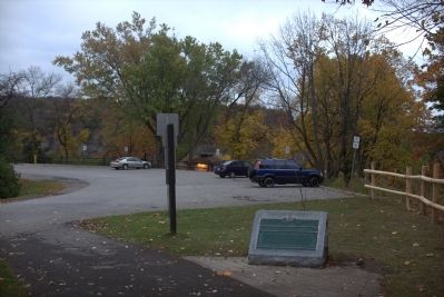
To
the memory of
Burrell Hecock
of
Cleveland Ohio
Aged 17 Years
Who lost his life in an
heroic attempt to rescue
Mr and Mrs
Eldridge Stanton
of Toronto Ontario
when the ice bridge in
the gorge immediately
below . . . — — Map (db m35065) HM
Opened in 1906 to supply the Toronto market, this generating station was the first wholly Canadian-owned hydro-electric facility at Niagara Falls. Engineers adapted advanced European and American technologies to a difficult site in a bold and . . . — — Map (db m79737) HM
This Monument erected July 25, 1991
by the American Legion, Niagara
County Committee & Dept. of New York
In memory of the U.S. Officers &
Soldiers who died at the Battle
of Lundy's Lane
Connecticut 25th; New York 23rd;
Massachusetts . . . — — Map (db m49695) HM
An abutment of the Upper Steel Arch Bridge built on this site 1897-98, is visible on the U.S. shore of the river. Also known as the Falls View Bridge and the Honeymoon Bridge, it stood until January 27, 1938, when an ice jam pushed the bridge off . . . — — Map (db m79521) HM
This plaque marks the entrance to the Upper Suspension Bridge, opened in July 1869, then the longest suspension bridge in the world. The iron cables were hung from timber towers. In 1884-87, this wooden bridge was changed to steel. In 1898, this . . . — — Map (db m64670) HM
The Napoleonic Wars raged in Europe from 1803 to 1815 and had a global impact. Wishing to remain neutral and assert its independence, the United States continued to trade with both Britain and France. Nevertheless, diplomatic relations between the . . . — — Map (db m139911) HM
An ancient river pre-dating the Wisconsin Glacier flowed through the channel of the Whirlpool Rapids and the Whirlpool draining glacial Lake Erie. After the retreat of the glacier when the present river broke through the rock barriers at Thompson . . . — — Map (db m79581) HM
A native of Pennsylvania, William Lundy and his wife Nancy (Silverthorn) came to Canada in 1786. They were among the first settlers in the Niagara area. As a United Empire Loyalist, William received from the Crown a large land grant in this section . . . — — Map (db m199068) HM
Built in 1901-05, it was the first Powerhouse on the Canadian side to produce electrical energy for commercial use and sale outside Niagara Falls.
Its location takes advantage of the natural flow of the river which formerly entered here to flow . . . — — Map (db m116098) HM
This beautiful fountain takes its name from Samuel Zimmerman who came to Canada from Pennsylvania in 1842. He amassed a fortune through a series of lucrative contracts involving the building of the second Welland Canal and various Railway Lines, . . . — — Map (db m75881) HM
The Tower
By 1813, the British were planning to build "a tower in small redoubt to command the entrance of the River...at Mississauga Point." Begun in the Spring of 1814, this tower rests on the remains of the first Capital of . . . — — Map (db m52200) HM
A Strategic Location
You are standing at Mississauga Point where the Niagara River flows into Lake Ontario. Long ago the lakes and rivers were military supply and transportation routes and forts were built to protect them. . . . — — Map (db m52610) HM
Fort Niagara was only 1200 metres from Fort George, well within artillery range. In May, 1813, combined artillery fire from Fort Niagara, its detached batteries, and American warships at the river's mouth completely destroyed Fort George and forced . . . — — Map (db m53604) HM
The Niagara River was extremely important from a strategic perspective. It was part of the St. Lawrence – Great Lakes system, one of the main transportation routes on either side of the border. Those who controlled the waterways would . . . — — Map (db m140087) HM
On the 8th of July, 1813, an outpost of the invading force, encamped near Fort George, was defeated by a band of Six Nations and Western Indians led by Chiefs John Norton and Blackbird and interpreters Michel Brisebois, Louis Langlade and Barnet . . . — — Map (db m48747) HM
This plaque, erected by the Legislative Assembly of Ontario, commemorates the Bicentennial of the first Parliament of Upper Canada held at Newark (Niagara-on-the-Lake) near this site on September 17th, 1792, which marked the beginning of . . . — — Map (db m140020) HM
Brown's Inn was located here. Both the Canadian York Militia and the American Army bivouacked near here on separate occasions during the War of 1812. Adam Brown later added a store to his inn, and built a wharf on the river shore below, where . . . — — Map (db m49166) HM
In 1777 John Butler of New York raised a force of Rangers who, with their Iroquois allies, raided the frontiers of New York, Pennsylvania and New Jersey throughout the American Revolutionary War. From their base at Fort Niagara they successfully . . . — — Map (db m75857) HM
In the early morning of December 19th, 1813, a force under Colonel John Murray, consisting of detachments of the 100th and 41st Regiments. Royal Scots, Royal Artillery and Canadian Militia embarked in bateaux at the foot of this ravine. Crossing . . . — — Map (db m49158) HM
On March 14, 1793 Chloe Cooley, an enslaved Black woman in Queenston, was bound, thrown in a boat and sold across the river to a new owner in the United States. Her screams and violent resistance were brought to the attention of Lieutenant Governor . . . — — Map (db m75858) HM
The first session of the Legislative Assembly held at Newark (Niagara-on-the-Lake) from 17 September to 15 October 1792, introduced a limited form of representative government to the newly created colony of Upper Canada. The elected assembly formed . . . — — Map (db m140021) HM
Constructed by order of Lieutenant-Governor Simcoe 1796-99, Fort George served as the headquarters for Major-General Brock in 1812. In May, 1813, it was bombarded and captured by the Americans who constructed fortifications of their own on the site. . . . — — Map (db m48743) HM
This tower and earthwork are all that survive of the barracks, guardroom, and cells of Fort Mississauga. Built between 1814 and 1816 to replace Fort George as the counterpoise to the American Fort Niagara immediately opposite, it was garrisoned . . . — — Map (db m48745) HM
• Mississauga Point was the location of a Neutral First Nation fishing settlement by the 15th century.
• The area was under the control of the Seneca Nation during the late 17th century, and it became home to the Mississauga Nation by the . . . — — Map (db m52236) HM
Explore a part of our heritage - visit a fort almost 200 years old and discover part of the Lake Ontario shoreline.
Explorez un volet de notre patrimoine - visitez un fort qui a presque 200 ans d'histoire et decouvrez une partie du rivage du . . . — — Map (db m48632) HM
Across the Niagara River is the imposing American stronghold, Fort Niagara. Originally built by the French, then occupied by the British, and finally by the Americans, this fort for nearly 150 years stood guard over the traditional supply route to . . . — — Map (db m53630) HM
Only 1200 metres across the Niagara River is the imposing American stronghold, Fort Niagara. Originally built by the French, then occupied by the British, and finally the Americans, this fort for nearly 150 years stood guard over the traditional . . . — — Map (db m140089) HM
Garrison guns were heavy and awkward to move. To be transported, the barrel had to be taken off the carriage with the help of a tripod hoist or gun gin. The gin was equipped with a pulley system that made it possible for two men to lift the barrel. . . . — — Map (db m54006) HM
For more than thirty years Janet Carnochan, a native of Stamford, Ontario, taught elementary and secondary school at Niagara-on-the Lake, but she made her greatest contribution to the community as a historian rather than as an educator. A . . . — — Map (db m75859) HM
Here at Niagara on September 17, 1792
he presided over the first
representative assembly
of this province.
His genius foresaw the greatness of
this country and he threw himself
into its building with ardour and
enthusiasm. . . . — — Map (db m49475) HM
Simcoe was born in Northamptonshire and educated at Oxford. He joined the British army in 1771, and from 1777-81 commanded the Queen's Rangers, a Loyalist corps in America. After the Loyalist influx had led to the creation of a separate province of . . . — — Map (db m75860) HM
With the generous support of the Ministry of Canadian Heritage, the Town of Niagara-on-the-Lake Heritage Fund and the Henry N.R. Jackson Foundation.
Sculptor Roy Charles Asplin Unveiled July 1999 — — Map (db m140011) HM
Soldier, politician, diplomatist and colonizer, de Puisaye was born at Mortagne-en-Perche, France, about 1755 and enlisted in the French Army at 18. Elected to the States General in 1789, he supported reform but, alarmed by the course of the . . . — — Map (db m49159) HM
[Text on Marker]:
Immediately after the War of 1812, a new wooden storehouse was built on this site. It was converted into barracks for British troops during the border troubles of 1838. The building remained in use until the 20th . . . — — Map (db m49478) HM
Born in New London, Connecticut, Butler settled in the Mohawk Valley, New York, in 1742. Commissioned in the British Indian Department in 1755, he served in the Seven Years War. At the outbreak of the American Revolution , he was compelled to leave . . . — — Map (db m49165) HM
For 103 years, beginning in 1854, a train powered by a steam locomotive pulled into the Niagara Dock. At first it only came from Chippawa via Niagara Falls and Queenston but by 1863 the line had been extended as far as Fort Erie and Buffalo. The . . . — — Map (db m54079) HM
This Georgian style house was built in 1800 by John McFarland (1757-1815) and his sons, on land granted by the Crown. It is one of the oldest surviving structures in the Niagara district. During the War of 1812 it was used as a hospital by both . . . — — Map (db m49480) HM
This building, the first in Ontario to be constructed for use solely as an historical museum, was begun in 1906 and completed the following year. Its erection was due largely to the dedicated efforts of Miss Janet Carnochan, founder, and for thirty . . . — — Map (db m75861) HM
The facilities of this strategic location have served British and later Canadian troops stationed at Niagara from 1765 to the 1920's. — — Map (db m49477) HM
Here stood a Baptist church erected in 1830 through the exertions of a former British soldier. John Oakley, who although white, became pastor of a predominantly negro congregation. In 1793 Upper Canada had passed an act forbidding further . . . — — Map (db m75862) HM
The first organization devoted to the improvement of agriculture in Ontario was founded at Niagara. Its original name, the Agricultural Society of Upper Canada, reflected Lieutenant-Governor John Graves Simcoe’s hope that it would become a . . . — — Map (db m139985) HM
Acquired by the Ontario Heritage Foundation in 1969, the Niagara Apothecary is a fine example of a Confederation era commercial establishment and pharmacy. Although the building probably dates to the 1820's. It was extensively renovated in 1866 when . . . — — Map (db m24609) HM
[English] This is the third and only surviving court house erected for the former Niagara District. Constructed between 1846 and 1848, it was designed by the prominent Toronto architect, William Thomas, in the fashionable Neoclassical style . . . — — Map (db m196309) HM
Formed by local businessmen in 1831, the Niagara Harbour and Dock Company created a shipping basin here on the Niagara River by hiring hundreds of labourers to excavate a riverside marsh. By the late 1830s the company employed close to 400 workers . . . — — Map (db m54049) HM
On December 12th, 1895, a group of dedicated persons founded the Niagara Historical Society. This tree was planted in 1995 to commemorate the 100th Anniversary of the Society. — — Map (db m140025) HM
To obtain land on which to settle Loyalists and dispossessed members of the Six Nations of the Iroquois, Guy Johnson in May 1781 and John Butler in May 1784 negotiated treaties with representatives of the Mississauga and Chippewa of this region. The . . . — — Map (db m75863) HM
Brock's Monument and
Queenston Heights:
This striking commemoration and final resting place of Major General Brock marks the site of the Battle of Queenston Heights. Visitors can climb the 235 stairs to take in spectacular views, or . . . — — Map (db m54037) HM
(Left side is in English)
In 1778, Loyalist refugees began crossing from Fort Niagara to settle the west bank of the Niagara River. A town was laid out in a grid pattern of four-acre blocks and grew quickly, gaining prominence as the first . . . — — Map (db m24585) HM
The first lighthouse on the Great Lakes was built of stone at Point Mississauga in 1804 by John Symington, under orders from Lieutenant-Governor Peter Hunter. Demolished in 1814 to make room for this fort, its materials with debris from the ruined . . . — — Map (db m48746) HM
This burial plot commemorates the Polish soldiers who trained in this community from 1917 – 1919 at Camp Kosciuszko and subsequently made the supreme sacrifice – They personified the Polish soldiers’ motto: “For Your Freedom and . . . — — Map (db m140019) HM
Field artillery was designed for mobility. Cannons mounted on carriages with large wheels could be moved quickly, even over rough terrain. This six pounder has a limber to carry ammunition and supplies and would be harnessed to a team of horses. . . . — — Map (db m54000) HM
This cairn marks the southern terminus of the Bruce Trail, a cross-country foot trail established along or adjacent to the Niagara Escarpment extending from Tobermory on Georgian Bay in the north to this southern terminus at Queenston Heights.
. . . — — Map (db m79046) HM
One of the earliest Anglican churches in the province, St. Mark’s was begun in 1804 to serve a congregation organized twelve years earlier. Its first rector, the Reverend Robert Addison, chaplain of Upper Canada’s first Legislative Assembly, . . . — — Map (db m139894) HM
The Parish of St. Vincent de Paul is the direct successor of the many and often interrupted endeavors in the Niagara area since 1626. At first concerned with native peoples, later French and then English-speaking priests came as chaplains for the . . . — — Map (db m37237) HM
On the 25th May, 1813, the American Fleet and the Batteries at Fort Niagara across the river began a devastating two-day bombardment of Fort George. On the 27th a large American force was landed and after a brief engagement in which his outnumbered . . . — — Map (db m48628) HM
In May of 1813, combined artillery fire from Fort Niagara and detached batteries destroyed Fort George paving the way for invasion. On May 27th, a large American force defeated a much smaller number of British regulars, militia and First Nations . . . — — Map (db m140092) HM
On July 18th, 1814, during the final American campaign on the Niagara frontier, Major-General Peter B. Porter sent a detachment of militia from the United States encampment at Queenston to attack St. Davids. This force, commanded by . . . — — Map (db m58172) HM
On July 20, 1799, the first edition of the "Canada Constellation", Upper Canada's earliest independent newspaper, was published at Niagara by Gideon and Silvester Tiffany, two brothers who had come from the United States. Gideon had at first held . . . — — Map (db m75864) HM
[Text on Marker]:
Navy Hall originally consisted of a small shipyard, storehouses, residences and docks which served as a depot for local supplies; it also served as a trans-shipment point for the posts on the upper Great Lakes. From . . . — — Map (db m49476) HM
One of the oldest brick houses in Ontario, this handsome Georgian structure was built about 1800. Originally a farm house, it was the home of Gilbert Field (1765-1815), a United Empire Loyalist who was in possesion of the land by 1790. During the . . . — — Map (db m56718) HM
On September 17, 1792, Colonel John Graves Simcoe, Lieutenant-Governor of Upper Canada, opened in this community, then the capital, the first provincial parliament. The legislature consisted of an appointed Legislative Council and an elected . . . — — Map (db m139893) HM
The St.Lawrence and Great Lakes system was the most efficient route to the interior of the continent of North America. Large waterways allowed for substantial sailing vessels to trade and maintain contact with Native allies from Montreal to the . . . — — Map (db m53624) HM
Inspired by the abolitionist sentiment emerging in the late 18th century, Lieutenant-Governor J.G. Simcoe made Upper Canada the first British territory to legislate against slavery, which had defined the conditions of life for most people of African . . . — — Map (db m75865) HM
One of Ireland's best loved and renowned poets and lyricists, Thomas Moore visited Niagara during July 1804. Captivated by the scenic splendour of the area and as guest of Col. Isaac Brock, Commander at Fort George, Moore frequently found rest and . . . — — Map (db m49481) HM
Known at various times as Butlersburg, West Niagara and Newark, its first permanent settlers, including Butler’s Rangers and other Loyalists, arrived about 1780. The first five sessions of Upper Canada’s legislature met here under . . . — — Map (db m139988) HM
This monument was erected in memory of the men of Niagara Township who gave their lives for the cause of freedom in the Great War 1914 – 1918 And in World War II 1939 – 1945 Whose names are here recorded and in honour of those who . . . — — Map (db m140123) WM
Everywhere
Artillery was vitally important to the defense of Upper Canada. Due to a shortage of heavy cannons available in the province, there were only five garrison guns mounted inside Fort George in May of 1813. . . . — — Map (db m53989) HM
Ontario’s first newspaper, Upper Canada Gazette, or American Oracle was published in Niagara-on-the-Lake by Louis Roy, King’s Printer to John Graves Simcoe, founding Lieutenant Governor of Upper Canada. The first edition of four pages . . . — — Map (db m140013) HM
Manned by Captain Samuel Hatt's 5th Lincoln (Militia) Regiment and a small party of the Lincoln Militia Artillery under Lieutenant John Ball, and consisting of one 24-pounder cannon mounted within a crescent-shaped earthwork, this Battery was . . . — — Map (db m48750) HM
Built in 1796, Fort George was the scene of fierce engagements during the War of 1812. It was captured and destroyed then refortified by the Americans in 1813. It was re-taken by the British later that same year. The fort was abandoned in the . . . — — Map (db m54038) HM
In English:
Born in England, Kirby came to Canada in 1839 and began work as a tanner in the vicinity of Niagara-on-the-Lake. There he developed his literary talents and soon after moving into the town in 1848 embarked on a long and . . . — — Map (db m34915) HM
This hall served as a Municipal Building for 118 years for the former Township of Humberstone.
The original hall with its local Welland Canal stone and Palladian windows was designed by architect John Latshaw in 1852.
The rear Lock-up wing for . . . — — Map (db m196261) HM
In 1833, four years after it had been opened, the Welland Canal was extended to Gravelly Bay to provide a more direct route between Lake Erie and Lake Ontario. The first ship to transit this extension was the schooner “Matilda” of Oakville. Its . . . — — Map (db m196333) HM
Early in the morning of October 13, 1812, after galloping seven miles from Fort George, General Brock tethered his gray horse ‘Alfred’ here in the Village of Queenston in order to lead a charge on foot to repel the invading enemy. Brock was killed . . . — — Map (db m49167) HM
If you go to the lookout behind the Laura Secord monument you will see across the river and slightly to your right the area where a huge American force assembled for the invasion of Canada. In the early hours of October 13, 1812, six hundred . . . — — Map (db m55029) HM
During the War of 1812, the Brock Dead House was owned by Patrick McCabe. The façade was oriented in an easterly direction, facing the Niagara River.
Courtesy Brock University Library,
Special Collections and Archives
Brock Dead House . . . — — Map (db m75882) HM WM
[Text on North Side of Marker]:
Near the spot
Major-General
Sir Isaac Brock, K.C.B.
Provisional Lieutenant
Governor of Upper Canada
fell on 13 - October, 1812
while advancing to repel
the invading enemy.
[Text . . . — — Map (db m49483) HM
Upper Canada has dedicated this monument
to the memory of the late
Major-General Sir Issac Brock K.B.
Provisional Lieut.Governor and commander of the forces
in this province whose remains are deposited in the vault . . . — — Map (db m49926) HM
The monument towering above you is a memorial to Major-General Sir Isaac Brock commander of British forces in Upper Canada at the beginning of the War of 1812. Brock died on the slopes below Queenston Heights on October 13, 1812, during an . . . — — Map (db m52137) HM
[English Text]: Fort Drummond
This small redoubt, or square fortification, and the U-shaped advance battery, named in honour of Sir Gordon Drummond, were built in the late spring of 1814 to defend the main portage road from Chippawa . . . — — Map (db m56658) HM
[Text inscribed on stone monument]:
Home of
Laura Ingersoll
Secord.
[Text on lower plaque]:
This stone marker was placed in 1901 by the Women's Literary Club of St. Catharines
to honour Laura Secord and was re- . . . — — Map (db m51612) HM
Warriors of the Six Nations of Iroquois (Mohawks, Oniedas Onondagos, Cayugas, Senecas, Tuscaroras), mainly from the Grand River, fought as allies of the British in this historic battle with the Americans. Speaking distinctive dialects and with . . . — — Map (db m49168) HM
[Front side of Monument]:
This monument has been
erected by the
Government of Canada
to
Laura Ingersoll Secord
who saved her husband's life
in the battle on these heights,
October 13th, 1812,
and who . . . — — Map (db m75866) HM
Born in Great Barrington, Massachusetts, Laura Ingersoll came to Upper Canada with her father in 1795, and settled in this area. About two years later she married James Secord, a United Empire Loyalist, and within seven years they had moved to this . . . — — Map (db m49160) HM
[English text]:
The celebrated heroine of the war of 1812 is a renowned figure in Canadian History. Determined to warn the British of an impending attack on Beaver Dams, Secord set out from her home on June 22, 1813, on a dangerous . . . — — Map (db m51613) HM
This pioneer historian, author and soldier was born in Queenston. His family moved to Amherstburg about 1802, and at the outbreak of the War of 1812 Richardson joined the British army. Retired on half pay in 1818 in London, England, he published the . . . — — Map (db m54135) HM
A devout Wesleyan Methodist and a Major in the British Army throughout the War of Independence, George Neal left the United States in pursuit of religious freedom and civil security. Landing in Queenston in 1786, Major Neal determined to spread the . . . — — Map (db m139905) HM
Roy Terrace here and Eldridge Terrace, the niche visible on the U.S. side at the same height, mark the level of glacial Lake Iroquois (Lake Ontario). When the Wisconsin glacier receded about 12,000 years ago, the Falls of Niagara were born here, . . . — — Map (db m139994) HM
This British officer, “the hero of Upper Canada,” led the successful defense of the province early in the War of 1812. Appointed commander of military forces in 1810, he organized the militia and prepared the colony for possible war with . . . — — Map (db m140079) HM
On October 13, 1812, following Isaac Brock's death in a preceding assault, Major-General Sheaffe assumed command and led a successful attack which dislodged an invading American force from Queenston Heights. Born in Boston, Mass., Sheaffe was . . . — — Map (db m49161) HM
[Side of Marker Using English Text]:
When the War of 1812 began, people of African descent in the Niagara peninsular feared an American invasion. They were anxious to preserve their freedom and prove their loyalty to Britain. Many joined . . . — — Map (db m49162) HM
In the early morning of 13 October 1812, American troops under Major-General Stephen Van Rensellaer crossed the Niagara River and took possession of Queenston Heights. Major-General Isaac Brock hurried from Fort George to lead a small force against . . . — — Map (db m48908) HM
The Battle of Queenston Heights
The village below you and the heights on which you are standing were the stage for the famous Battle of Queenston Heights.
It took place during the Anglo-American conflict 1812-1815 known as the . . . — — Map (db m51682) HM