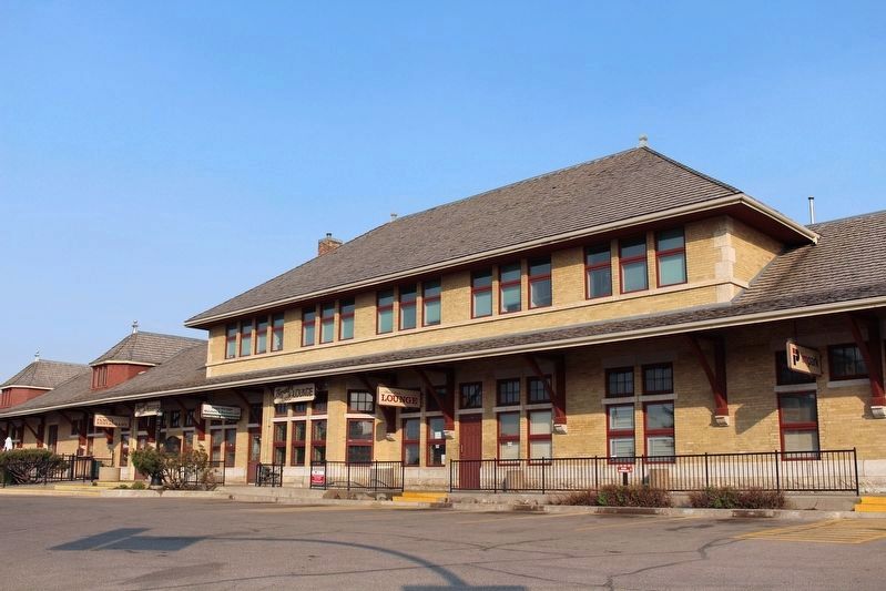
On Idylwyld Drive North (Highway 1) just south of 25 Street West, on the right when traveling south.
[English] Saskatoon was initially bypassed by two transcontinental railways but its growing significance as the major distribution centre for north-central Saskatchewan resulted in the convergence of three separate lines in the city by 1908. . . . — — Map (db m196883) HM
On 11th Street East east of Broadway Avenue, on the right when traveling east.
Firehall No. 3 was built in 1911, along with an adjacent watertower, to serve an ever expanding city and was officially opened on January 6th, 1912. The first run occurred on February 17th, 1912 to put out a fire caused by boiling tar in a local . . . — — Map (db m196884) HM
Near 20th Street West at Avenue D South, on the right when traveling west.
Built by the Texaco Oil Company in 1929, this building was an early Saskatoon landmark. Originally known as West Side Service Station, the name was changed to Little Chief Service Station in 1943. Frank Carr, who operated the station between 1947 . . . — — Map (db m203733) HM
On 21st Street East just east of 3rd Avenue South, on the right when traveling east.
This is the oldest provincial government office building in Saskatoon. It was erected in 1909 from designs by Storey and van Egmond, the prominent Regina architects. By 1911 the structure was doubled in size, reflecting the rapid expansion in urban . . . — — Map (db m196885) HM
On Wanuskewin Heritage Park Access Road, 0.8 kilometers south of Penner Road (Township Road 380).
[English] People have occupied the Plains of North America for thousands of years. Here at Wanuskewin many archaeological features have been identified, representing most of the known elements which characterize Northern Plains . . . — — Map (db m203726) HM
As one of the first buildings constructed on campus, the College Building reflects the prominent role Agriculture Education was to play at the newly created University of Saskatchewan. Originally designed to house the College of Agriculture, this . . . — — Map (db m220898) HM
[English] This handsome structure stands as the centrepiece of the finest grouping of university buildings in Canada designed in the Collegiate Gothic, a style widely used for institutions of higher learning throughout North . . . — — Map (db m220952) HM