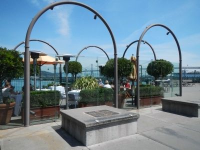
On The Embarcadero near Broadway, on the right when traveling north.
In memory of the selfless and courageous actions of the Russian Imperial Navy sailors while saving the lives of many city residents in suppressing the great fire in San Francisco on October 23, 1863.
A close Russian translation on the . . . — — Map (db m200520) HM
Russian Hill was named for the graves of several sailors of the “Russian-American Company,” who died here in the early 1840s. During the Gold Rush the 49ers found their graves, marked by wooden crosses, at the top of this hill and added . . . — — Map (db m69988) HM
On Cheatham Hill Drive SW near Whitlock Avenue NW (Georgia Route 120), on the right when traveling south.
After each Union assault on June 27, hundreds of casualties were left between the lines. By afternoon, wounded Union soldiers lying helpless near here faced a new danger; flames, started by the battle’s gunfire, crept steadily toward them.
Lt. . . . — — Map (db m70077) HM
On Summer Shade Road (Kentucky Route 90) at Nobob Summer Shade Road, on the right when traveling east on Summer Shade Road.
Dr. C.C. Howard, an outstanding physician and citizen of Barren County, was born in Summer Shade, Kentucky, 1888. Began his medical career in Glasgow. He opened a private hospital there, 1914, and later helped build Glasgow's first community . . . — — Map (db m233178) HM
On West Franklin Street at South Mechanic Street, on the right when traveling east on West Franklin Street.
Underground Railroad Hub
The DeLand family's property was located on the northeast corner of Mechanic and Franklin streets from 1851 until 1878. Three family members participated in the Underground Railroad: William DeLand offered his . . . — — Map (db m210762) HM
On Main Street (Ohio Route 129) at South "D" Street, on the right when traveling east on Main Street.
Author Side Raised and educated in St. Louis, author Fannie Hurst (1885-1968) was born in Hamilton at 918 Central Avenue, the home of her maternal grandparents. She was the daughter of Rose Koppel and Samuel Hurst. Already a writer as a student . . . — — Map (db m122411) HM
Layle Lane (1893 - 1976), educator, social activist, humanitarian and political leader, lived and ran a camp for inner-city Philadelphia and New York, NY, youth on this property of 23 acres called Lacitadelle Camp (now Manor), named after the . . . — — Map (db m136929) HM
Arthur William Phillips was born in Emlenton on July 29, 1888. His father, Samuel W. Phillips, successfully owned and operated oil wells in the Emlenton area. His mother, Clara Crawford Phillips, was a native of neighboring Scrubgrass Township. . . . — — Map (db m78843) HM
On Cabot Avenue at Dwight, Winona, & Lakefront Aves. & Coolidge Cir., on the right when traveling north on Cabot Avenue.
Nichols came to Alabama City in 1894 to supervise construction of the Dwight Manufacturing Company. While serving as the mill's first agent, he planned and began a model mill village and was elected Mayor of Alabama City. — — Map (db m18578) HM
On South Holt Street at Bullock Street, on the right when traveling south on South Holt Street. Reported missing.
Born on the west side of Holt Street, April 11, 1899, Percy Lavon Julian entered Depauw University in 1916; graduated in chemistry with Phi Beta Kappa honors. Earned master's from Harvard, Ph.D. at the University of Vienna. His studies led to a . . . — — Map (db m86418) HM
Near Ferran Park Drive at East McDonald Avenue, on the right when traveling south.
Born in Tallahassee, 1916. Graduated from Florida A&M University, 1937, BS Degree. Continued his career as Principal of J.R.E. Lee High School, Wildwood and then at Carver Heights High School, Eustis. Recognized for his efforts to improve . . . — — Map (db m166231) HM
Riverwalk Amphitheater and Plaza named in honor
of Jessye Norman, internationally acclaimed opera star,
born in Augusta, Georgia, September 15, 1945. Miss Norman began singing at Mounty Calvary Baptist Church, 1260 Wrightsboro Road. She . . . — — Map (db m10032) HM
In appreciation of his service to the Boyhood of America. Inspired by the good turn of an unknown English Scout, he brought scouting to the United States. — — Map (db m82183) HM
Self-taught pianist Mary Elfrieda Scruggs was born May 8, 1910 in Atlanta, Georgia. She grew up in Pittsburgh and played professionally as a child. At age 15 she joined the John Williams' Jazz Syncopators, and eventually married John. In April of . . . — — Map (db m201583) HM
On Leon Netterville Dr. south of Harding Boulevard, on the right when traveling north.
Born the eldest of three daughters to Rev. and Mrs. Richard E.
Brogdon, Dr. Julia Brogdon Purnell received a B.A. from
Allen University and an M.A. from Atlanta University.
Dr. Purnell served as the Sixteenth International President
of Alpha . . . — — Map (db m199187) HM
On Brooke Road, 0.1 miles west of Chandlee Mill Road, on the right when traveling west.
She was born in Poolesville on November 13, 1917, grew up in Dickerson, graduated from Rockville Colored High School in 1934, and received her first degree in elementary education from Hampton Institute in 1942. Her thirst for higher education . . . — — Map (db m205944) HM
On Rue Saint Francois just west of St. Jean Street, on the right when traveling east.
Ken had a lifetime of community service in two cities & St. Louis County. He served Pine Lawn as Mayor, Alderman & businessman. In Florissant he owned two popular hi touch Handyman Hardware stores with wife Kathleen & sons Dave & Glenn, was . . . — — Map (db m145344) HM
On Henry Street at Chenango Street, on the right when traveling west on Henry Street.
William L. Moore was a man of action. This Binghamton native faced many challenges while helping to preserve the freedom and rights of others. After he served our country honorably as a U.S. Marine and graduated from Harpur College (SUNY), he . . . — — Map (db m198184) HM
On Council Street at North Main Street (U.S. 29), on the right when traveling south on Council Street.
Wiley Immanuel Lash (1908-1995), son of the Reverend Wiley H. and Mayzonetta "Mary" Grundy Lash received his education at a local black parochial school and Livingstone College. He rose to political prominence in the Negro Civic League where he . . . — — Map (db m228946) HM
On Park Street at Broadway (U.S. 62), on the left when traveling west on Park Street.
Dr. Leslie A. Bostic served 40 consecutive years as the founding executive director of the Buckeye Ranch (formerly Buckeye Boys Ranch) in Grove City. He earned his undergraduate degree and Master of Social Work from the Richmond . . . — — Map (db m137678) HM
Welcome to the Pearl S. Buck House, a National Historic Landmark. Pearl S. Buck was the first American woman to be awarded both the Nobel and Pulitzer Prizes for literature. In addition to her literary achievements, Pearl S. Buck was passionately . . . — — Map (db m86313) HM
Near 15th Street Northwest north of Pennsylvania Avenue Northwest, on the right when traveling north.
“All my life I have had a love affair with the City of Washington.”
In a time of racial strife he brought reconciliation and mutual respect.
In the struggle between management and labor he worked for reason and moderation. In a marketplace . . . — — Map (db m92230) HM
Near Henderson Falls Road, 1 mile north of Toccoa Falls Road (Georgia Route 17).
“An unforgettable personality whose courage shone with such crystal brilliance as to brighten the world about him and uplift the spirits of those even more fortunate, but not fashioned of such heroic fibre. His is a name to remember when the . . . — — Map (db m58884) HM
Donor of Glen Iris and his estate comprising of the original 1,000 acres of this park, including Upper, Middle and Lower Falls, so that this gorge might remain a place of inspiration and beauty forever, Erected in 1957 by the Genesee State Park . . . — — Map (db m76125) HM
On Tremont Road at Kenny Road, on the right when traveling north on Tremont Road.
Born in Clifton, Ohio. Graduate of Denison
University. Served in U.S. Navy as Lt. Commander
during World War II.
Lived on Cardiff road from 1951 when he became
head football coach at The Ohio State University. Led the Buckeyes to 3 national . . . — — Map (db m223376) HM
On West Third Street west of Williams Street, on the right when traveling east.
Her strong religious and social conviction, dedication and hard work helped her make a difference in lives of the peoples of the Brazilian communities of the earth's tropical rain forest. She established base Christian Communities with schools, . . . — — Map (db m240153) HM
On N. Queen Street, 0.1 miles north of Orange Street, on the right when traveling north.
He rose from sales trainee to become president and chairman of Armstrong World Industries, a director of the U.S. Chamber of Commerce, and chairman of the National Association of Manufacturers. A leader in the revitalization of Downtown Lancaster, . . . — — Map (db m5324) HM
Near Main Street (Pennsylvania Route 660) 0.1 miles west of Central Avenue (Pennsylvania Route 287).
This testimonial is dedicated by the North American survivors, colleagues of E.A. VanValkenburg during the quarter-century in which he directed the publication of the Philadelphia North American. As its editor he inspired and directed public opinion . . . — — Map (db m88334) HM
On Presbyterian College Road west of South Adair Street, on the right when traveling east.
This building -- dedicated as a memorial to alumni killed in World War II and the Korean War -- is named Douglas House in memory of that beloved servant of God, the Reverend Davison McDowell Douglas, B.A., B.D., M.A., D.D., LL.D., who served . . . — — Map (db m11980) WM
Near Interstate 40, 3.1 miles west of the Goffs Road Interchange, on the right when traveling west.
As Caltrans Highway Superintendent for the Needles area, John Wilkie sought ways to improve maintenance at this Rest Area. Pursuing this goal, John became a statewide leader in increasing employment opportunities for persons with disabilities.
. . . — — Map (db m335) HM
On South Broadway Street south of West State Street (Indiana Route 28), on the left when traveling south.
Diplomat James G. McDonald grew up in Albany and taught history at Indiana University by 1910. Representing the Foreign Policy Association, he met with Nazi officials in 1933, including Adolph Hitler who was quickly rising to power. McDonald . . . — — Map (db m203649) HM
Here on the evening of April 4, 1968, Kennedy came to address a large crowd of mostly African Americans in his bid for Democratic Party nomination for president of U.S. Instead, visibly shaken, he gave an impromptu speech about the assassination of . . . — — Map (db m236) HM
On Beale Street, on the right when traveling south.
Ida B. Wells crusaded against lynchings in Memphis and the South. In 1892 while editor of the Memphis Free Speech, located in this vicinity, she wrote of the lynching of three Black businessmen. As a result, her newspaper office was destroyed . . . — — Map (db m9306) HM
On Ox Road (Virginia Route 123) at Fairfax Station Road, on the right when traveling south on Ox Road.
Here at Fairfax Station in early Sept. 1862, after the Second Battle of Manassas and the action near Chantilly, Clara Barton ministered to the suffering. By her humane and tireless efforts this Angel of the Battlefield helped move over 3000 wounded . . . — — Map (db m102) HM
Born in Cleveland, Ohio to German Jewish immigrants, Hiram Halle bought his first house in Pound Ridge on Trinity Pass Road, February 1929. From 1916-1944 he was head of the petrochemical giant, Universal Oil Products. From 1933 through the onset . . . — — Map (db m134062) HM
First black City Councilman (1979), first black Assistant to the Mayor (1982), educator religious leader, civil rights activist, a great humanitarian. — — Map (db m96470) HM
On Third Street at Murray Street, on the left when traveling south on Third Street.
The Rotary Club of Alexandria, Louisiana Was chartered December 1, 1916. It is the fourth oldest club in Louisiana and the 259th in the Rotary world. As of 2007, there were over 32,000 clubs in 200 countries with more than 1,200,000 members. . . . — — Map (db m116059) HM
On South Jackson Street, on the left when traveling south.
Side A House built circa 1912. It has been the home of the ministers of Dexter Avenue Baptist Church since 1919. Its most famous occupant, Dr. Martin Luther King, lived here from Sept. 1954-Feb. 1960. During this time he led the Bus Boycott . . . — — Map (db m86132) HM
On Thompson Park east of Thompson Blvd., on the right when traveling east.
The 10th Mountain Division (Light Infantry) was reactivated at Fort Drum on February 13, 1985. By 1988, with the support of Fort Drum's world class civilian workforce, the Division was manned, equipped, trained and certified as combat ready, As the . . . — — Map (db m179340) HM
Since 1942, Troop Carriers were responsible for air transport of parachute troops, airborne infantry, glider units, and for conducting local air transportation within the theaters of operations, including providing air transport to air and . . . — — Map (db m183643) HM WM
On East Market Street just west of North Clinton Street, on the right when traveling west.
Formerly First Presbyterian Church & North Presbyterian Church (Old School) Erected 1856-1865 This property is listed in the National Register of Historic Places — — Map (db m194099) HM
Médicos mexicanos y la asociación civil de veteranos de la Cruz Blanca dedican este homenaje a la memoria del ilustre médico oaxaqueño Dr. Antonio Marquez G. quien murió frente a este lugar el dia 9 de feb de 1913 en el desempeño de su . . . — — Map (db m90600) HM
On Main Street east of Church Street, on the right when traveling east.
This mill was built in 1911 and used to crush ore at the Hewitt Brothers Mine on Hopkins Creek. It was powered by a steam engine and a pelton water wheel. It was discovered by Fred and Janet Miles in 1978 and brought to La Porte by members of E . . . — — Map (db m56320) HM
Juana Briones, born in Hispanic California, was a preeminent woman of her time. In the 1830s and 1840s she transformed an isolated cove in the then Mexican hamlet of Yerba Buena into her rancho. At the site of this park she raised cattle and grew . . . — — Map (db m143437) HM
On Market Street near O'Farrell Street, on the left when traveling north.
was built in 1908 by philanthropist, humanitarian, and statesman James D. Phelan. This spectacular Flatiron style building was designed by William Curlett, one of the foremost architects of the Victorian-era and founding father of the AIA San . . . — — Map (db m71870) HM
On Old Adobe Road at Old Trace Lane on Old Adobe Road.
In 1844 Juana de Briones de Miranda, a pioneer Latina property owner, businesswoman and humanitarian, purchased the 4,439 acre Rancho La Purisima Concepcion from Indian grantee Jose Gorgornio. The grant extended two miles south, encompassing . . . — — Map (db m54016) HM
Near Jordan Street south of Escalona Drive, on the right when traveling south.
An intellectual, humanitarian and suffragist, Georgiana raised her family in this house from 1854 until her death in 1887. Born in England and educated in the East by America’s leading thinkers and writers. She brought to California an intellectual . . . — — Map (db m202234) HM
On Main Street (Connecticut Route 154) just south of Pennywise Lane, on the right when traveling south.
The first African-American female pharmacist in Connecticut, proprietor of the James Pharmacy and beloved member of the community for generations of residents and visitors. Known to all as "Miss James," she represented the humanitarian spirit that . . . — — Map (db m227270) HM
On U.S. 301, 0.2 miles south of East Dr. Martin Luther King Jr. Boulevard, on the right when traveling south.
Unified Task Force (UNITAF) was an American-led, United Nations-sanctioned multinational force which operated in Somalia between 5 December 1992 - 4 May 1993. A United States initiative (code-named Operation Restore Hope), UNITAF was, charged . . . — — Map (db m194693) HM WM
Near East Orange Avenue, 0.1 miles east of South Beach Street.
Roberto Clemente Walker was one of the greatest baseball players ever to play right field. His pride and humanitarianism won him universal admiration. Despite an unorthodox batting style, the Pirates' great won four batting crowns and amassed . . . — — Map (db m105773) HM
On South Hill Street (U.S. 19/41) at East College Street, on the right when traveling north on South Hill Street.
Founded in Chicago by Paul P. Harris, Rotary is a worldwide organization of business and professional leaders that provides humanitarian service, encourages high ethical standards in all vocations, and helps build goodwill and peace in the world. — — Map (db m59637) HM
On Main Street just east of Symington Drive, on the right when traveling east.
During the Berlin Airlift, also called Operation Vittles, he instituted operation Little Vittles by dropping small parachutes laden with candy from his C-54 aircraft to the children of Berlin, while motivating Berliners to never give up hope, his . . . — — Map (db m184339) HM
On North Stephenson Street north of Woodland Drive, on the left when traveling east.
Birthplace of Jane Addams 1860 - 1935 Humanitarian, Feminist, Social Worker, Reformer, Educator, Author, Publicist, Founder of Hull House, Pioneer, Settlement Center Chicago, 1889. President Women's International League for Peace and, Freedom. Nobel . . . — — Map (db m128729) HM
On West Vermont Street west of Limestone Street, on the right when traveling west.
John Morton-Finney (1889-1998) educator, lawyer, and humanitarian, was born in Kentucky to a former slave. Morton-Finney was a Buffalo Soldier in World War I, a teacher at historically black colleges, and taught Greek, Latin, German, Spanish, and . . . — — Map (db m132739) HM
Humanitarian and academician Dr. Eva Jessye organized her first all-girl singing quartet as a pre-teen. Thus began a lifetime of establishing and directing singing ensembles. The Negro spirituals of her ancestors formed her musical foundation. In . . . — — Map (db m201574) HM
On Philadelphia Road (Maryland Route 7) 0.1 miles north of Allender Road, on the left when traveling north.
Built for the African American Community in 1874 as a school for children in the Loreley area and as home to this “benevolent” society, founded in 1872. Beginning in the late 18th century, such mutual aid societies, often formed by . . . — — Map (db m152189) HM
On Cass Avenue, 0.1 miles south of West Warren Avenue.
This 1895 Queen Anne style house, designed by Malcolmson & Higginbotham, was the home of David Mackenzie. Educator, scholar, and humanitarian, Mackenzie fostered higher education for Detroit students. While principal of Central High School, then . . . — — Map (db m84284) HM
On Jerry Clower Boulevard (U.S. 49E) 0.1 miles north of Haley Barbour Parkway, on the right when traveling north.
Organized in 1948, the Mississippi Chemical Corporation was the nation's first farmer-owned nitrogen fertilizer plant. Under the leadership of Owen Cooper, director of the Farm Bureau Federation and a well-known humanitarian, the company quickly . . . — — Map (db m213944) HM
On South 4th Street at Lewis Avenue, on the right when traveling north on South 4th Street.
With gratitude to the Engelstad Family Foundation for its generous contribution to this Liberty Bell monument, and in recognition of the life and achievements of Ralph Louis Engelstad who personified the highest qualities of personal liberty. Just . . . — — Map (db m47828) HM
On Haddon Avenue at South 9th Street, on the left when traveling south on Haddon Avenue.
Lewis L. Coriell was a charismatic physician, scientist, and humanitarian. He established the critical technology needed to produce the vaccine to eradicate polio, in addition to many other pioneering techniques used in laboratories today. In 1953, . . . — — Map (db m146685) HM
On George Street at Somerset Street, on the right when traveling south on George Street.
Built in 1873 in the High Victorian Gothic Revival style, this chapel was designed by New Brunswick native, Henry J. Hardenbergh, the great-great-grandson of Rutgers' first president, Rev. Jacob Hardenbergh. Its vibrant glass windows are some of the . . . — — Map (db m208911) HM
On Cliff Street, on the right when traveling east.
On this site stood the St. Thomas A.M.E. Zion Parsonage. From 1910 to 1925, it was the home of Paul Robeson, noted actor, singer, scholar, athlete and humanitarian. — — Map (db m49969) HM
On Erie Street, 0.5 miles north of Marine Drive, on the left when traveling north.
Chester C. Gorski statesman, community leader, humanitarian Born June 22, 1906. Died April 25, 1975. President of The Common Council 1959 to 1973. Member of the United States Congress, Erie County Board of Supervisors Buffalo Common . . . — — Map (db m92937) HM
On 421 (U.S. 421) at Johnson Farm Road, on the right when traveling west on 421.
Birthplace of the dramatist, novelist, teacher and humanitarian is situated 2.1 miles north. Awarded Pulitzer Prize 1927. Originator of the Symphonic Drama, of which he wrote 16, including "The Lost Colony." Lifelong champion of racial equality, and . . . — — Map (db m219804) HM
On East King Street at South Churton Street (U.S. 70), on the right when traveling east on East King Street.
Designed and erected, 1844 – 45 by John Berry of Hillsborough, 1798 – 1870 Builder, Architect, Legislator, Humanitarian --------------- Builder of distinguished structures in his native state Contributor to the tradition of American architecture . . . — — Map (db m223127) HM
On West Third Street east of Broadway Street, on the right when traveling east.
Promoter of world peace through her international humanitarian involvement with the Friendship Force. She was instrumental in creating lasting monuments to peace in Dayton (unreadable) Ohio and throughout the world. — — Map (db m240128) HM
On West Third Street east of Broadway Street, on the right when traveling east.
Pulitzer Prize winning political cartoonist and creator of the popular comic strip Mother Goose and Grimm. He has received many national awards for his career in cartooning and his humanitarian efforts. — — Map (db m240116) HM
On Bayard Street at North Bellefield Street, on the right when traveling west on Bayard Street.
A distinguished philanthropist and humanitarian, she created and funded numerous social service agencies, including the Western Pennsylvania School for Blind Children, here. Her pioneering efforts in charitable giving have served those in need, . . . — — Map (db m46526) HM
On Johns Street at Walnut Street, on the right when traveling south on Johns Street.
On June 5, 1889, Clara Barton and a group of American Red Cross volunteers arrived in Johnstown to help the survivors of a devastating flood resulting from the failure of the South Fork Dam. It was one of the first major disaster responses for the . . . — — Map (db m74402) HM
On North Cameron Street (U.S. 22) 0.2 miles north of Maclay Street, on the right when traveling north.
The first State mental hospital in Pennsylvania. Opened in 1851, a result of efforts by the noted humanitarian, Dorothea Lynde Dix, to improve this State's treatment of the mentally ill. The hospital is on the wooded hills east of this marker, . . . — — Map (db m6474) HM
Near North Orange Street just north of West Front Street, on the right when traveling north.
In 1900, at the age of two he emigrated with his family from Europe. A pioneer in the food industry, he opened the first super market and shopping center in the United States and Sixth and Penn Streets in Chester. In 1936, he was a man of . . . — — Map (db m205526) HM
Founded in Philadelphia in 1917, the AFSC has given practical expression to the faith of the Religious Society of Friends (Quakers). Its worldwide humanitarian work has reflected a commitment to nonviolence & justice. Co-recipient, Nobel Peace . . . — — Map (db m83475) HM
On East Keswick Road at Rayland Road on East Keswick Road.
Physician, humanitarian, educator, patriot leader. He signed the Declaration of Independence, opposed slavery, and supported public health & social reforms. Known as "Father of American Psychiatry." His house of birth stood here until 1969. — — Map (db m82038) HM
On South Main Street, 0.2 miles south of Reservoir Avenue, on the left when traveling south.
The humanitarian's boyhood home. Served worldwide, 1917-76. In Asia, directed UNICEF; aided family planning. Chief, UN's Italy relief; assisted Russian relief. A YMCA officer in Mesopotamia, Siberia, Estonia, Poland; later was on its U.S. Council. — — Map (db m241774) HM
On Bull Street (U.S. 76) at Elmwood Avenue, in the median on Bull Street.
Institution authorized 1821 by General Assembly, mainly through the work of two members, Samuel Farrow and William Crafts, Jr. The original building, on right, designed by Robert Mills, shows a pioneer grasp of the ideas of humanitarian treatment. — — Map (db m37004) HM
On Maynardville Hwy (Tennessee Route 33) at Monroe Street, on the left when traveling east on Maynardville Hwy.
Roy Claxton Acuff, Grand Ole Opry star for more than 50 years, actor, international music entertainer, goodwill ambassador, and humanitarian, was born in Maynardville, near this site, on September 15, 1903. He recorded more than 100 country and . . . — — Map (db m100166) HM
On West Main Street at Oscar Street, on the right when traveling south on West Main Street.
A fine example of Queen Anne Revival architecture, this house has among its many rooms two hexagons, two octagons. It was built in 1890-91 by Judge Oscar E. Dunlap (1849-1925), a banker, political leader, chairman of Texas Council of Defense in . . . — — Map (db m170519) HM
On San Gabriel south of West 24th Street, on the right when traveling south.
Dedicated to the pursuit of education and humanitarian programs, the Texas Federation of Women’s Clubs was founded in 1897. The goal of a permanent state headquarters was realized with the construction of this building in the early 1930s. Designed . . . — — Map (db m25710) HM
On Booker T. Washington Highway (Virginia Route 122) east of Lost Mountain Road (County Route 636), on the right when traveling west.
Booker T. Washington was born a slave on the nearby Burroughs plantation on April 5, 1856. He was graduated from Hampton Institute in 1875 where he became an instructor. Because of his achievements as an educator, he was selected to establish a . . . — — Map (db m65611) HM
Near Thorstrand Road, 0.2 miles north of University Avenue, on the right when traveling north.
These two Mediterranean Revival mansions were designed for Magnus and Annie Swenson and their daughter Mary North by Madison architects Law and Law. Swenson was a Norwegian immigrant who became an internationally famous inventor and humanitarian. . . . — — Map (db m46031) HM
Near Moody Avenue south of Winnie Street, on the left when traveling south.
Called the "First Citizen of Texas" by U. S. President Woodrow Wilson, Rabbi Henry Cohen, an internationally known humanitarian, was born in London, England.
He came to Galveston in 1888 as spiritual leader of congregation B'Nai Israel and . . . — — Map (db m118254) HM
On Bulevar Sergio Viera De Mello, on the left when traveling west.
Nombre otorgado El 25 de septiembre de 2003 por la Alcaldia de San Salvador en homenaje al brasileño Sérgio Vieira de Mello Representante especial de las Naciones Unidas, caido en defensa de la paz mundial. English translation: This . . . — — Map (db m95019) HM WM
On 5th Street just west of Railway Street, on the right when traveling west.
This plaque was erected to commemorate the many humanitarian gifts made for the benefit of the citizens of Nipigon by John Salo, who was born in Finland and came to Canada in 1905, taking up residence here one year later. Following his retirement . . . — — Map (db m244598) HM
El Canada • San Andres Itzapa El Canton San Antonio perpetua su agradecimiento a la hermana republica de El Canada por su inmensa labor humanitaria, al haber descombrado, limpiado y reconstruido nuestro pueblo, con motivo del terremoto que . . . — — Map (db m103965) HM
Gratitud a Dios Ser Supremo al Parroco Clemente Penelen a pueblos vecinos al pueblo de San Antonio A.C. por su labor humanitaria en el trágico accidente del 10 de mayo San Antonio A.C. Mayo 1,990. Dijo Jesus yo soy la resurrecion y la . . . — — Map (db m95873) HM
“Ukraina” is the site of the farm and burial place of the Ukrainian patriot and exiled orthodox priest Agapius Honcharenko (1832-1916) and his wife Albina. Honcharenko was the first nationally conscious Ukrainian to arrive in the United States. He . . . — — Map (db m146447) HM
On Riverside Drive at Los Feliz Boulevard, on the right when traveling south on Riverside Drive.
A penniless Irish immigrant boy who rose by the force of his industry, intelligence, integrity and intrepidity to be a sturdy American citizen, a self-educated engineering genius, a whole-hearted humanitarian, the father of the city's water system, . . . — — Map (db m164804) HM
On 15th Street Northwest south of F Street Northwest, on the right when traveling north.
Inspired by the simple idea of combining fellowship and service, Paul Harris pioneered the service club movement with the founding of Rotary International. Rotary fulfilled his dream of a worldwide organization of business and professional people . . . — — Map (db m92025) HM
On South Tampa Avenue at West South Street, on the right when traveling north on South Tampa Avenue.
On March 20, 1955, a young Roberto Clemente stepped onto Tinker Field for the first time. The Washington Senators led the Pittsburgh Pirates 2-1 in the eighth when the rookie Clemente drove in the tying run with a double. The Pirates won 4-2 in . . . — — Map (db m189256) HM
Near West Main Street (Georgia Route 113) west of South Public Square, on the right when traveling west.
Lawyer, politician, soldier, planter, humanitarian. Born Habersham County, Georgia, June 28, 1824; died Cass Station, Georgia, May 22, 1884. Captain in Mexican War. Georgia Legislator, 1849. Delegate to Georgia Secession Convention, 1861. Voted not . . . — — Map (db m190698) HM
On Peachtree Street Northeast south of 14th Street Northeast, on the right when traveling south.
The Atlanta Woman's Club, organized Nov. 11, 1895, was inspired by a council meeting in Atlanta of the General Federation of Women's Clubs during the Cotton States and International Exposition. Mrs. Rebecca Douglas Lowe was founder and first . . . — — Map (db m197659) HM
On South 4500 West near West 4900 South, on the left when traveling south.
Personification of the Spirit of Samaria - called "Uncle Ben" but those who knew him. Great pioneer, civic leader, humanitarian and booster. He held the distinction of being Samaria's first merchant, owned the only hotel, a butch shop, and ice house . . . — — Map (db m140128) HM
419 entries matched your criteria. The first 100 are listed above. Next 100 ⊳
* Inflectional forms of words are their plurals, singulars, and possessives as well as gramatical tenses and similar variations.