Marker Logo HMdb.org THE HISTORICAL
MARKER DATABASE
“Bite-Size Bits of Local, National, and Global History”


2 entries match your criteria.  


Historical Markers in Abbotsford, British Columbia

 
Gur Sikh Temple Marker image, Touch for more information
By B.C. Ministry of Transportation and Infrastructure via Flickr (CC BY-NC-ND 2.0)
Gur Sikh Temple Marker
1 British Columbia, Fraser Valley, Abbotsford, Clearbrook — Gur Sikh Temple
On South Fraser Way at Fairlane Street, on the right when traveling west on South Fraser Way.
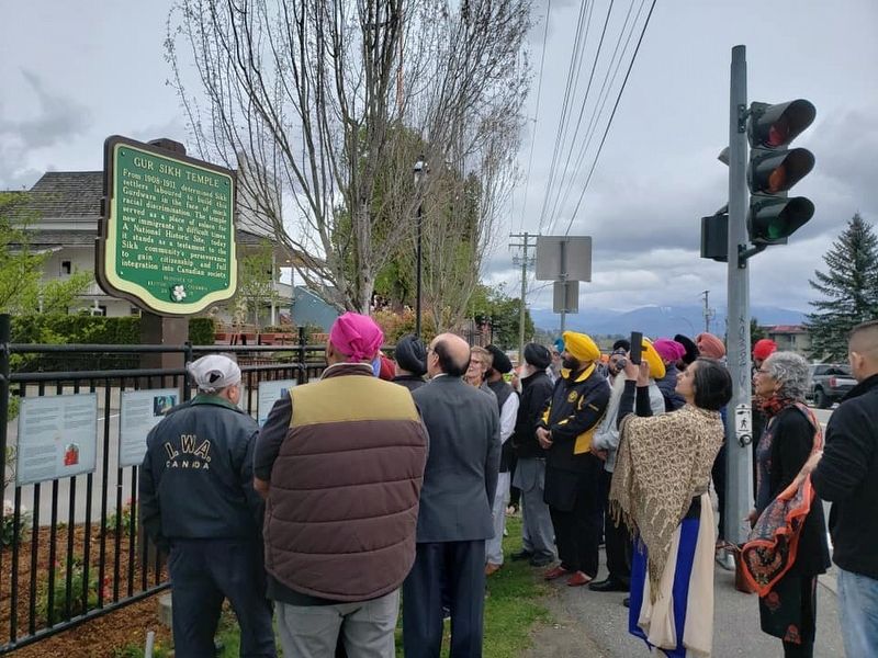
From 1908-1911, determined Sikh Settlers laboured to build this Gurdwara in the face of much racial discrimination. The temple served as a place of solace for new immigrants in difficult times. A National Historic Site, today it stands as a . . . Map (db m187881) HM
2 British Columbia, Fraser Valley, Abbotsford, Sumas Prairie — Sumas Lake Reclamation
Near Cole Road just south of South Parallel Road, on the right when traveling south.
In 1924, by a system of stream diversions, dams, dykes, canals and pumps, 33,000 acres of fertile land were reclaimed from Sumas Lake. Few areas in B.C. have such rich soil with transportation and markets in close proximity. Produce of the mixed . . . Map (db m187960) HM


CeraNet Cloud Computing sponsors the Historical Marker Database.
This website earns income from purchases you make after using our links to Amazon.com. We appreciate your support.
Paid Advertisement
Apr. 19, 2024