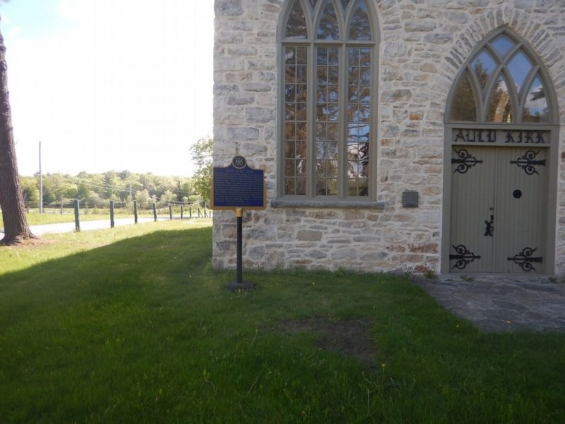
On Wolf Grove Road (County Highway 16) close to Ramsay Concession 8, on the right when traveling west.
This stone church, an attractive example of an early form of Gothic Revival architecture, was constructed in 1835–36 on land obtained from John Mitchell, one of Ramsay Township's earliest settlers. Built by the local congregation of the Established . . . — — Map (db m104031) HM
On County Road 29, 0.1 kilometers north of James Naismith Way / Clayton Road, on the right when traveling north.
This is the boyhood home of James Naismith, the inventor of basketball. Born in a house which formerly stood on this lot, he entered McGill University in 1883 where he was active in athletics. In 1890 Naismith graduated in theology from . . . — — Map (db m104107) HM
On Mill Street at Little Bridge Street, on the right when traveling west on Mill Street.
Begun in 1889 and finished in 1891, this building was erected to house postal and customs services. Federal chief architect Thomas Fuller was responsible for the design and Robert Cameron was the contractor. The building was part of a national . . . — — Map (db m104019) HM
On Mill Street, 0.1 kilometers west of Little Bridge Street, on the right when traveling west.
The Mississippi River in eastern Ontario is a tributary of the Ottawa River. The upper basin starts in the Mazinaw Lake area and enters the Ottawa River above Chats Falls. Recognizing a need to manage the water flow, Mr. Jim Brown of Carleton Place . . . — — Map (db m104108) HM
On Bridge Street (County Highway 16A) at Water Street, on the right when traveling south on Bridge Street.
The sawmill and grist-mill completed here on the Mississippi River in 1823 by Daniel Shipman provided the nucleus around which a community known as Shipman's Mills had developed by 1824. About 1850 two town plots were laid out here - "Victoria" by . . . — — Map (db m104000) HM
On Mill Street at Almonte Street (County Highway 16), on the right when traveling west on Mill Street.
In 1857 James Rosamond built this mill on the Mississippi River, thereby firmly establishing the woollen industry in Almonte. An Irish-born entrepreneur, Rosamond was previously a resident of nearby Carleton Place where, in 1846, he had built one . . . — — Map (db m104009) HM