3 entries match your criteria.
Historical Markers in Greater Napanee, Ontario
By Barry Swackhamer, August 8, 2014
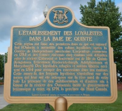
L’Etablissement des Loyalistes dans la Baie d Quinte Marker
| On Loyalist Parkway (Provincial Highway 33) close to Quinte View Road, on the right when traveling west. |
| On Loyalist Parkway (Provincial Highway 33) close to County Route 21. |
| On Loyalist Parkway (Provincial Highway 33) close to Quinte View Road, on the right when traveling west. |
Apr. 25, 2024