On Harbour Street at St. Andrew Street, on the right when traveling north on Harbour Street.
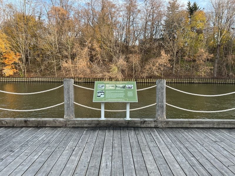
“Midnight Herring”
(Rum-Running 1920-1933)
In 1919 the commercial fishermen of Lake Erie were experiencing one of their industry's cyclical downturns. On Jan. 1, 1920 the Volstead Act introduced prohibition across the United States and created . . . — — Map (db m236371) HM
On Main Street (County Highway 6) at Prospect Street, on the left when traveling east on Main Street.
On May 14, 1814, about 800 American regulars and militia under Lieutenant Colonel John Campbell disembarked nearby at the mouth of the Lynn River. The following day, meeting no opposition, they burnt the settlements of Dover and Ryerse’s Mills and . . . — — Map (db m198920) HM
On Brown Street, 0.1 kilometers west of John Street, on the right when traveling west.
Near this spot, March 23rd,
1670, was erected a cross with
arms of France and inscription claiming sovereignty in
the name of King Louis XIV
over the Lake Erie region, as
shown in procès-verbal reproduced on this memorial
placed . . . — — Map (db m236355) HM
On Harbour Street south of St. George Street when traveling south.
This monument is dedicated to those commercial fishermen who have lost their lives on the lake. It will serve as a lasting memorial celebrating the heritage of our fishing ports and the unique and hazardous way of life of our fishermen. — — Map (db m236364) HM
On Donjon Boulevard at Somerset Drive, on the right when traveling west on Donjon Boulevard.
Here, 1669-1670, wintered Dollier and Galinée with seven other Frenchmen, the first Europeans
known to have ascended the
Great Lakes to Sault Ste. Marie.
The earthen mounds are the remains
of their hut, which was at . . . — — Map (db m236329) HM
On Harbour Street at St. Andrew Street, on the right when traveling north on Harbour Street.
Although vessels had come to the mouth of the Lynn River since the 1790s, there was no proper harbour here until the 1840s. At that time the mouth of the river was dredged and the first piers and lighthouse were built, This project was initiated . . . — — Map (db m236376) HM
On Harbour Street at St. Andrew Street, on the right when traveling north on Harbour Street.
The story of this 3-cylinder Kahlenberg engine intertwines three communities:
Port Dover, Ontario; Cellardyke, Scotland; Two Rivers, Wisconsin.
From 1912 to 1931, Scottish communities experienced an exodus of commercial fisherman, migrating . . . — — Map (db m236565) HM
On Harbour Street at St. Andrew Street, on the right when traveling north on Harbour Street.
With Peggy Scruton's aid, I located a working three cylinder Kahlenberg engine in Albion, Maine, U.S.A
When I explained to the owner, William Alexander, a Kahlenberg descendant, that I wished to display it as representing the transition to . . . — — Map (db m236566) HM
On Harbour Street, 0.1 kilometers south of St. George Street, on the right when traveling south.
The first Port Dover lighthouse was a 7.3 metre (24 foot) high wooden structure built on the west pier at the mouth of the Lynn River in 1845 as a small harbour light for the active shipbuilding, square timber trade, inshore fishery and, later, . . . — — Map (db m236339) HM
On Main Street at Market Street East, on the right when traveling west on Main Street.
In 1835 Israel Wood Powell purchased land at the mouth of the Lynn River for the town site of Port Dover. A representative of Norfolk in the Canadian legislature (1841 - 1848), warden of Talbot District (1842) and reeve of Woodhouse Township . . . — — Map (db m236337) HM
The Capture of Detroit
To counter the American invasion of the Detroit frontier,
Major General Isaac Brock mustered a force of about 50
regulars and 250 militia here at Port Dover. They embarked
on 8 August 1812 and, proceeding . . . — — Map (db m237003) HM
On Harbour Street at St. Andrew Street, on the right when traveling north on Harbour Street.
For much of the twentieth century, Port Dover was the heart of Canada's freshwater fishing industry. The industry had already begun to grow by 1911 when William "Cap" Kolbe came from Eric, Pennsylvania to establish the town's first large scale . . . — — Map (db m236363) HM
On Main Street (Highway 6) just west of Clinton Street, on the right when traveling west.
The original name of the hotel was the Royal Exchange. The back section of the hotel dates back to 1812 and the front was built between 1835 and 1840. During the Wm. Lyon Mackenzie Rebellion of 1837, the hotel served as the headquarters for . . . — — Map (db m217671) HM
On Saint George Street just west of Harbour Street, on the left when traveling west.
Port Dover joined Canada’s railway boom in the late 1800s. The Port Dover & Lake Huron was the first train to enter the village in 1875. The Hamilton & Lake Erie Railway, completed in 1878, linked the harbour communities of Port Dover and Hamilton, . . . — — Map (db m236359) HM
On Walker Street just south of St. George Street when traveling south.
During the Roaring Twenties, dance halls grew in popularity. Port Dover's first pavilion was built by businessman Ben Ivey. The building extended over the lake and opened on Saturday, June 18, 1921, to the music of Charlie Cody and his Singing . . . — — Map (db m236340) HM
On Main Steet at Market Street East, on the right when traveling west on Main Steet.
During the War of 1812, Long Point Bay
provided a safe harbour for the vessels
of the British Provincial Marine, and
later the Royal Navy. Port Ryerse,
Turkey Point (Fort Norfolk) and the site
of present-day Port Dover were all
transfer . . . — — Map (db m236332) HM
On Main Street (County Highway 6) at Market Street East, on the right when traveling north on Main Street.
[World War I Memorial Plaque]1917 — 1919 In Memory of Port Dover and Woodhouse Boys who gave their lives in the Great War DT Abbot • Leonard Blake • Alfred L Blake • Walter Bradbury • Lea Boughner • Milton Cruise • William Faulkner • . . . — — Map (db m236342) WM
On Main Street (County Highway 6) at Park Street, on the right when traveling north on Main Street.
Major General Isaac Brock with 40 men of His Majesty’s 41st Regiment and 260 of the York, Lincoln, Oxford and Norfolk militia, set out from Port Dover on the 8th August, 1812, to relieve the invaded western frontier. His brilliant capture of . . . — — Map (db m199073) HM