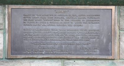
Early in the morning of October 13, 1812, after galloping seven miles from Fort George, General Brock tethered his gray horse ‘Alfred’ here in the Village of Queenston in order to lead a charge on foot to repel the invading enemy. Brock was killed . . . — — Map (db m49167) HM
If you go to the lookout behind the Laura Secord monument you will see across the river and slightly to your right the area where a huge American force assembled for the invasion of Canada. In the early hours of October 13, 1812, six hundred . . . — — Map (db m55029) HM
During the War of 1812, the Brock Dead House was owned by Patrick McCabe. The façade was oriented in an easterly direction, facing the Niagara River.
Courtesy Brock University Library,
Special Collections and Archives
Brock Dead House . . . — — Map (db m75882) HM WM
[Text on North Side of Marker]:
Near the spot
Major-General
Sir Isaac Brock, K.C.B.
Provisional Lieutenant
Governor of Upper Canada
fell on 13 - October, 1812
while advancing to repel
the invading enemy.
[Text . . . — — Map (db m49483) HM
Upper Canada has dedicated this monument
to the memory of the late
Major-General Sir Issac Brock K.B.
Provisional Lieut.Governor and commander of the forces
in this province whose remains are deposited in the vault . . . — — Map (db m49926) HM
The monument towering above you is a memorial to Major-General Sir Isaac Brock commander of British forces in Upper Canada at the beginning of the War of 1812. Brock died on the slopes below Queenston Heights on October 13, 1812, during an . . . — — Map (db m52137) HM
[English Text]: Fort Drummond
This small redoubt, or square fortification, and the U-shaped advance battery, named in honour of Sir Gordon Drummond, were built in the late spring of 1814 to defend the main portage road from Chippawa . . . — — Map (db m56658) HM
[Text inscribed on stone monument]:
Home of
Laura Ingersoll
Secord.
[Text on lower plaque]:
This stone marker was placed in 1901 by the Women's Literary Club of St. Catharines
to honour Laura Secord and was re- . . . — — Map (db m51612) HM
Warriors of the Six Nations of Iroquois (Mohawks, Oniedas Onondagos, Cayugas, Senecas, Tuscaroras), mainly from the Grand River, fought as allies of the British in this historic battle with the Americans. Speaking distinctive dialects and with . . . — — Map (db m49168) HM
[Front side of Monument]:
This monument has been
erected by the
Government of Canada
to
Laura Ingersoll Secord
who saved her husband's life
in the battle on these heights,
October 13th, 1812,
and who . . . — — Map (db m75866) HM
Born in Great Barrington, Massachusetts, Laura Ingersoll came to Upper Canada with her father in 1795, and settled in this area. About two years later she married James Secord, a United Empire Loyalist, and within seven years they had moved to this . . . — — Map (db m49160) HM
[English text]:
The celebrated heroine of the war of 1812 is a renowned figure in Canadian History. Determined to warn the British of an impending attack on Beaver Dams, Secord set out from her home on June 22, 1813, on a dangerous . . . — — Map (db m51613) HM
This pioneer historian, author and soldier was born in Queenston. His family moved to Amherstburg about 1802, and at the outbreak of the War of 1812 Richardson joined the British army. Retired on half pay in 1818 in London, England, he published the . . . — — Map (db m54135) HM
A devout Wesleyan Methodist and a Major in the British Army throughout the War of Independence, George Neal left the United States in pursuit of religious freedom and civil security. Landing in Queenston in 1786, Major Neal determined to spread the . . . — — Map (db m139905) HM
Roy Terrace here and Eldridge Terrace, the niche visible on the U.S. side at the same height, mark the level of glacial Lake Iroquois (Lake Ontario). When the Wisconsin glacier receded about 12,000 years ago, the Falls of Niagara were born here, . . . — — Map (db m139994) HM
This British officer, “the hero of Upper Canada,” led the successful defense of the province early in the War of 1812. Appointed commander of military forces in 1810, he organized the militia and prepared the colony for possible war with . . . — — Map (db m140079) HM
On October 13, 1812, following Isaac Brock's death in a preceding assault, Major-General Sheaffe assumed command and led a successful attack which dislodged an invading American force from Queenston Heights. Born in Boston, Mass., Sheaffe was . . . — — Map (db m49161) HM
[Side of Marker Using English Text]:
When the War of 1812 began, people of African descent in the Niagara peninsular feared an American invasion. They were anxious to preserve their freedom and prove their loyalty to Britain. Many joined . . . — — Map (db m49162) HM
In the early morning of 13 October 1812, American troops under Major-General Stephen Van Rensellaer crossed the Niagara River and took possession of Queenston Heights. Major-General Isaac Brock hurried from Fort George to lead a small force against . . . — — Map (db m48908) HM
The Battle of Queenston Heights
The village below you and the heights on which you are standing were the stage for the famous Battle of Queenston Heights.
It took place during the Anglo-American conflict 1812-1815 known as the . . . — — Map (db m51682) HM
The Niagara escarpment rises above you. The British reinforcements arriving here from Fort George, in battle dress and exhausted from a "double quick march", struggled up this slope some distance to your right. While the Americans controlled . . . — — Map (db m55533) HM
On the plateau before you, the British and Americans met for battle. The British formed a line to your right, the Americans to your left. General Sheaffe formed a British counter-offensive force of nine hundred men in a line shoulder to shoulder. . . . — — Map (db m55028) HM
Following the loss, after the American Revolution of the Niagara River's east bank, a new portage around Niagara Falls was established in the 1780s' with Queenston its northern terminous. Wharves, storehouses and a block-house were built. Robert . . . — — Map (db m51621) HM
Queenston Heights is part of the Niagara escarpment. A height of land which extends 725 kilometers across Ontario from Niagara Falls to Manitoulin Island. Over 430 million years ago, a shallow tropical sea covered most of central North America. . . . — — Map (db m51623) HM
By 1808 the Rev. Elkanah Holmes, a missionary from the United States, had organized the first Baptist congregation in Queenston. Following the war of 1812 the congregation declined, was reorganized in 1831 and between 1842 and 1845 erected the . . . — — Map (db m51627) HM
"An unguarded trail up this steep cliff was the only route which the Americans had to the heights of Queenston. The trail was to your right but does not exist any longer. Trapped on the river shore by unrelenting gunfire, the Americans contemplated . . . — — Map (db m55030) HM