St. Simons Island in Glynn County, Georgia — The American South (South Atlantic)
Battle of Bloody Marsh
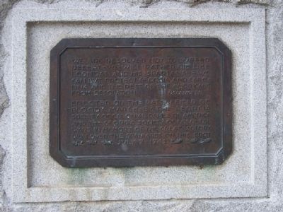
We are resolved not to suffer defeat - we will rather die like Leonidas and his Spartans - if we can but protect Georgia and Carolina and the rest of the Americans from desolation Oglethorpe
Erected on the battlefield of Bloody Marsh - by the Georgia Society of Colonial Dames of America and the Georgia Society of Colonial Wars in memory of the great victory won over the Spainiards on this spot July 7 - 1742
Tiffany & Co.
Erected by Society of Colonial Dames of America, Georgia Society of Colonial Wars.
Topics and series. This historical marker is listed in these topic lists: Colonial Era • Military. In addition, it is included in the The Colonial Dames of America, National Society of series list. A significant historical year for this entry is 1742.
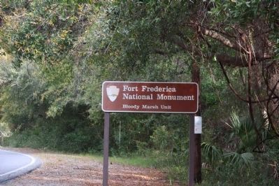
Location. 31° 9.387′ N, 81° 22.78′ W. Marker is on St. Simons Island, Georgia, in Glynn County. Marker is on Demere Rd. This marker is located in the Blood Marsh Unit of the Fort Fredericka National Monument. The unit is located on Demere Rd., south of Stewart St. Touch for map. Marker is in this post office area: Saint Simons Island GA 31522, United States of America. Touch for directions.
Other nearby markers. At least 8 other markers are within 2 miles of this marker, measured as the crow flies. A Clash Of Cultures (within shouting distance of this marker); Slave Cabin (approx. 0.6 miles away); Demere Road (approx. 0.6 miles away); S.S. Oklahoma and Esso Baton Rouge (approx. 0.8 miles away); Retreat Plantation (approx. 1.4 miles away); St. Simons Park (approx. 1˝ miles away); Fort Saint Simons (approx. 1˝ miles away); Delegal's Fort (approx. 1˝ miles away). Touch for a list and map of all markers in St. Simons Island.
Regarding Battle of Bloody Marsh. Occupying most of the southeast portion of the island was Kelvin Grove. Its over sixteen hundred acres included the site of Bloody Marsh battlefield, near which stood a beautiful three-story house with a widow's walk that looked out over the ocean. The tract was settled in the 1790s by Thomas Cater, and developed into a prominent estate by South Carolinian James Postell, who married into the Cater family.
Related marker. Click here for another marker that is related to this marker. The Battle of Gully Hole Creek which occurred earlier in the same day.
Also see . . . Wikipedia entry ; War of Jenkins Ear. The battle took place during
Photographed By Mike Stroud, September 2008
2. Battle of Bloody Marsh Marker
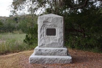
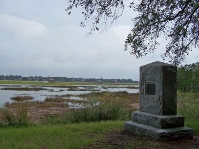
Granite monument on St. Simons Island commemorating the victory of James Oglethorpe's forces over a Spanish invasion force at the Battle of Bloody Marsh. The monument is on dry land at the edge of the marsh where the July 1742 battle was fought.
Photographed By Mike Stroud, September 2008
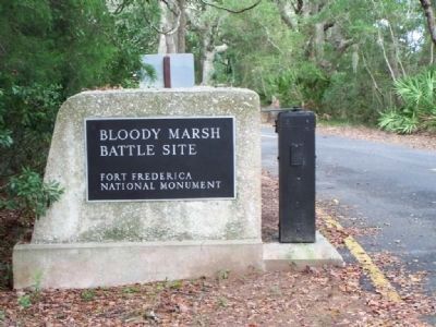
3. Bloody Marsh Battle Site
In the 1742 Battle of Bloody Marsh on St. Simons Island, General Oglethorpe's soldiers defeated Spanish forces in what was the only Spanish invasion of Georgia during the War of Jenkins' Ear. The battle earned its name from its location rather than from the number of casualties, which were minimal.
General Oglethorpe's English, Scottish Highlander, and Indian forces numbered around 650 men. Spanish Governor Montiano's invasion forces numbered 52 ships and over 2000 men.
Credits. This page was last revised on January 25, 2021. It was originally submitted on October 24, 2008, by Mike Stroud of Bluffton, South Carolina. This page has been viewed 3,817 times since then and 45 times this year. Last updated on March 23, 2013, by Byron Hooks of Sandy Springs, Georgia. Photos: 1, 2, 3. submitted on October 24, 2008, by Mike Stroud of Bluffton, South Carolina. 4, 5. submitted on March 23, 2013, by Byron Hooks of Sandy Springs, Georgia.
