5 entries match your criteria.
Related Historical Markers
The Verendrye National Historic Site
By Cosmos Mariner, August 19, 2016
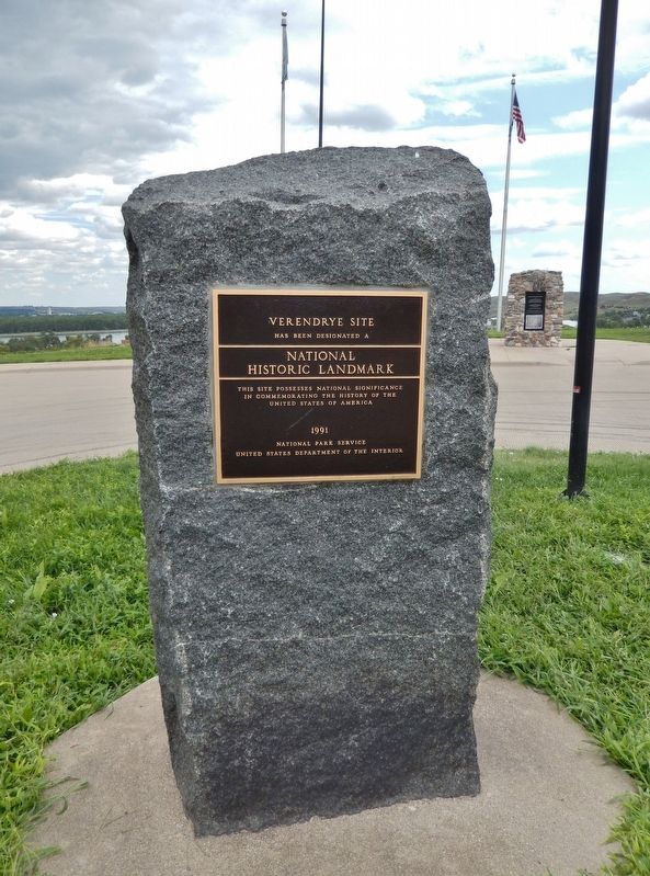
Verendrye Site Marker (tall view; related marker in background)
SHOWN IN SOURCE-SPECIFIED ORDER
| | Verendrye Site
has been designated a
National Historic Landmark
This site possesses national significance
in commemorating the history of the
United States of America 1991
National Park Service
United States Department . . . — — Map (db m124595) HM |
| | In the 1700s, England, France, and Spain all worked hard to colonize North America. The French king gave Quebec fur trader, Pierre Gaultier de Varennes, Sieur de La Verendrye, authorization to expand France's hold in the new world. The French moved . . . — — Map (db m124591) HM |
| | Front
”In the twenty-sixth year of the reign
of Louis XV, the most illustrious Lord,
the Lord Marquis of Beauharnois being Viceroy,
1741, Pierre Gaultier de La Verendrye placed this.”
Back
Placed by the Chevalier . . . — — Map (db m124593) HM |
| | Here on March 30, 1743, the Verendryes buried a lead tablet to claim this region for France. This tablet found on Feb. 16, 1913, is the first written record of the visit of white men to South Dakota. — — Map (db m177391) HM |
| | Explorers Francois and Louis-Joseph Verendrye buried a lead plate here on March 30, 1743, claiming the region for France. The plate documents the Verendryes as the first European explorers on the northern plains. This site serves as proof of early . . . — — Map (db m124597) HM |
Apr. 24, 2024