St. Michaels in Talbot County, Maryland — The American Northeast (Mid-Atlantic)
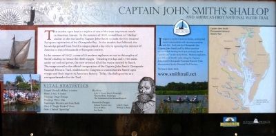
Captain John Smith's Shallop
and America's First National Water Trail
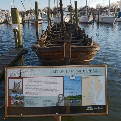
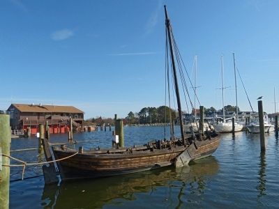
In the summer of 2007, a crew of 12 modern explorers set out in this replica of Smith's Shallop to retrace the 1608 voyages. Traveling 121 days and 1,700 miles under oar and sail power, the crew revisited all of the waters traveled by Smith. The voyage served as the official inauguration of Captain John Smith's epic voyages and their import in American history. Today, the shallop serves as a roving ambassador for the Trail.
Imagine a world of ancient forests, widespread native communities and waterways teeming with life. Such was the Chesapeake that Captain John Smith and his fellow travelers encountered during their epic journeys on this "goody bay" in the early 1600's. Modern explorers can follow in Smith's wake along the Captain John Smith Chesapeake National Historic Trail, administered by the National Park Service.
Vital Statistics
Length overall: 28 feet, 7 inches
Beam: 7 feet,8 inches
Framing: Osage Orange
Fastenings: Wooden and Iron Nails
Oars: 6 "Single Banked" Oars
Sails: 2 Sailed "Sprit Rig"
Builders:
John E. Swain, Master Shipwright
Nicholas Biles, Shipwright
The Volunteers of the Sultana Shipyard
Research/Design
Sultana Projects Inc.
Kees de Mooy
Eric Speth
John E. Swain
William A. Baker
Topics and series. This historical marker is listed in these topic lists: Colonial Era • Waterways & Vessels. In addition, it is included in the Captain John Smith Chesapeake National Historic Trail series list. A significant historical year for this entry is 1608.
Location. Marker has been reported permanently removed. It was located near 38° 47.222′ N, 76° 13.284′ W. Marker was in St. Michaels, Maryland, in Talbot County. Marker could be reached from Cherry Street just west of Burns Street, on the left when traveling west. Near the Chesapeake Bay Maritime Museum along the harbor front walk (Cherry Street extended). Touch for map. Marker was at or near this postal address: 304 Mill Street, Saint Michaels MD 21663, United States of America.
We have been informed that this sign or monument is no longer there and will not be replaced. This page is an archival view of what was.
Other nearby markers. At least 8 other markers are within walking distance of this location. Shallop (within shouting distance of this marker); Navy Point Historic Houses (within shouting distance of this marker); Freedom's Figurehead (within shouting distance of this marker); What's under your feet? (within shouting distance of this marker); Oystering on the Chesapeake (within shouting distance of this marker); Deflecting the Enemy (within shouting distance of this marker); War in the Chesapeake (within shouting distance of this marker); Lost Overboard (about 400 feet away, measured in a direct line). Touch for a list and map of all markers in St. Michaels.
Related marker. Click here for another marker that is related to this marker. This marker has been replaced by the linked marker.
Also see . . . www.smithtrail.net. This URL appears on the marker. (Submitted on November 24, 2012, by Allen C. Browne of Silver Spring, Maryland.)
Credits. This page was last revised on August 25, 2019. It was originally submitted on November 24, 2012, by Allen C. Browne of Silver Spring, Maryland. This page has been viewed 820 times since then and 27 times this year. Photos: 1, 2, 3. submitted on November 24, 2012, by Allen C. Browne of Silver Spring, Maryland. • Bill Pfingsten was the editor who published this page.


