New Hope in Bucks County, Pennsylvania — The American Northeast (Mid-Atlantic)
Ferry Landing
In 1718 King George I granted to John Wells a license to operate a ferry on this site, which provided an essential link in the establishment of the principal Stage Coach Route between Philadelphia and New York. The Landing became known as “Wells Ferry”. During the Revolution, the Ferry was used to transport General George Washington’s Continental Troops in their Trenton campaign. Operation of the ferry ended in 1827.
Topics. This historical marker is listed in these topic lists: Colonial Era • Settlements & Settlers • War, US Revolutionary • Waterways & Vessels. A significant historical year for this entry is 1718.
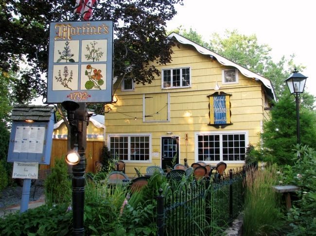
Location. 40° 21.798′ N, 74° 57.034′ W. Marker is in New Hope, Pennsylvania, in Bucks County. Marker can be reached from East Ferry Street. Market is located within the front garden at Martine's River House Restaurant. Touch for map. Marker is at or near this postal address: 14 East Ferry Street, New Hope PA 18938, United States of America. Touch for directions.
Other nearby markers. At least 8 other markers are within walking distance of this marker. A different marker also named Ferry Landing (within shouting distance of this marker); 36 South Main Street (within shouting distance of this marker); 2 East Ferry Street (within shouting distance of this marker); Road to Monmouth Battlefield (within shouting distance of this marker); Cannon (within shouting distance of this marker); New Hope World War I Memorial (within shouting distance of this marker); Indian Logan (within shouting distance of this marker); 28 South Main Street (within shouting distance of this marker). Touch for a list and map of all markers in New Hope.
More about this marker. Marker consists of engraved metal placards on a wooden pedestal. It is somewhat weathered.
Related marker. Click here for another marker that is related to this marker.

Photographed By Cosmos Mariner, July 7, 2008
2. Ferry Landing Marker ("Wells Ferry")
Marker is located in the garden adjacent to Martine's River House Restaurant, near the former site of "Wells Ferry." The marker can be seen in the lower right corner of this image. A brick-paved walkway leads to the river and ferry site.
Credits. This page was last revised on June 16, 2016. It was originally submitted on October 15, 2014, by Cosmos Mariner of Cape Canaveral, Florida. This page has been viewed 660 times since then and 33 times this year. Photos: 1, 2. submitted on October 15, 2014, by Cosmos Mariner of Cape Canaveral, Florida. • Bill Pfingsten was the editor who published this page.
