On Whitman Avenue at Prospect Avenue (County Road 27/1), on the left when traveling north on Whitman Avenue.
Union and Confederate soldiers transformed these fields into campgrounds full of dingy tents, smoky campfires and boiling kettles during the Civil War. Shouting officers drilled their troops until Bolivar's grass was trampled into precision . . . — — Map (db m148864) HM
On Whitman Avenue at Prospect Avenue, on the right when traveling west on Whitman Avenue.
Surrounded by the Blue Ridge Mountains at the confluence of the Potomac and the Shenandoah Rivers, Harpers Ferry thrived as an industrial community during the first half of the 19th century. By 1860, nearly 3,000 residents lived in the . . . — — Map (db m144875) HM
On Whitman Avenue at Prospect Avenue (County Road 27/1), on the left when traveling north on Whitman Avenue.
Union Commander Dixon Miles knew the Confederates were coming. His cavalry reported the Southern troops advancing from three different directions. Ordered to "hold Harpers Ferry until the last extremity," Miles divided his forces to retain . . . — — Map (db m155702) HM
On Whitman Avenue at Prospect Avenue (County Road 27/1), on the left when traveling north on Whitman Avenue.
Resting with his troops in Frederick, Maryland, 20 miles northeast of here, Confederate General Robert E. Lee had hoped the Union garrison at Harpers Ferry would abandon its post when he invaded the North. They did not. Lee decided to attack. He . . . — — Map (db m148866) HM
The Union army refused to give up. Frustrated by the Federals' stronghold on Bolivar Heights, "Stonewall" Jackson ordered cannons to the mountain tops and nearby plateaus. Pounded by a day and a morning of Confederate bombardment, Union soldiers . . . — — Map (db m148868) HM
Near Whitman Avenue at West Washington Street (Alternate U.S. 340), on the left when traveling north.
"…We enter the barren waste of Bolivar Heights…a windswept deserted moorland…except its populous graveyard." James E. Taylor, war correspondent Frank Leslie's Illustrated Newspaper August 10, 1864
Near Whitman Avenue, 0.2 miles north of West Washington Street (Alternate U.S. 340), on the left when traveling north.
"Do all you can to annoy the rebels should they advance on you...You will not abandon Harpers Ferry without defending it to the last extremity." Maj. Gen. John G. Wool, USA Telegraph message to Col. Dixon S. Miles, USA September 7, 1862 The . . . — — Map (db m148869) HM
Near Whitman Avenue, 0.2 miles north of West Washington Street (Alternate U.S. 340), on the left when traveling north.
"…the heights became dotted with tents, and at night…the neighboring hills were aglow with hundreds of watchfires…" Joseph Barry, Harpers Ferry resident October 1862
After the Battle of Antietam on September . . . — — Map (db m148871) HM
"…make all the valleys south of the Baltimore and Ohio [rail]road a desert as high up as possible…so that crows flying over it [Virginia] for the balance of the season will have to carry their provisions with them." Lt. Gen. . . . — — Map (db m5370) HM
On Bakerton Road, on the right when traveling north.
Union troops on the crest and slope of Bolivar Heights to the East were attacked by Confederates lead by Gen. Jackson from School House Ridge to the West on 14 Sept. 1862. Private Paylor, Co. D., 111th NY, recalled this as "an awful fight." This . . . — — Map (db m2944) HM
Near Bakerton Road (County Route 27), on the right when traveling north.
Some of the Union infantrymen who defended this ground on the night of September 14th returned the next day. Even though the Confederate strategy had won the battle for Harpers Ferry, and these Union soldiers were part of the largest surrender of . . . — — Map (db m5398) HM
On Bakerton Road (County Route 27), on the right when traveling north.
"We went below and formed in line of battle and laid down on our arms. Sleep was out of the question but of course, human nature will succumb and drowsiness was general among the boys. It must have been nine O'Clock or more by this . . . — — Map (db m5396) HM
On Bakerton Road (County Route 27), on the right when traveling north.
On the dark, moonless night of September 14, 1862, 100 men from the 126th New York Regiment established a skirmish line here. These men were new to the war, having only been in uniform for a few short weeks. After surviving a terrifying afternoon . . . — — Map (db m5397) HM
On Bakerton Road (County Road 27), on the right when traveling north.
The 115th New York Regiment, young and inexperienced, formed a skirmish line here. When gunfire erupted on their left during the night, the men of the 115th must have felt the rush of adrenaline through their veins. Dander was headed in their . . . — — Map (db m7816) HM
Near Bakerton Road (County Route 27), on the right when traveling north.
"General J.R. Jones was directed to make a demonstration against the enemy's right." Jackson's official report Confederate Colonel Edmund Pendleton wrote about the night of September 14, 1862, from his perspective across the road on School . . . — — Map (db m155727) HM
Near Bakerton Road (County Route 27), on the right when traveling north.
In 1862 Union Colonel Dixon Miles thought that the ridge in front of you, Bolivar Heights, was the perfect place to defend Harpers Ferry. However, in September of '62, Colonel Miles and 14,000 Union soldiers found themselves surrounded by 24,000 . . . — — Map (db m155728) HM
Near Bakerton Road (County Route 27), on the right when traveling north. Reported permanently removed.
After sunset on September 14, 1862, the Confederate cannons across the road on School House Ridge vanished in the darkness. The features of the landscape began to blur as the shell-shocked Union soldiers on Bolivar Heights wondered if they could . . . — — Map (db m5394) HM
On Prospect Avenue (County Road 27/1) at Whitman Avenue, on the left when traveling north on Prospect Avenue.
Battle of Harpers Ferry
Invasion rocked the United States during the second year of the American Civil War. In September 1862 Confederate General Robert E. Lee launched his army into Maryland - the North. Lee's first target became Harpers . . . — — Map (db m148862) HM
On Sept. 13, 1862 Stonewall Jackson’s forces approaching from the west were shelled by 2 Union artillery guns under Col. Miles from this position. On Sept. 14, Gen. A.P. Hill outflanked these Union troops while Jackson swept past this location. Col. . . . — — Map (db m155751) HM
In August 1864, Gen. U.S. Grant ordered Gen. Phillip Sheridan to construct earth fortifications on Bolivar Heights. These forts faced northwest to protect against Confederate movements down the Shenandoah Valley to Harpers Ferry. This Sheridan . . . — — Map (db m5863) HM
During the construction of this fort, many of the trees which were located directly in front of these embankments were felled forming an “abatis”. This timber obstruction slowed the advance of the attacking forces so that snipers, . . . — — Map (db m5872) HM
Infantry troops occupied positions along these fortifications. The low height of the earth embankment at this location permitted the defending troops easy passage to and from the abatis without exposure. — — Map (db m5878) HM
This gun protected the south end of the fort and was positioned to fire on flank movements. An outside picket trench, which can be seen ahead of the main embankment, protected the artillery crew. — — Map (db m5879) HM
The Civil War affected not only the soldiers who fought but the families whose homes and towns became battlefields. Edmund H. Chambers bought this farm in 1848 and lived here with his family until the Civil War. Although Chambers was a loyal . . . — — Map (db m115283) HM
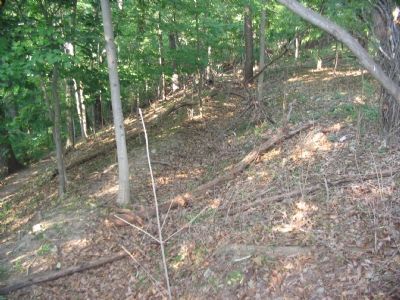
Consider dragging 2,000-pound cannon up this ravine—at night. General A.P. Hill’s Confederates faced that task during the second night of battle. The assignment was essential to “Stonewall” Jackson’s plan to flank the Union army on . . . — — Map (db m5889) HM
After an exhausting night of dragging 20 cannon along the river and up the ravines to this site on Chambers (Murphy) Farm, General A.P. Hill and his 3,500 men sprang their trap on the unsuspecting Union army. Before dawn on the last day of the . . . — — Map (db m5894) HM
In August 1864 Harpers Ferry was again a Union stronghold. Union General Philip Sheridan and his men built this redoubt—the earthwork in front of you—as fortification against the Confederates. Sheridan’s objective was to stop the . . . — — Map (db m5896) HM
Confederate Major General “Stonewall” Jackson could not see this view. His lower vantage on Schoolhouse Ridge, 1000 yards upriver, blocked his sight of this strategic position. Yet Jackson remembered this farm from his time as . . . — — Map (db m155752) HM