Moorefield in Hardy County, West Virginia — The American South (Appalachia)
McMechen House
Confederate Headquarters
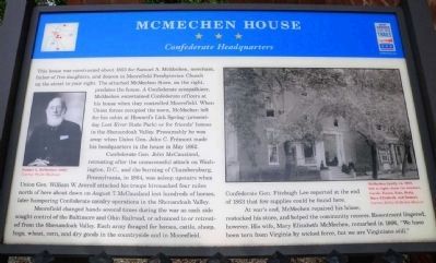
This house was constructed about 1853 for Samuel A. McMechen, merchant, father of five daughters and deacon of Moorefield Presbyterian Church up the street on your right. The attached McMechen Store, on the right, predates the house. A Confederate sympathizer, McMechen entertained Confederate officers at his house when they controlled Moorefield. When Union forces occupied the town, McMechen left for his cabin at Howard's Lick Spring (presently Lost River State Park) or for friends' homes in the Shenandoah Valley. Presumably he was away when Union Gen. John C. Frémont made his headquarters in the house in May 1862.
Confederate Gen. John McCausland, retreating after the unsuccessful attack on Washington, D.C. and the burning of Chambersburg, Pennsylvania, in 1864, was asleep upstairs when Union Gen. William W. Averell attacked his troops bivouacked four miles north of here about dawn on August 7. McCausland lost hundreds of horses, later hampering Confederate cavalry operations in the Shenandoah Valley.
Moorefield changed hands several times during the war as each side sought control of the Baltimore and Ohio Railroad, or advanced to or retreated from the Shenandoah Valley. Each army foraged for horses, cattle, sheep, hogs, wheat, corn, and dry goods in the countryside and in Moorefield.
Confederate Gen. Fitzhugh Lee reported at the end of 1863 that few supplies could be found here.
At war's end, McMechen repaired his house, restocked his store, and helped the community recover. Resentment lingered, however. His wife, Mary Elizabeth McMechen, remarked in 1866, "We have been torn from Virginia by wicked force, but we are Virginians still."
Erected by West Virginia Civil War Trails.
Topics and series. This historical marker is listed in these topic lists: Notable Buildings • War, US Civil. In addition, it is included in the Baltimore and Ohio Railroad (B&O), and the West Virginia Civil War Trails series lists. A significant historical month for this entry is May 1862.
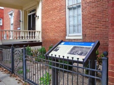
Location. This marker has been replaced by another marker nearby. It was located near 39° 3.752′ N, 78° 58.185′ W. Marker was in Moorefield, West Virginia, in Hardy County. Marker was at the intersection of North Main Street (U.S. 220) and Winchester Avenue (Old West Virginia Route 55) on North Main Street. Touch for map. Marker was at or near this postal address: 109 N Main St, Moorefield WV 26836, United States of America. Touch for directions.
Other nearby markers. At least 8 other markers are within walking distance of this location. A different marker also named McMechen House (here, next to this marker); S. A. McMechen House (a few steps from this marker); Moorefield (within shouting distance of this marker); Presbyterian Church (about 300 feet away, measured in a direct line); Moorefield Presbyterian Church (about 300 feet away); Hardy County's First Court House (about 500 feet away); The Parsonage (about 700 feet away); Maslin House (approx. 0.2 miles away). Touch for a list and map of all markers in Moorefield.
More about this marker. Upper Left Photo is Samuel A. McMechen (1903), Courtesy Phoebe Heishman
Right photo shows "McMechen family, ca. 1900, left to right: Janie (in window), Carrie, Emma, Kate, Betty, Mary Elizabeth, and Samuel. Courtesy McCoy-McMechen Museum."
Related marker. Click here for another marker that is related to this marker. This marker has been replaced by the linked marker.
Credits. This page was last revised on July 18, 2020. It was originally submitted on October 3, 2011, by Linda Walcroft of Woodstock, Virginia. This page has been viewed 1,304 times since then and 42 times this year. Photos: 1, 2. submitted on October 3, 2011, by Linda Walcroft of Woodstock, Virginia. • Craig Swain was the editor who published this page.

