4 entries match your criteria.
Related Historical Markers
Point Iroquois Light Station, Michigan
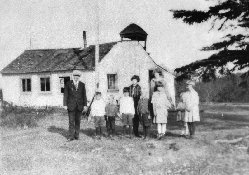
Marker detail: One-room schoolhouse at Point Iroquois, early 1900s
SHOWN IN SOURCE-SPECIFIED ORDER
| | Unlike more remote or isolated stations surrounded by water, life at Point Iroquois included many land-based activities and contacts with neighbors. Lighthouse Service rules and regulations strongly encouraged self-sufficiency through the use of . . . — — Map (db m154409) HM |
| | Ice-Age glaciers covered the Whitefish Bay Area for thousands of years and left behind a complex mosaic of sand, gravel and clay. Following the last glacier's retreat about 10,000 years ago, water and wind shaped these deposits into the landscape of . . . — — Map (db m154413) HM |
| | Native American History Links Past to Present and People with the LandAccording to traditions and historical evidence, Whitefish Bay is part of the central Anishinabeg (Ojibwe or Chippewa) homeland in the Great Lakes. Members of the nearby Bay . . . — — Map (db m154414) HM |
| | When the first French traders and missionaries arrived in the 1600s, the Native American Tribe called Ojibwe or Chippewa lived along the Bay. They referred to themselves in their native language as Anishinabeg, which translates as "Original People." . . . — — Map (db m154415) HM |
Apr. 24, 2024