6 entries match your criteria.
Related Historical Markers
Discovery Trail to the Straits of Mackinac
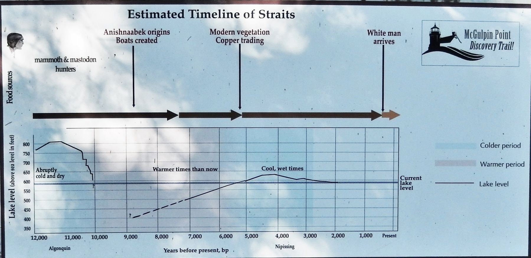
Marker detail: Timeline
SHOWN IN SOURCE-SPECIFIED ORDER
| | How Did the Odawa Survive? When the Odawa were living on the waterfront in the Straits what was their life like? What did they eat? What did they do? And wouldn't it be wonderful if we could ascertain what they thought? Here are the few answers . . . — — Map (db m154599) HM |
| | Native families settle in the Straits area Following the glacial retreat 11,000 years ago, Anishnaabek people began to populate Lower Michigan, drawn here by plentiful natural resources. This land holds tremendous cultural value to the local . . . — — Map (db m154601) HM |
| | Nissowaquet, a legendary Odawa Nissowaquet (Nosawaguet, Sosawaket, La Fourche), Odawa chief; the name evidently comes from Nassauaketon, meaning “forked river,” the designation of one of the four Odawa bands; b. 1715; d. 1797. . . . — — Map (db m154698) HM |
| | Worlds collide in Mackinac’s “Middle Ground” Charles Michel de Langlade was an Odawa war chief, diplomat, fur trader and a French officer. He was one of the most influential people in the Great Lakes during the 1700s, due to his . . . — — Map (db m154700) HM |
| | European soldiers stay and become land owners For thousands of years, generations before the arrival of the French in the 1600s, the Anishnaabek nation established villages along the Straits of Mackinac, including near where you are standing . . . — — Map (db m154819) HM |
| | Post-war life at McGulpin Point With the turn into the 1800s, the social and economic systems in the Mackinaw area become more predictable. During this period Patrick McGulpin, now 60 years old, stopped having children and became a grandfather . . . — — Map (db m154820) HM |
Apr. 24, 2024