5 entries match your criteria.
Related Historical Markers
The battle of Garnett's & Golding's Farm and Trent House by markers
By Bernard Fisher, January 28, 2009
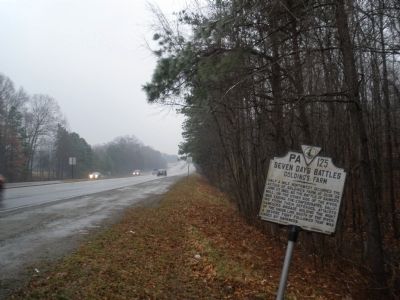
Seven Days Battles Marker
SHOWN IN SOURCE-SPECIFIED ORDER
| | Half a mile northwest occurred the action of Golding's Farm at dusk on June 27, 1862, as the battle of Gaines's Mill, on the other side of the river, was ending. The Confederates, sallying from their defenses, attacked Hancock's brigade holding the . . . — — Map (db m15657) HM |
| | Here stood Grapevine Bridge across which, on the night of June 27, 1862, part of McClellan's Army moved in changing base from the Pamunkey to the James after the Battle of Gaines' Mill. "Stonewall" Jackson pursued, June 29. — — Map (db m15656) HM |
| | Here Sumner crossed the river to reinforce the part of McClellan's army fighting at Fair Oaks, May 31, 1862. Here a part of Porter's force crossed in the night of June 27, 1862 after the battle of Gaines's Mill. Here Stonewall Jackson, rebuilding . . . — — Map (db m15655) HM |
| | In the residence of Dr. Peterfield Trent, situated about 500 yards from this road, General G.B. McClellan, U.S.A., had his headquarters in May-June, 1862. Here he planned the withdrawal to James River. — — Map (db m14211) HM |
| | Between June 12 and June 28, 1862, Union Gen. George B. McClellan maintained his headquarters here at Trent House. Known as “Reynoldsville,” the house dates from about 1825. During the Civil War, it was the home of Dr. Peterfield Trent . . . — — Map (db m14207) HM |
Apr. 25, 2024