7 entries match your criteria.
Related Historical Markers
Los Alamos Historical Walking Tour
Los Alamos Historical Society Archives
Marker detail: Harold H. Brook
SHOWN IN SOURCE-SPECIFIED ORDER
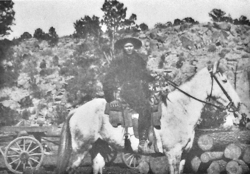
| | Harold H. Brook Homestead Entry: August 1908 Los Alamos Ranch School Purchase: 1917 Harold Hemingway Brook was an agronomist from Illinois who came to Santa Fe for treatment of tuberculosis. He recovered enough to apply for homestead entry in . . . — — Map (db m156686) HM |
| | William Mackwood Hopper Homestead Entry: August 1908 Harold H. Brook Purchase: 1914 Los Alamos Ranch School Purchase: 1917 William Mackwood Hopper met Harold Brook when they both lived in Santa Fe. In August 1908, four days after Brook applied for . . . — — Map (db m156681) HM |
| | Martha Brook Homestead Entry: August 1913 Los Alamos Ranch School Purchase: 1920 Martha Brook was Harold Brook's mother. Brook applied for homestead entry in Martha's name in August 1913 for 150 acres of what is now Eastern Area, the airport, and . . . — — Map (db m156687) HM |
| | Albert J. Connell In Lieu Entry: October 1930 Ashley Pond bought H. H. Brook's ranch in January 1917. That same year, Pond hired Albert J. (A. J.) Connell to be the director of the newly formed Los Alamos Ranch School. The school did not own all the . . . — — Map (db m156673) HM |
| | Among those tempted by the Homestead Act of 1862, which offered free land in exchange for the successful establishment of a farmstead, was Victor Romero. In 1913 he applied for 15 acres of land that is now within the boundaries of Los Alamos . . . — — Map (db m156598) HM |
| | The human history on the Pajarito Plateau goes back at least 10,000 years. Paleoindians first hunted its forests; millennia later, Pueblo Indians farmed its broad mesas before abandoning their settlements for locations along the Rio Grande. The . . . — — Map (db m156599) HM |
| | Today a memorial stands at the site of the original Ice House. During World War II, nuclear components of the Trinity device (a prototype nuclear weapon) were assembled here to be detonated later at Trinity Site 255 miles south near Socorro, New . . . — — Map (db m156695) HM |
Apr. 23, 2024