Chapman's Mill
Heart of the Battle of Thoroughfare Gap
— The Historic Chapman-Beverly Mill, Broad Run, Virginia • 1742 —
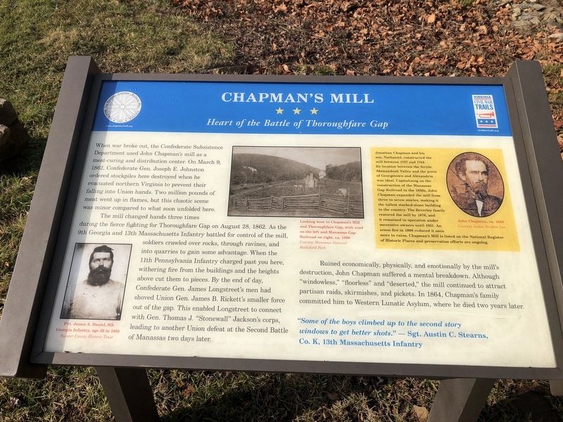
When war broke out, the Confederate Subsistence Department used John Chapman's mill as a meat-curing and distribution center. On March 9, 1862, Confederate Gen. Joseph E. Johnston ordered stockpiles here destroyed when he evacuated northern Virginia to prevent their falling into Union hands. Two million pounds of meat went up in flames, but this chaotic scene was minor compared to what soon unfolded here.
The mill changed hands three times during the fierce fighting for Thoroughfare Gap on August 28, 1862. As the 9th Georgia and 13th Massachusetts Infantry battled for control of the mill, soldiers crawled over rocks, through ravines, and into quarries to gain some advantage. When the 11th Pennsylvania Infantry charged past you here, withering fire from the buildings and the heights above cut them to pieces. By the end of the day, Confederate Gen. James Longstreet's men had shoved Union Gen. James B. Rickett's smaller force out of the gap. This enabled Longstreet to connect with Gen Thomas J. "Stonewall" Jackson's corps, leading to another Union defeat at the Second Battle of Manassas two days later.
Ruined economically, physically, and emotionally by the mill's destruction, John Chapman suffered a mental breakdown. Although "windowless," "floorless" and "deserted," the mill continued to attract partisan raids, skirmishes,
and pickets. In 1864, Chapman's family committed him to Western Lunatic Asylum, where he died two years later."Some of the boys climbed up to the second story windows to get better shots." — Sgt. Austin C. Stearns, Co. K, 13th Massachusetts Infantry
[Sidebar:]
Jonathan Chapman and his son, Nathaniel, constructed the mill between 1737 and 1742. Its location between the fertile Shenandoah Valley and the ports of Georgetown and Alexandria was idea. Capitalizing on the construction of the Manassas Gap Railroad in the 1850s, John Chapman expanded the mill from three to seven stories, making it the tallest stack-stoned building in the country. The Beverly family restored the mill by 1878, and it remained in operation under successive owners until 1951. An arson fire in 1998 reduced it once more to ruins. Chapman's Mill is listed on the National Register of Historic Places and preservation efforts are ongoing.
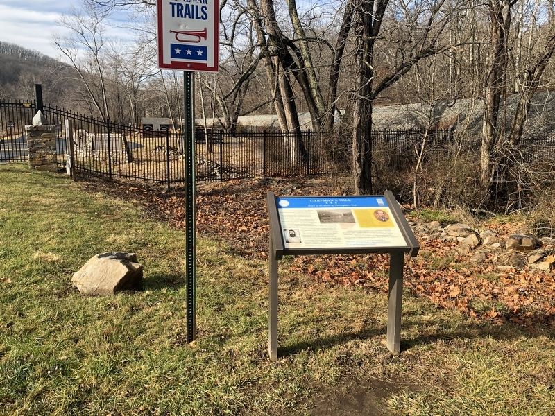
Erected by Virginia Civil War Trails; The Historic Chapman-Beverly Mill.
Topics. This historical marker is listed in these topic lists: Colonial Era • Industry & Commerce • War, US Civil. A significant historical date for this entry is March 9, 1862.
Location. 38° 49.483′ N, 77° 42.401′ W. Marker is near Broad Run, Virginia, in
Other nearby markers. At least 8 other markers are within 2 miles of this marker, measured as the crow flies. Bull Run Mountains Natural Area Preserve (within shouting distance of this marker); Thoroughfare Gap (approx. ¼ mile away); a different marker also named Thoroughfare Gap (approx. ¼ mile away); Campaign of Second Manassas (approx. ¼ mile away); Heflin's Store (approx. 1.4 miles away); Free People Of Color At Thoroughfare (approx. 1.6 miles away); The Thoroughfare Colored / North Fork School (approx. 1.8 miles away); Water Fowl And Their Habitat (approx. 1.8 miles away). Touch for a list and map of all markers in Broad Run.
Regarding Chapman's Mill. The inscription includes the possessive form "Rickett's", which should have been "Ricketts'". That General was James Brewerton Ricketts.
Related marker. Click here for another marker that is related to this marker. This marker has replaced the linked marker which had different content.
Credits. This page was last revised on February 28, 2021. It was originally submitted on January 2, 2021, by Devry Becker Jones of Washington, District of Columbia. This page has been viewed 377 times since then and 30 times this year. Last updated on February 25, 2021, by Carl Gordon Moore Jr. of North East, Maryland. Photos: 1, 2. submitted on January 2, 2021, by Devry Becker Jones of Washington, District of Columbia.

