7 entries match your criteria.
Related Historical Markers
Stuart's Ride around McClellan by Markers.
By Bernard Fisher, February 2, 2009
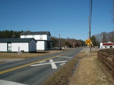
Elmont (Kilby's Station)
SHOWN IN SOURCE-SPECIFIED ORDER
| On Elmont Road (County Route 626) 0.2 miles north of Cobbs Road, on the right when traveling north. |
| | Here at Elmont (known as Kilby's Station during the Civil War), Confederate Brig. Gen. J. E. B. Stuart assembled the last of his 1,200 cavalrymen and began his ride around Union Maj. Gen. George B. McClellan's Army of the Potomac on 12 June 1862. . . . — — Map (db m15840) HM |
| On Cedar Lane (County Route 623) at Winns Church Road, on the left when traveling west on Cedar Lane. |
| | Confederate Brig. Gen. J. E. B. Stuart with his 1,200 cavalrymen rode past this spot on the morning of 12 June 1862, heading west. On a mission to gather intelligence about Union Maj. Gen. George B. McClellan's Army of the Potomac, Stuart hoped to . . . — — Map (db m15837) HM |
| On Cedar Lane (County Route 623) at Ashland Road, on the left when traveling west on Cedar Lane. |
| | Late in the morning of 12 June 1862, Confederate Brig. Gen. J. E. B. Stuart and 1,200 cavalrymen reached this intersection on a mission to gather intelligence about Union Maj. Gen. George B. McClellan's Army of the Potomac. Here Stuart's column . . . — — Map (db m15842) HM |
| On Blanton Road (County Route 666) at West Patrick Henry Road (Virginia Highway 54), on the right when traveling north on Blanton Road. |
| | On the afternoon of 12 June 1862, Confederate Brig. Gen. J. E. B. Stuart's column passed here on a mission to gather intelligence about Union Maj. Gen. George B. McClellan's Army of the Potomac. Riding northeast toward the Richmond, Fredericksburg, . . . — — Map (db m15881) HM |
| On Hanover Courthouse Road (U.S. 301) 0.2 miles north of Depot Road, on the right when traveling north. Reported permanently removed. |
| | (Obverse)
Near here lived in 1610 Machumps, brother-in-law to King Powhatan.
Near here were born Patrick Henry and Henry Clay.
In this building on 1st December 1763 Patrick Henry lighted the torch of liberty in the Parson’s . . . — — Map (db m226209) HM |
| On Hanover Courthouse Road (U.S. 301) 0.2 miles north of Depot Road, on the left when traveling north. Reported permanently removed. |
| |
This community’s first real taste of war came in May 1862, when Gen. George B. McC1e11an’s Union army moved from the east to threaten Richmond. On May 25, McClellan ordered troops to reconnoiter the Hanover Courthouse area and push back any enemy . . . — — Map (db m15818) HM |
| On Studley Road at Southard Lane, on the right when traveling south on Studley Road. |
| | During Confederate Brig. Gen. J. E. B. Stuart's intelligence gathering "Ride Around McClellan," a skirmish ensued atop this hill on 13 June 1862 when several companies of the 9th Virginia Cavalry collided with the 5th United States Cavalry. Stuart's . . . — — Map (db m15846) HM |
Apr. 24, 2024