5 entries match your criteria.
Related Historical Markers
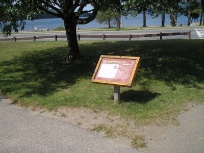
Series of marker located in Lake George Battlefield Park.
By Bill Coughlin, July 10, 2008
Marker in Lake George Battlefield Park
SHOWN IN SOURCE-SPECIFIED ORDER
| On Beach Road at Fort George Road, on the right when traveling east on Beach Road. |
| | Numerous vessels plied the waters of the lake during the French and Indian War (1755-1763) and the American Revolution (1775-1783). Many of the smaller vessels were constructed elsewhere, while others were constructed at the south end of Lake George . . . — — Map (db m16114) HM |
| On Fort George Road, on the right when traveling south. |
| | Lake George played an important role throughout the American Revolution as a transportation route, staging area and outpost. In December 1775, as some American troops were ferried north during their abortive invasion of Canada, Colonel Henry Knox’s . . . — — Map (db m16111) HM |
| On Fort George Road, on the left when traveling south. |
| | In 1759, while Colonel Montresor constructed Fort George out of limestone, a star-shaped stockaded fort was built closer to Lake George by Major General Jeffery Amherst’s army. This British complex encompassed an officers’ barracks, a soldiers’ . . . — — Map (db m16113) HM |
| On Fort George Road, on the left when traveling south. |
| | In September 1755, a Colonial army commanded by Major General William Johnson camped on this location in preparation for an advance against the French Fortress of St. Frederic at Crown Point on Lake Champlain. On September 8, a French force . . . — — Map (db m16035) HM |
| On Fort George Road, on the left when traveling south. |
| | At a junction along one of the most historic water routes in America, connecting the Hudson River to Lake Champlain, this site witnessed military engagements during both the French and Indian War (1755-1763) and the American Revolution (1775-1783). . . . — — Map (db m16115) HM |
Apr. 19, 2024